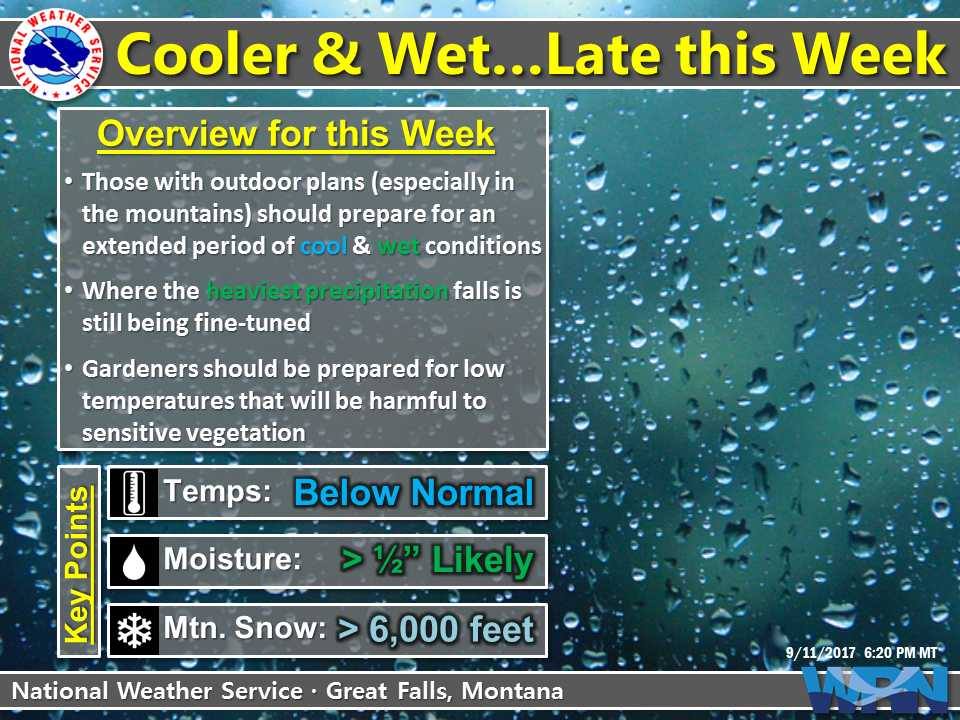
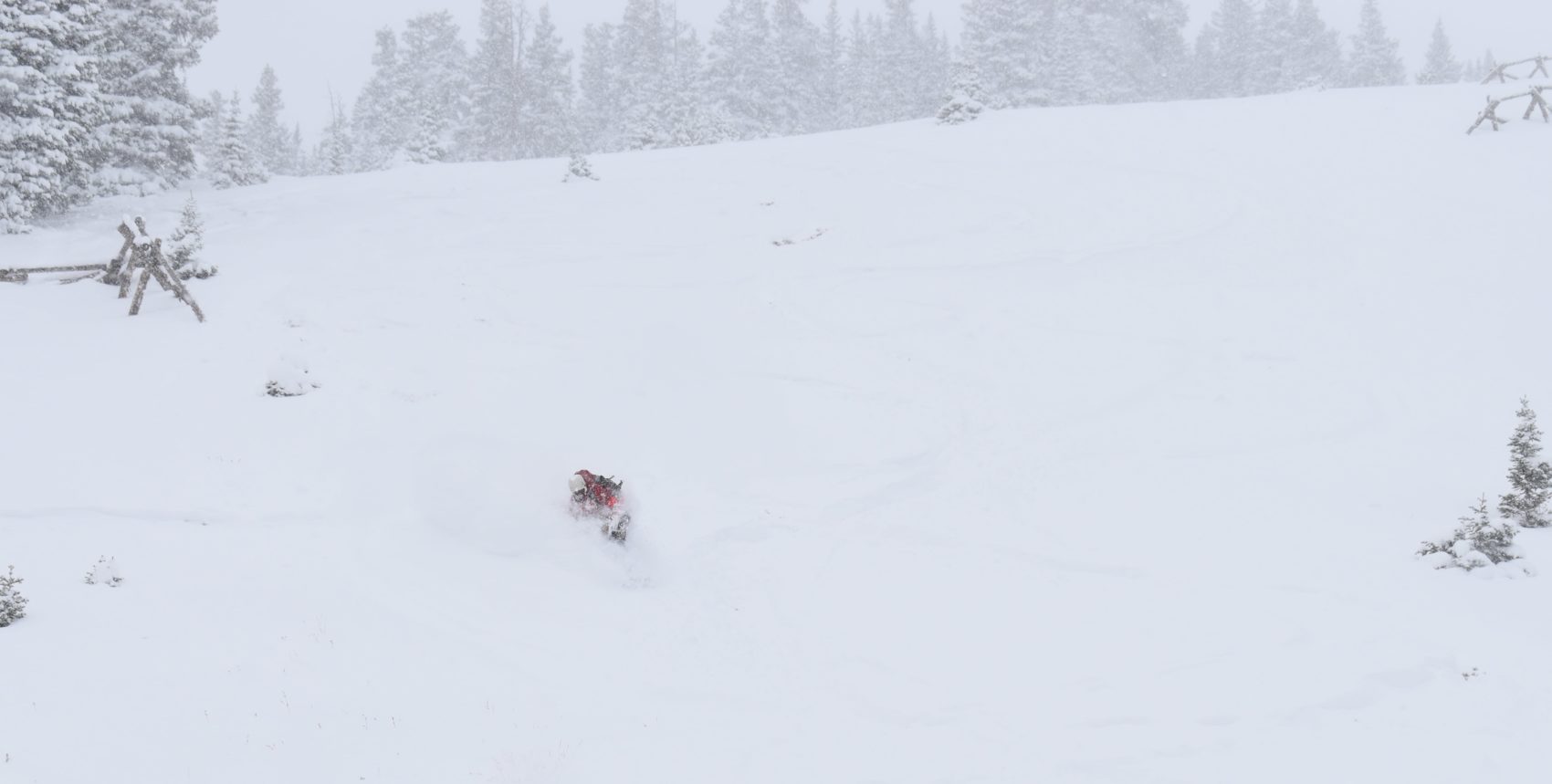
A strong fall storm is expected to hit the west late this week. Cold temperatures are expected to arrive along with it, which will turn rain into snow.
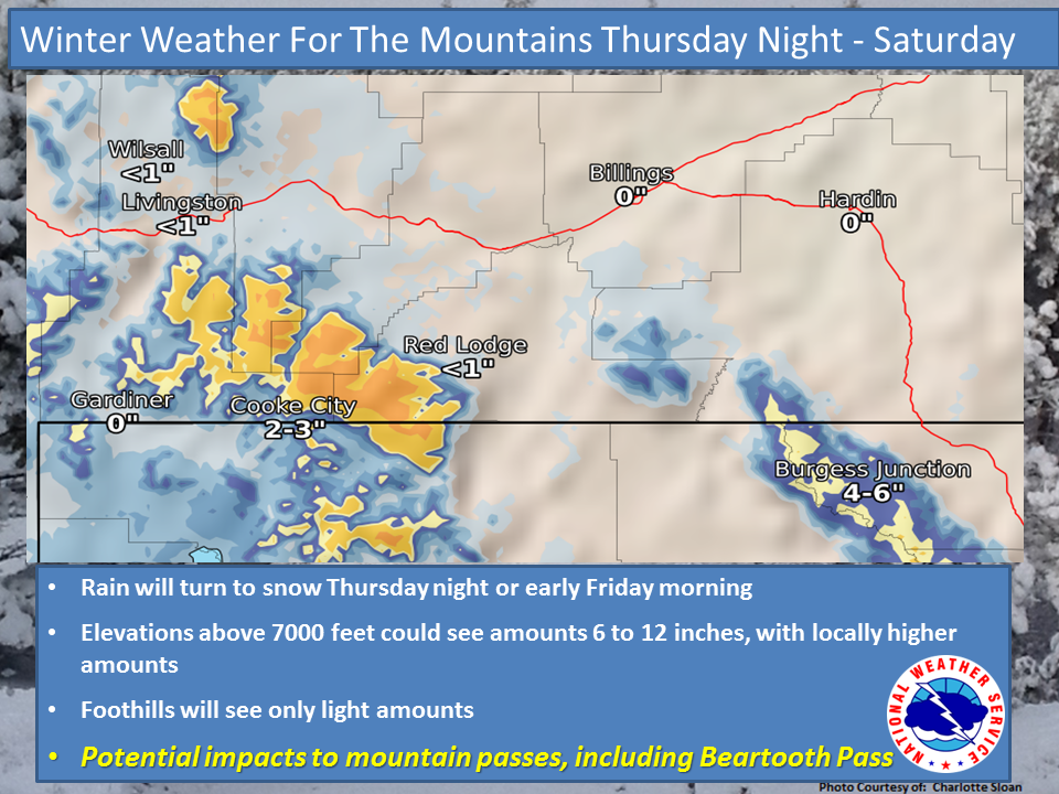
Up to 10″ of snow is expected to fall Thursday Night – Saturday Morning.
NOAA Has Issued A Winter Weather Advisory For:
Idaho
Montana
NOAA Has Issued A Winter Storm Watch For:
Idaho
Montana
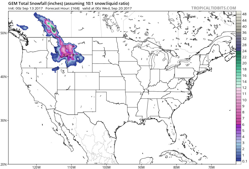
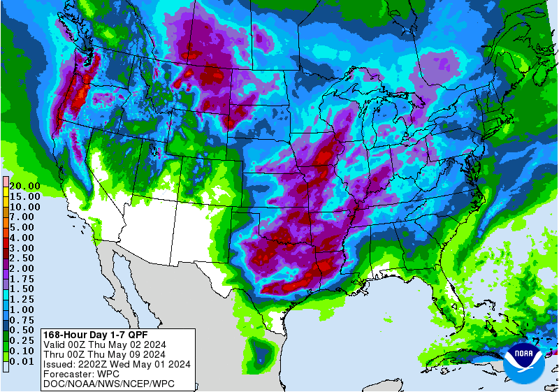
7 day snowfall totals. Image: Tropical Tidbits7 day precipitation totals. Image: NOAA
Snow levels will start out around 7,000ft on Thursday Night and drop below 6,000ft by the time Friday Morning rolls around.
Additional Storm Information:
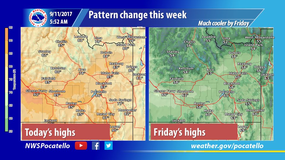
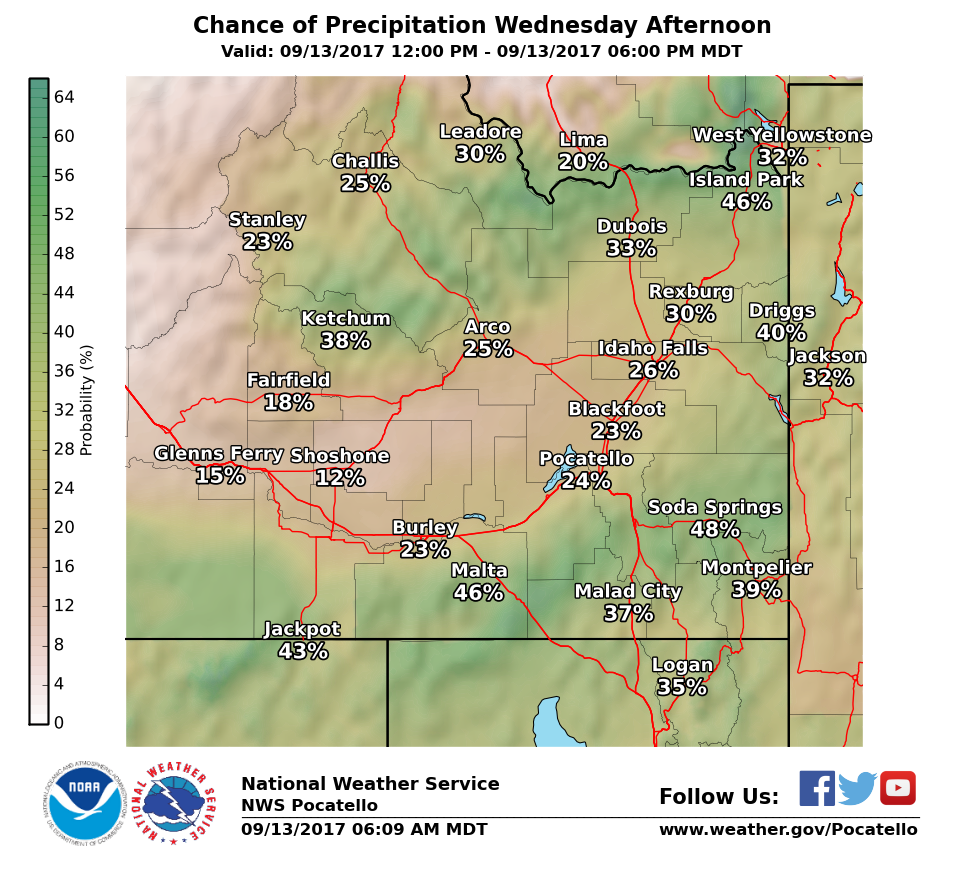
Colder temperatures are on the way. Image: NOAA Pocatello ID Facebook PagePrecipitation chances wednesday. Image: NOAA Pocatello, ID Facebook Page
Idaho: Up To 10″ of Snow Through Saturday Morning
* Accumulations: Snow accumulation of up to 2 inches on mountain passes
Thursday and Friday nights, with falling snow melting on road surfaces during
daylight hours Friday. Snow accumulation of 4 to 10 inches above pass level.
- NOAA Great Falls, MT Today
A Pacific system will move into the Northern Rockies by late Wednesday, affecting North Central and Southwest Montana through the day on Friday. Image: NOAA Great Falls, MT, TodayAreas above 7000 feet could see accumulations of 6 to 12 inches. Image: NOAA Great Falls, MT, Today
Montana: Up To 10″ of Snow Thursday Night – Saturday
*Accumulations: Snow accumulation of up to 2 inches on mountain passes Thursday night, with falling snow melting on road surfaces during daylight hours Friday. Snow
accumulation of 3 to 6 inches over the Rocky Mountain Lewis Range, and up to 10inches above pass level in the Little Belt and Boulder mountain ranges.
- NOAA Great Falls, MT Today
6-10 day temperature outlook. Image: NOAA6-10 day precipitation outlook. Image: NOAA
Winter Weather Advisory For Montana:
URGENT - WINTER WEATHER MESSAGE
National Weather Service Great Falls MT
345 AM MDT Wed Sep 13 2017

...WINTER WEATHER ADVISORY IN EFFECT FROM 3 AM FRIDAY TO NOON MDT
SATURDAY FOR ELEVATIONS ABOVE 7000 FEET...

The National Weather Service in Great Falls has issued a Winter
Weather Advisory For elevations above 7000 feet for snow, which
is in effect from 3 AM Friday to noon MDT Saturday.

* Locations: Big Hole Pass, Chief Joseph Pass, and Targhee Pass.

* Timing: Rain will change to snow Thursday night as snow levels
  lower to around 6000 feet. Snowfall rates will peak Friday
  morning. Mountain snow will continue through Friday night,
  gradually ending from west to east on Saturday.

* Accumulations: Snow accumulation of up to 2 inches on mountain
  passes Thursday and Friday nights, with falling snow melting on
  road surfaces during daylight hours Friday. Snow accumulation of
  4 to 10 inches above pass level.

* Winds: North 5 to 10 mph with gusts up to 20 mph.

* Snow Level: Lowering to 6000 feet.

* Impacts: Slushy snow accumulation Thursday night will cause
  minor travel difficulties over mountain passes. Wet and raw
  conditions could cause hypothermia issues for firefighters,
  hunters, and anyone else caught unprepared in the backcountry.