
The National Weather Service has issued a Winter Storm Warning for Montana and Idaho. This is in effect from Tonight – Saturday.
Contents
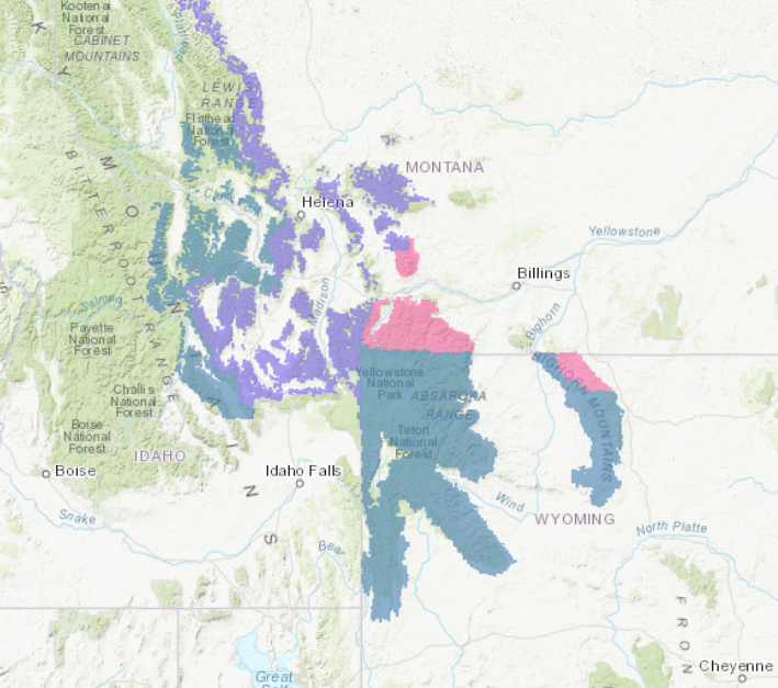
NOAA Has Issued Winter Storm Warnings For:NOAA Has Issued Winter Storm Watches For:NOAA Has Issued Winter Weather Advisories For:Additional Storm Information:Idaho: Up To 10″ of Snow Tonight – Saturday MorningMontana: 14+” of Snow Tonight – Saturday MorningWyoming: Up To 20″ of Snow Tonight – Saturday MorningWY/MT Winter Storm Warning:
This is the FIRST Winter Storm Warning in the Continental USA this season!
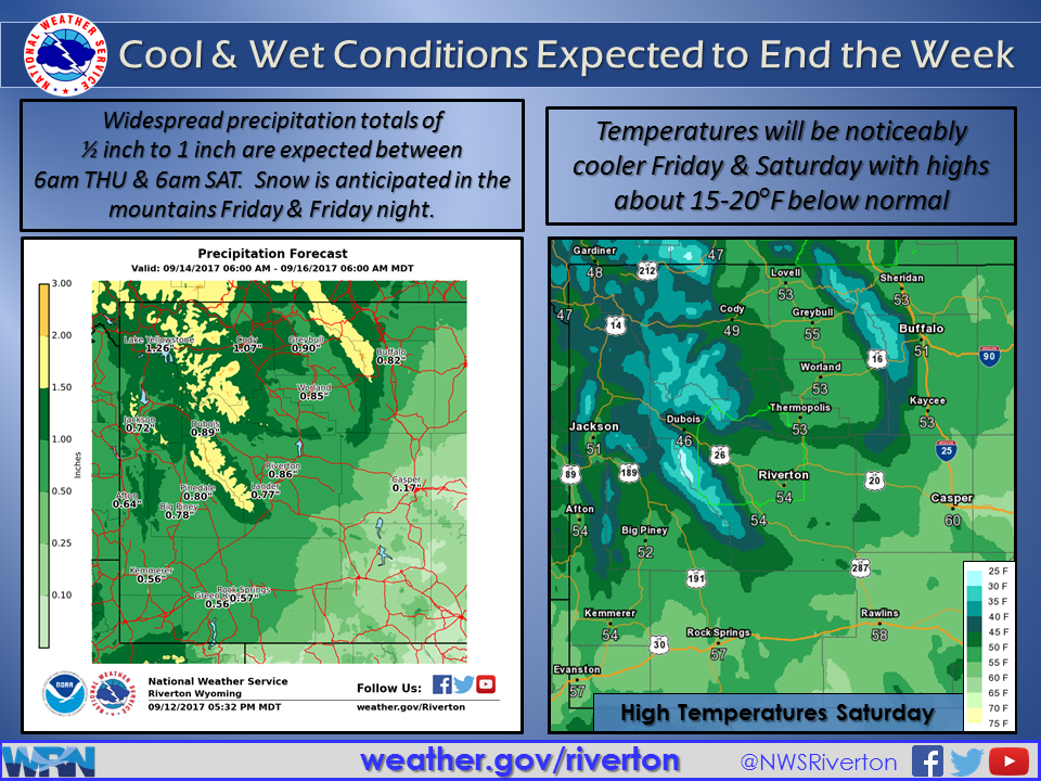
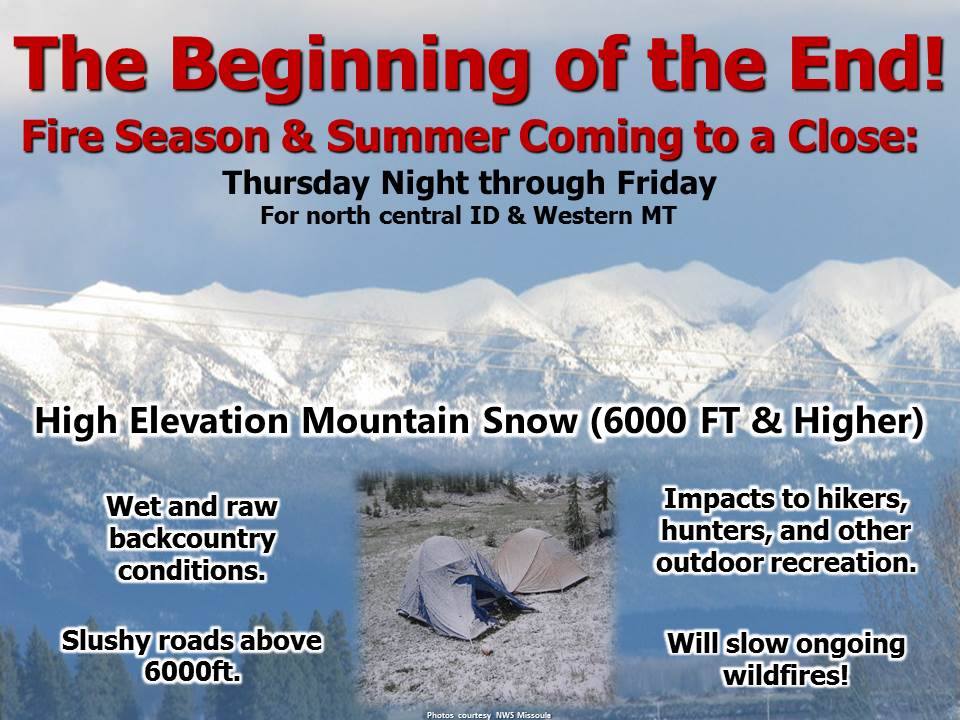
A strong fall storm is expected to hit the west late this week into the weekend. Cold temperatures are expected to arrive along with it, which will turn rain into snow.
Up To 20″ of Snow Is Forecasted To Fall.
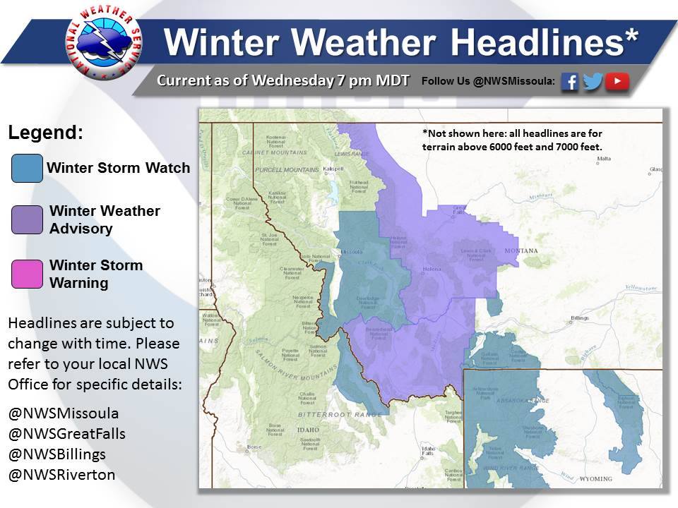
NOAA Has Issued Winter Storm Warnings For:
- Montana
- Wyoming
NOAA Has Issued Winter Storm Watches For:
- Idaho
- Montana
- Wyoming
NOAA Has Issued Winter Weather Advisories For:
- Idaho
- Montana
- Wyoming
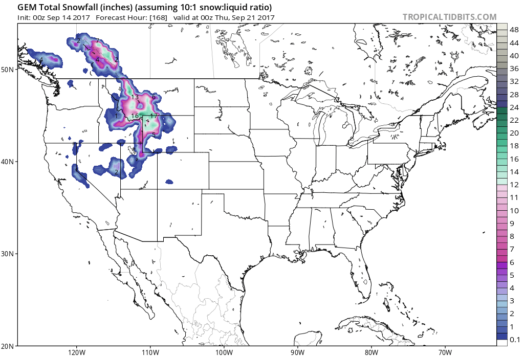
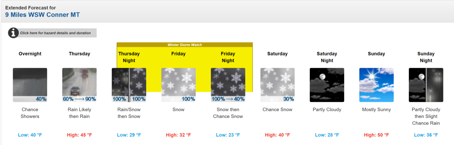
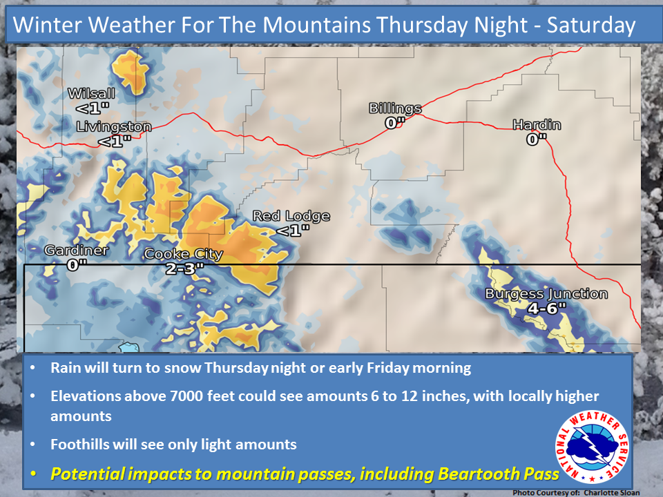
Snow levels will start out around 7,000ft on Thursday Night and drop below 6,000ft by the time Friday Morning rolls around.
Additional Storm Information:
Idaho: Up To 10″ of Snow Tonight – Saturday Morning
* Accumulations: Snow accumulation of 1 to 3 inches, with up to 10
inches on mountain peaks above 7000 feet.
- NOAA Missoula, MT Today
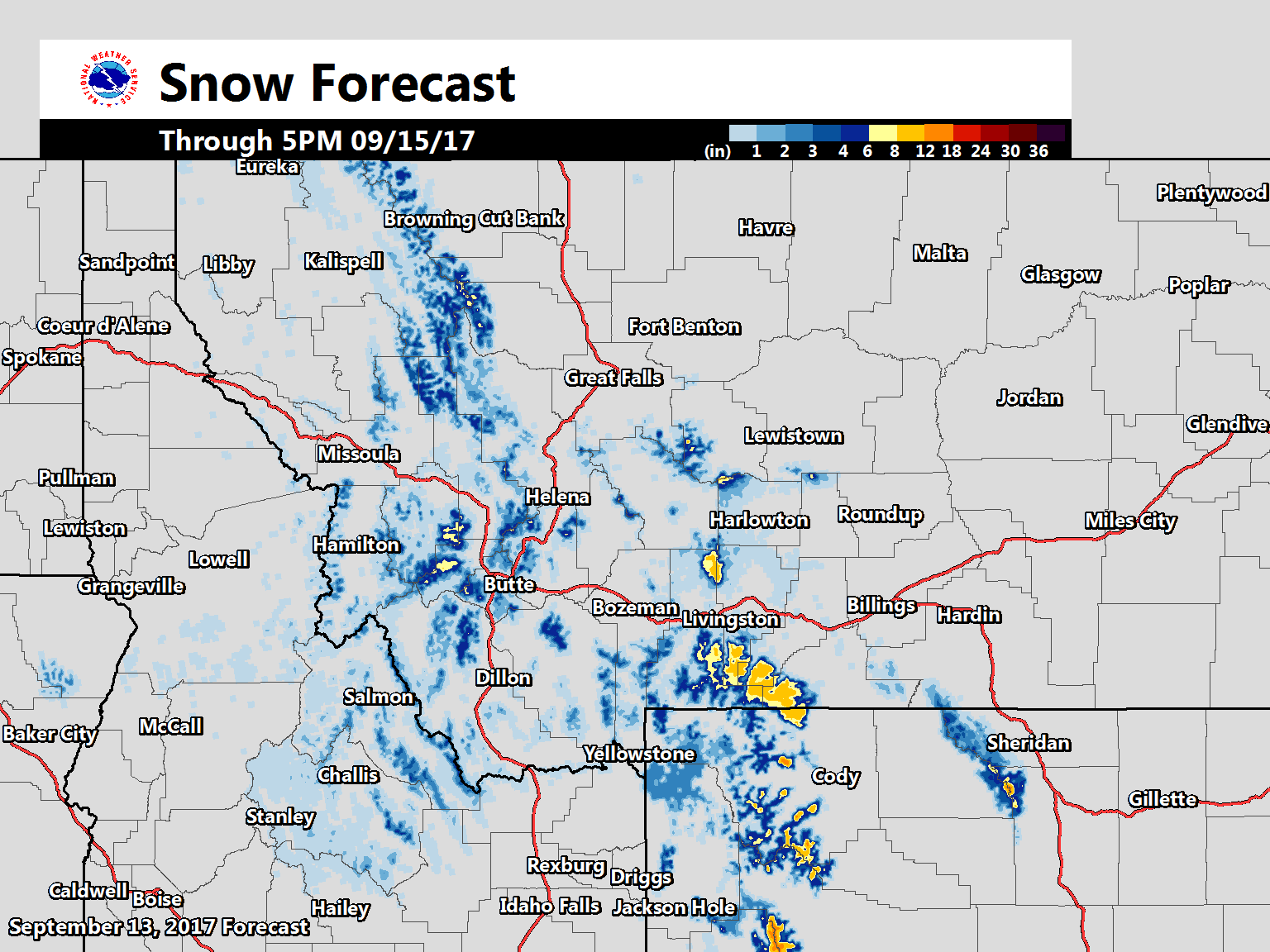
Montana: 14+” of Snow Tonight – Saturday Morning
* SNOW ACCUMULATION...8 to 14 inches above 7,000 feet, with
 locally higher amounts possible. Greatest totals will be on
 north facing slopes.
- NOAA Billings, MT Today
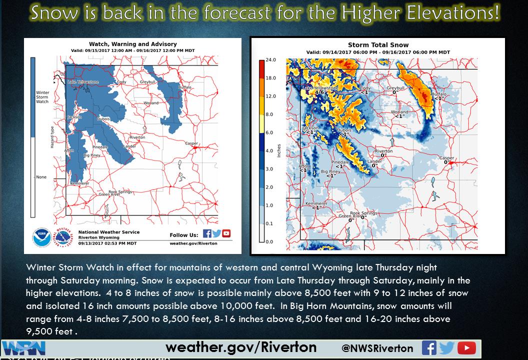
Wyoming: Up To 20″ of Snow Tonight – Saturday Morning
* SNOW AMOUNTS...4 to 8 inches above 7500 feet, 8 to 14 inches
 above 9000 feet.
- NOAA Riverton, WY Today


WY/MT Winter Storm Warning:
URGENT - WINTER WEATHER MESSAGE
National Weather Service Billings MT
404 AM MDT Thu Sep 14 2017

...WINTER STORM WARNING IN EFFECT FROM 6 PM THIS EVENING TO 6 PM
MDT SATURDAY...

The National Weather Service in Billings has issued a Winter
Storm Warning for Heavy Snow...which is in effect from 6 PM this
evening to 6 PM MDT Saturday.

* IMPACTS...Travel in the high country will become difficult. Tree
 and powerline damage is possible due to heavy wet snow. US
 Highway 212 and the Beartooth Pass will likely be impacted by
 heavy snow and very low visibility. Heavy, wet snow could pose a
 threat to those with outdoor interests.

* TIMING...This evening through Saturday afternoon.

* SNOW ACCUMULATION...8 to 14 inches above 7,000 feet, with
 locally higher amounts possible. Greatest totals will be on
 north facing slopes.

* PERIOD OF HEAVIEST SNOW...Late tonight through Friday.
What is the forcast for
grangeville Idaho 83530