Huge areas of the Earth’s northern latitudes have wildfires burning right now due to the unusually hot weather that has engulfed a huge portion of the Arctic, from Alaska to Greenland to Siberia. The heat is responsible for creating conditions perfect for wildfires, including some enormous ones burning in remote parts of the region that are visible from space.
- Related: Record-Breaking High Temperatures in Alaska this Weekend | Anchorage Just Had its Hottest June EVER
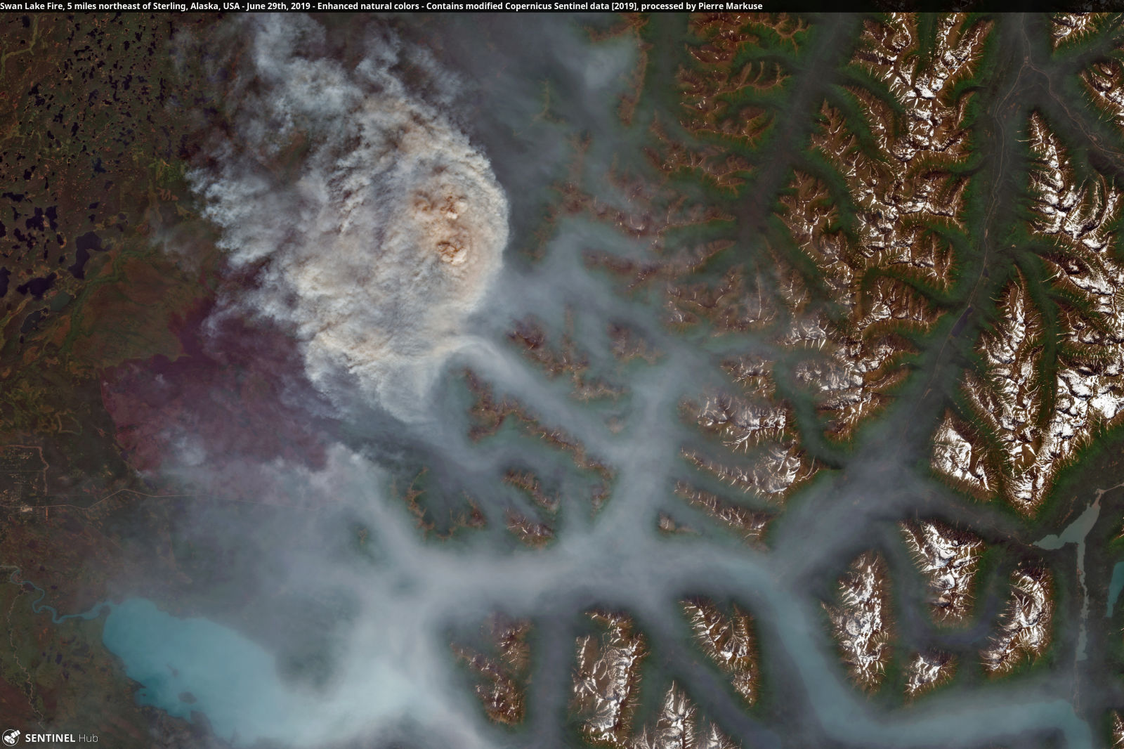
Pierre Markuse, a satellite imagery processing guru, has documented some of the blazes attacking the forests and peatlands of the Arctic, reports Earther. The imagery reveals the delicate landscapes with braided rivers, towering mountains, and vast swaths of forest, all under a thick blanket of smoke.
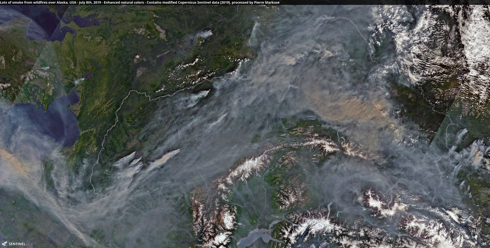
In Alaska, you can see the damage from wildfires that have burned more than 1.6 million acres of land so far this year. The image below shows some of the more remote fires in Alaska as well as the Swan Lake Fire, which was responsible for the smoke affecting Anchorage in late June and early July.
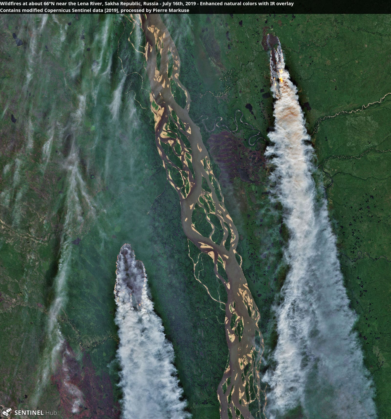
Incredibly hot conditions have also exacerbated flames in Siberia. The remote nature of many of the fires there means they’re burning out of control, often, through peatland that’s normally frozen or soggy. That’s a concern as peat is rich in carbon, and burning it can release the gas into the atmosphere as carbon dioxide. Peat fires can also burn underground into the winter and reignite in spring.
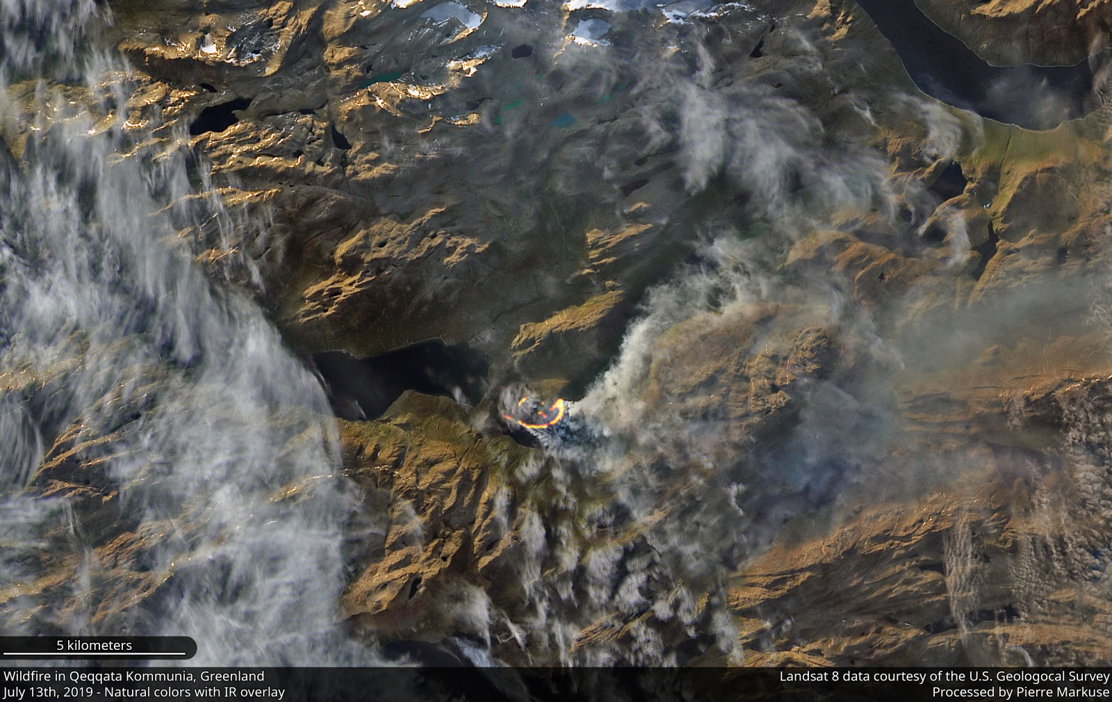
A landscape known more for its ice, this is the second time in the past three years a wildfire has started in western Greenland, yet another symptom of the Arctic climate transforming into a more volatile state.

