Denver-based meteorologist Chris Tomer is one of the most accurate forecasters we know. Check out and subscribe to his mountain weather forecast videos to see where North America will get the most snow.
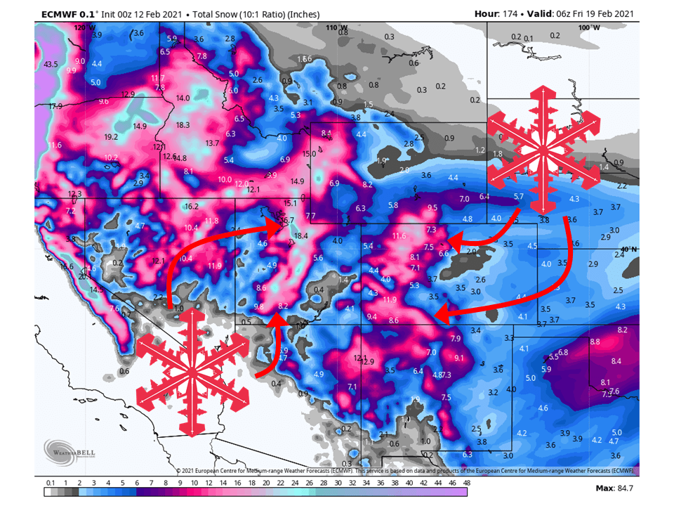
“Snow bullseyes 1/31-2/5 at PNW/BC/WY/ID with feet of accumulation. Less in UT. Colorado stays out of the mix except for a Southern Track storm system 1/29-1/30.
Snow Timeline:
Big Sky: Late 1/31-2/1(L), 2/2(M), 2/3(L),
2/4-2/5(H)
Wasatch: 2/1-2/2(M/H), 2/5(L)
Tetons: Late 1/31-2/2, 2/4-2/5(H)
Colorado: 1/29-AM 1/30(L/M)
Interior BC: 1/30(L), 1/31-2/1(H)
Tahoe: PM 1/31-2/2(H), 2/4-2/5(H)
Northeast: 1/29(M), 1/31(M), 2/2-2/3(L)”
Here are the main highlights from the forecast, but please check out the full video for a detailed forecast, more resort totals, and support for Chris Tomer.
Current Weather Overview
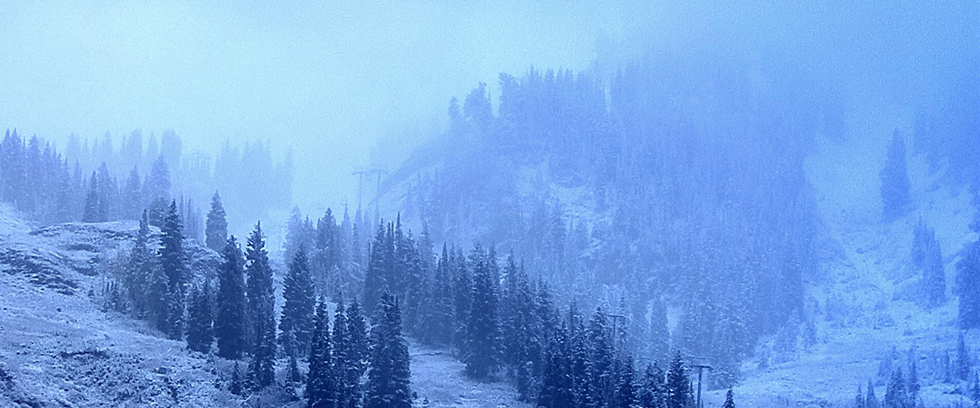
Today, January 29, 2025, brings clear skies to Big Sky, Montana, making it a great day for skiing. However, no new snow is expected until a pattern change arrives late on January 31. This upcoming change will bring snow into the first week of February.
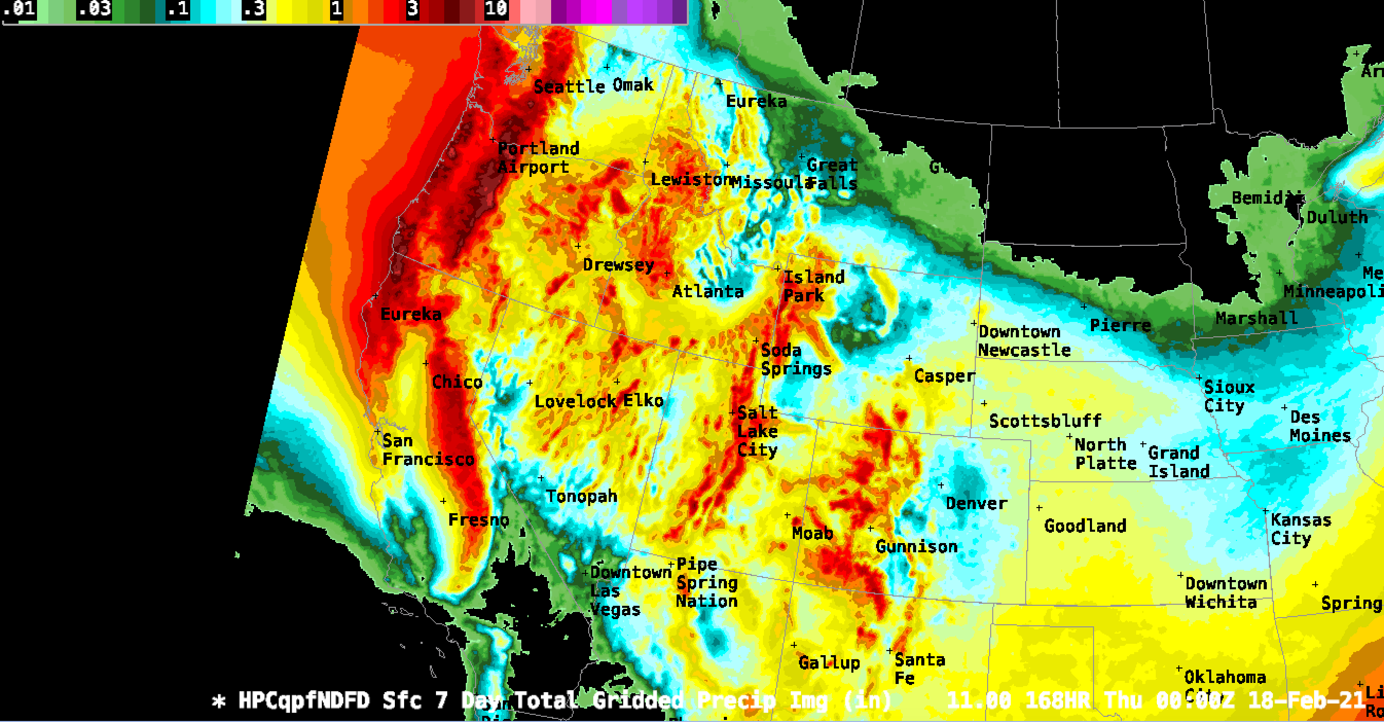
Snow Forecast for the Southwest
A slow-moving storm system is currently affecting the Four Corners region. Over the next couple of days, it is anticipated to bring 6 to 10 inches of snow to parts of Southwest Colorado and Southern New Mexico.
Northeast Snow Accumulation
The Northeast is set to experience moderate snow today due to a series of Clipper systems moving in from Canada. Areas in New York, Vermont, New Hampshire, and Maine are expected to see good skiing conditions with moderate accumulations.
Upcoming Storm Patterns
A significant pattern shift is on the horizon, with a powerful storm system expected to impact the Pacific Northwest. This will lead to heavy snowfall across regions including British Columbia, Idaho, and Wyoming, while Colorado may remain largely unaffected.
Detailed Timeline for Snowfall
The best chances for snow in Big Sky are forecasted from late January 31 through February 1. Following that, moderate snow is expected on February 2, and heavier snowfall on February 24 and 25.
Colorado’s Snow Outlook
The forecast indicates limited snowfall across Denver and the Front Range in Colorado. A low-pressure system moving through today and tomorrow will give Southern Colorado the primary chance for snow.
Jet Stream Dynamics
The jet stream currently guides storm systems but lacks strength for significant snowfall in Denver. As the low-pressure system moves away, attention will shift to the upcoming pattern change that could bring better snow chances to Utah and Colorado.
Snow Accumulation Projections
Forecasts indicate varying levels of snowfall across different regions. Areas in the Wasatch could see 6 to 10 inches, while the Pacific Northwest may receive up to three feet in some locations. The Northeast is also expected to have moderate accumulations today.