The 2005 and 2020 hurricane seasons have been strikingly similar so far. 2020 is on track to match or even beat the record 2005 season, and the chance of La Niña forming this fall and winter is extremely similar.
La Niña patterns play a huge role in what winter looks like in terms of snowfall. La Niña systems generally indicate colder equatorial ocean temperatures, which forces the jet stream further north, delivering above-average precipitation to the Pacific Northwest. The higher latitude jet stream forces moisture away from the Intermountain West, meaning areas such as the Sierra Nevada and the Rocky Mountains often have drier winters with less snowfall.
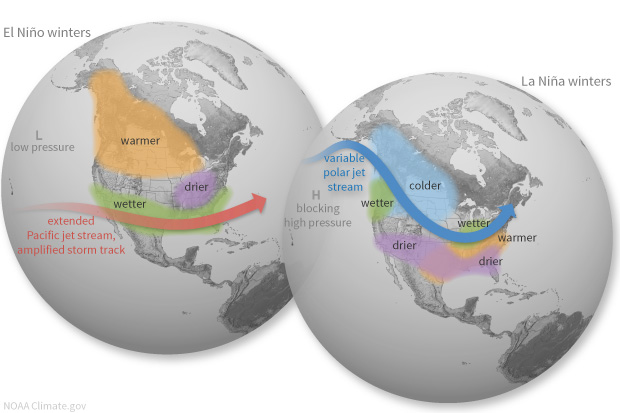
La Niña ENSO patterns do not always mean below-average snowfall, however, and they are very hard to accurately predict due to ever-changing atmospheric conditions. Despite having a La Niña watch issued the preceding summer, which would indicate below-average snowfall for the region, California’s Sierra Nevada mountains had the best seasons on record. Squaw Valley received over 700 inches (58 feet of snow, about the height of a 6 story building) during their 2016-2017 season. They had so much snow, in fact, that they were able to keep daily operations running until July 15.
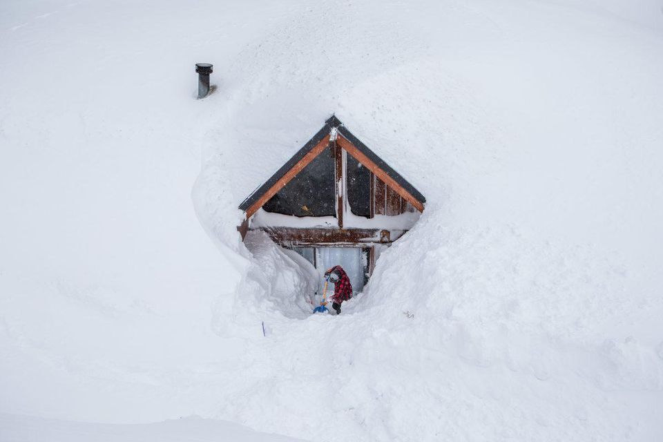
Since the Atlantic hurricane season is generally a good indicator of climate, we can pair that with La Niña to make some predictions about winter 2020-2021. University of Colorado Boulder’s waterdesk.org site lets you see total snowfall amounts for prior years. Let’s take a look and break it down state-by-state. Scroll to the bottom for a TL;DR summary.
California
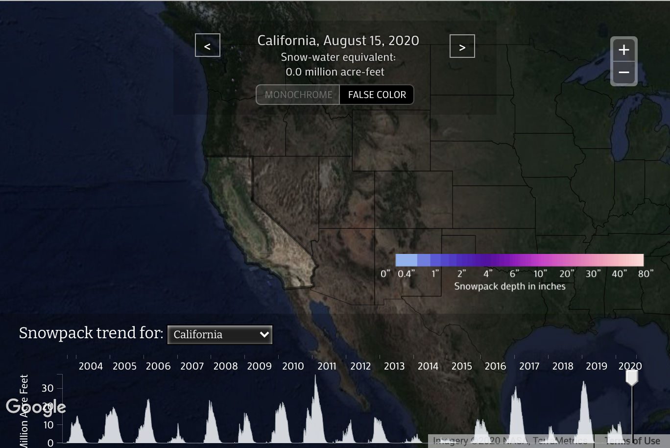
California generally has very variable winters, some years they will get 60 feet of snow, and others less than 10. This makes it hard to compare the 2005 season to the “average,” but it looks like the 2005 season fell right in the middle of the spectrum. If the Atlantic hurricane season progresses on track with the 2005 season as it is now, California could see average snowfall.
Oregon
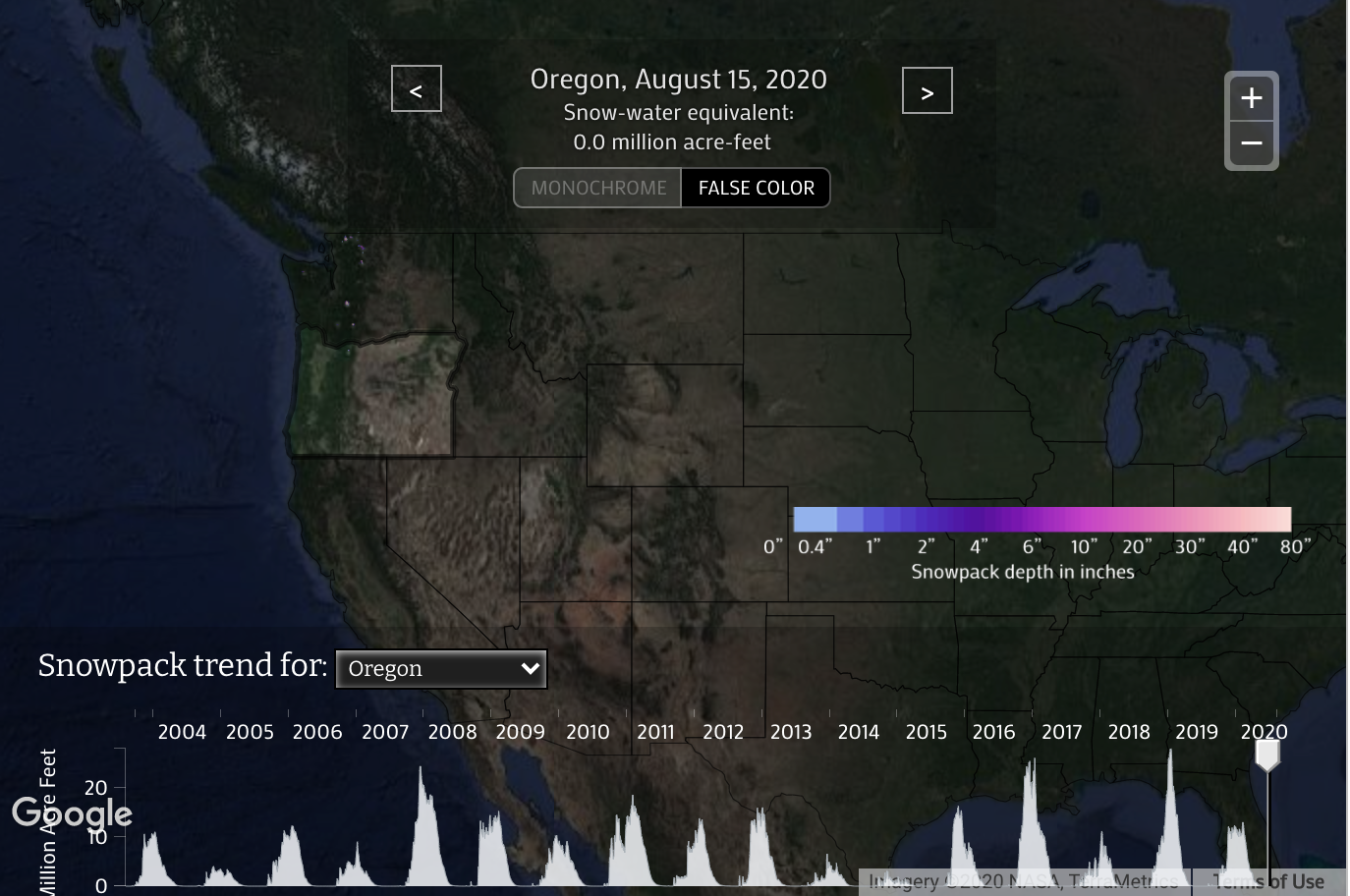
Oregon saw a particularly dismal 2005 season. Unfortunately, 2020 may follow in its footsteps.
Washington
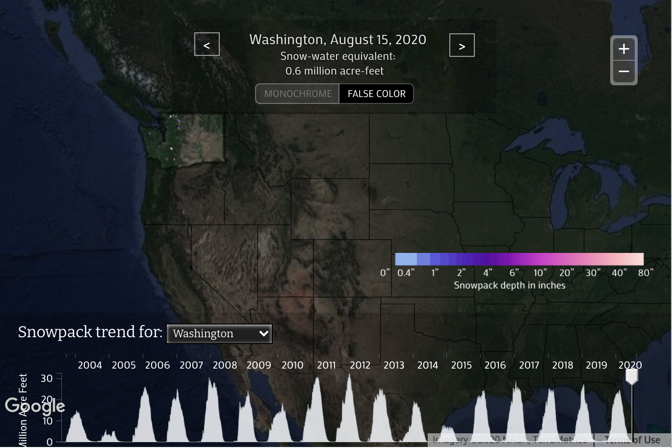
Washington also saw a poor snow year in 2005. It looks like the pacific northwest as a whole may see below-average snowfall in 2020.
Idaho
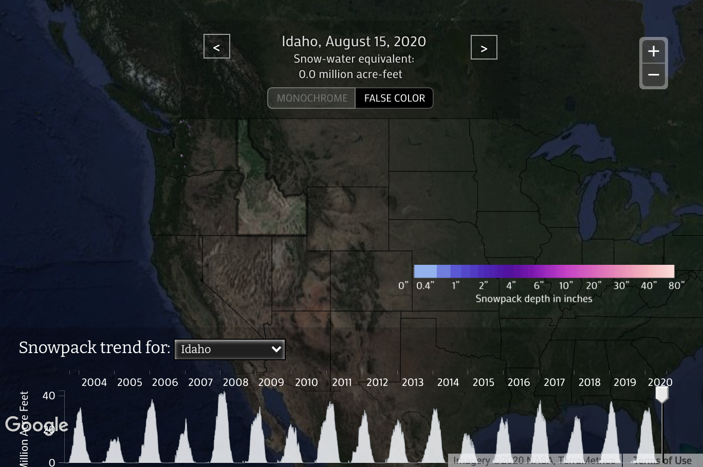
Idaho once again saw below-average totals for 2005, but far less so than the pacific northwest. Could Idaho mirror the 2005 season?
Montana
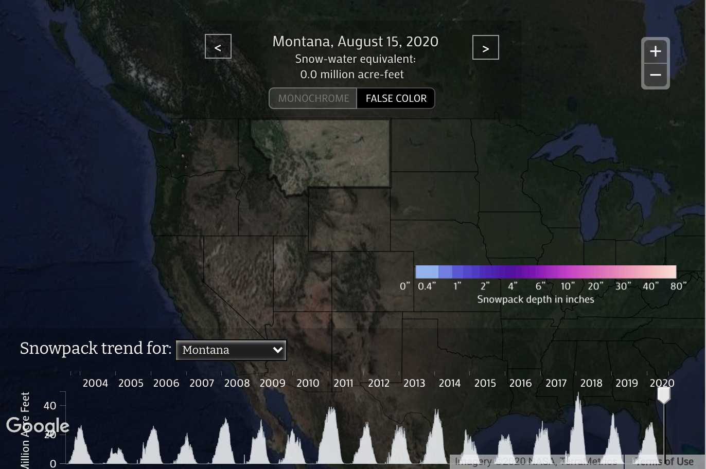
Once again, below-average snowfall might be expected in Montana for 2020.
Wyoming
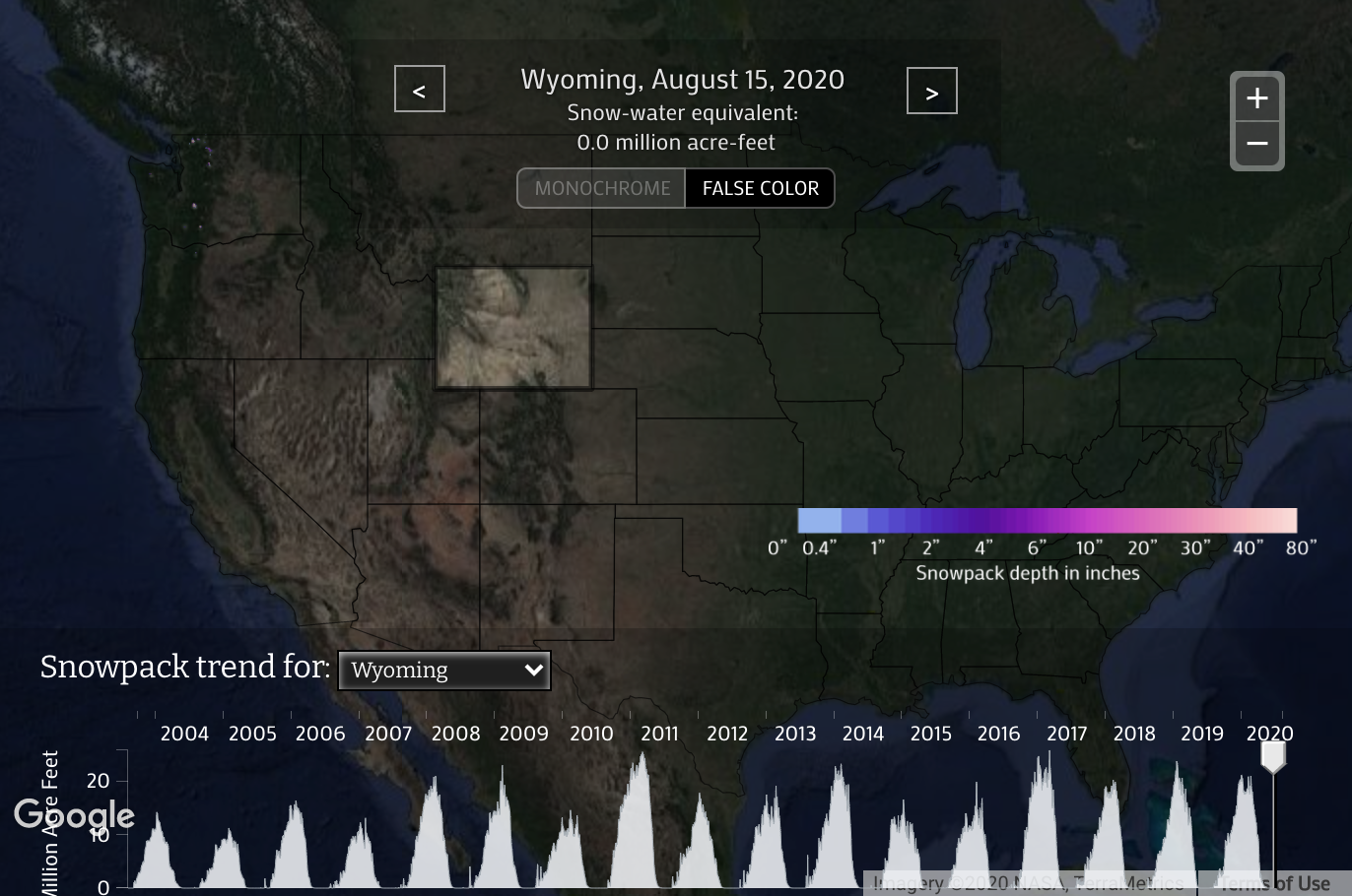
Wyoming saw slightly below-average snowfall in the 2005 season, which may indicate the same in 2020.
Utah
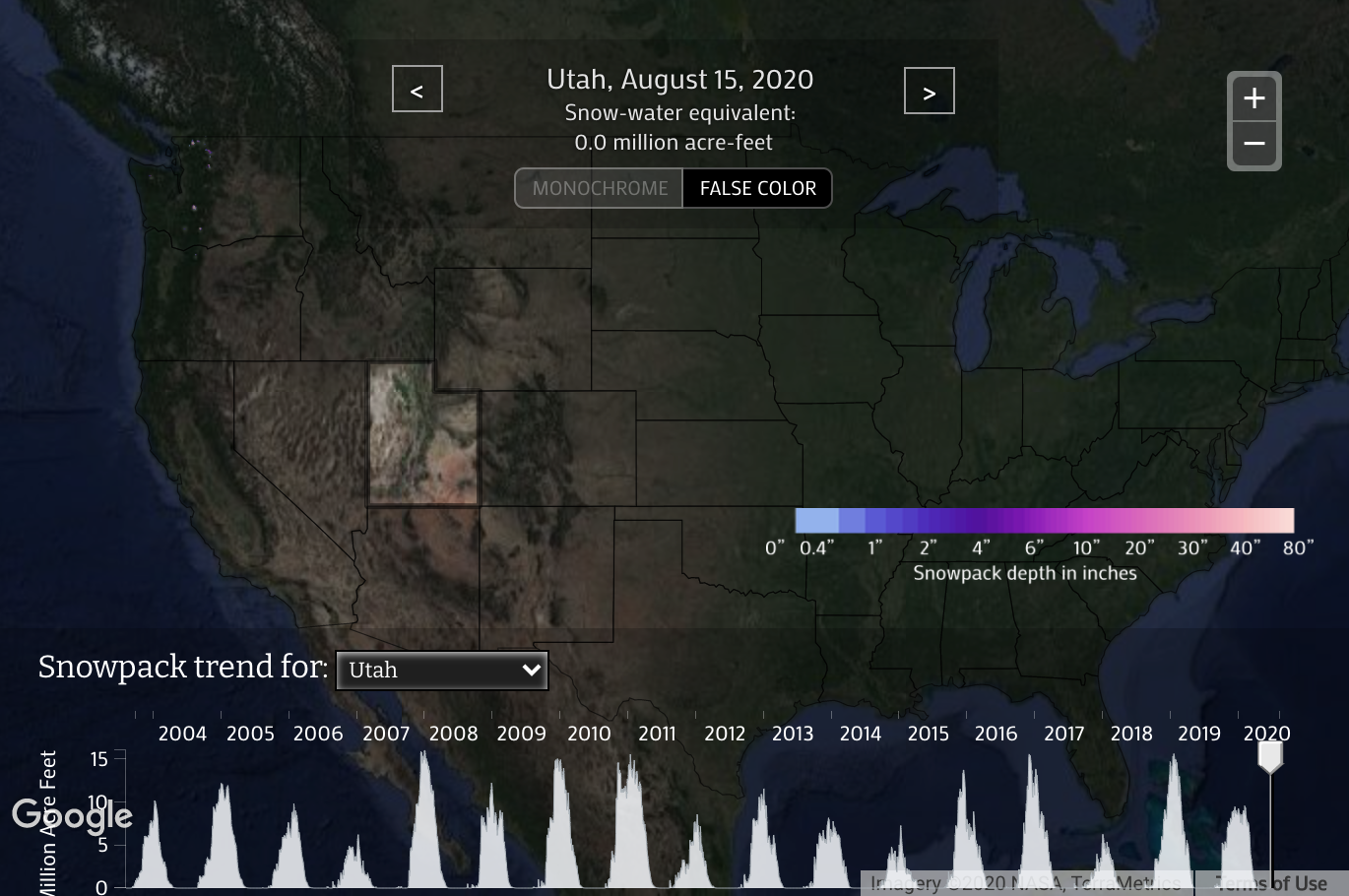
Utah saw above-average snowfall in 2005, and Wasatch skiers are hoping for the same in 2020.
Colorado
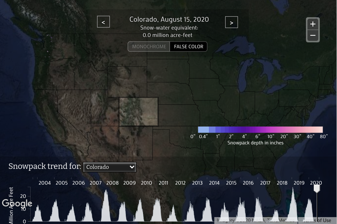
Colorado saw a slightly above-average year in 2005, hopefully, 2020 will be the same.
Vermont/New England
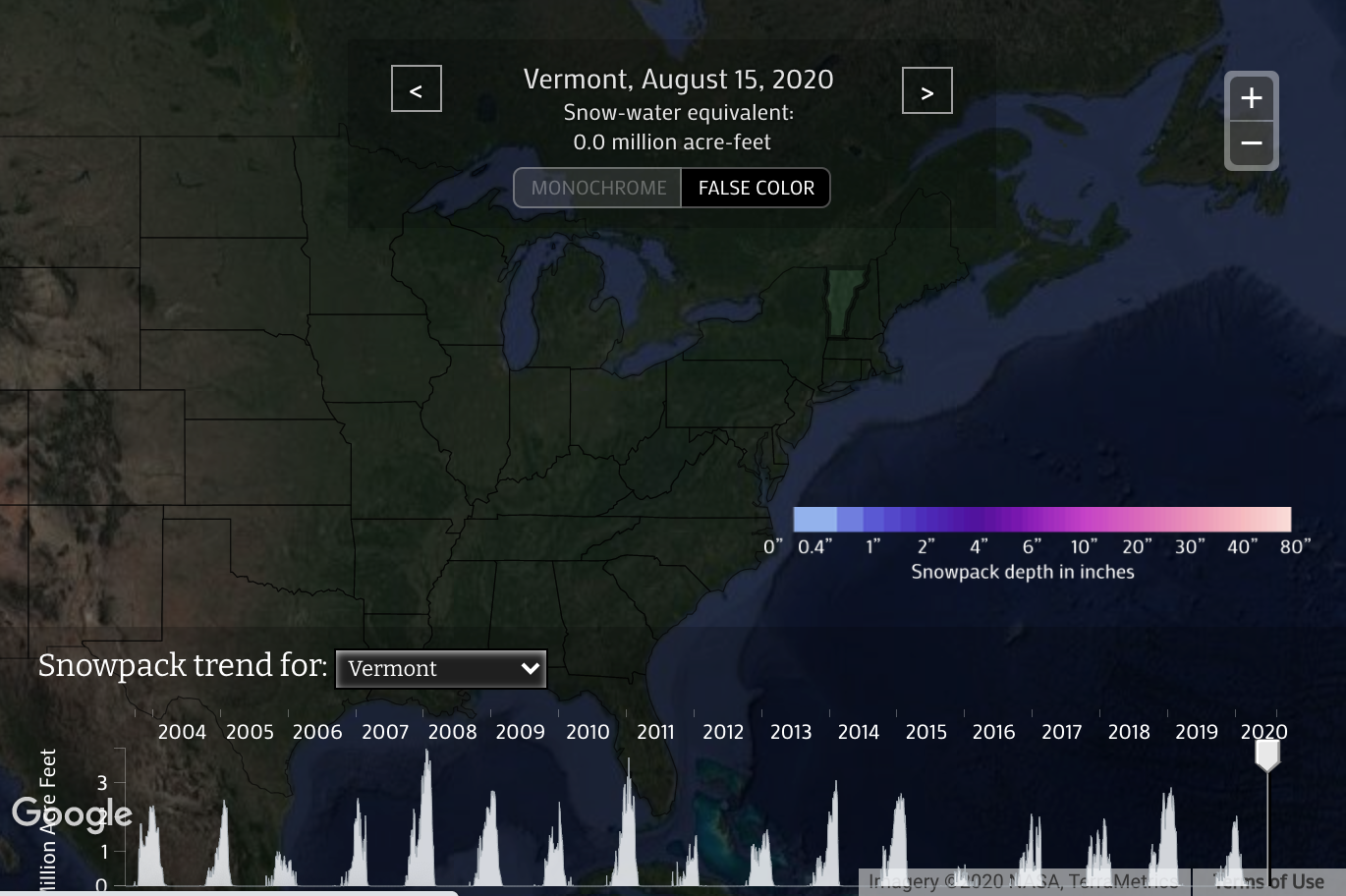
Since New England states generally see similar flows in the winter, we used Vermont as a proxy to roughly estimate all New England states snowfall. It looks like winter 2005 was mild, just about average. 2020 may mirror the same pattern.
TL;DR: according to our prediction of matching two similar hurricane and La Niña seasons together, many states will receive less than average snowfall, including Washington, Oregon, Montana, Idaho, and Wyoming. Some states appear to be right on the average, including California and New England. Finally, there are two states that appear to receive above-average snowfall: Colorado and Utah.

