
Forecast by SnowBrains Meteorologist Nathan Tarino
Last Updated 5 AM MST Saturday, July 1st
Overview
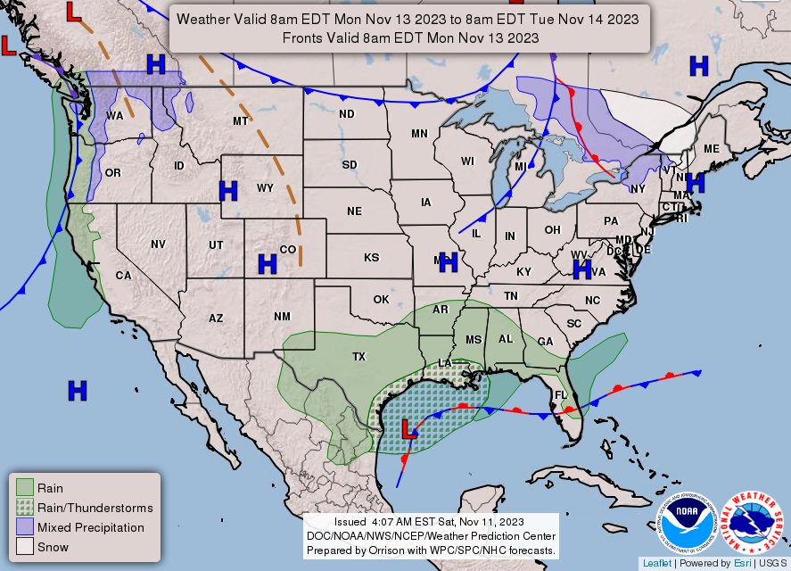
The holiday weekend weather pattern will be dominated by a ridge of high pressure over the Central US, a storm system departing off the Eastern Seaboard, and another system coming ashore over the Northwest.
On Saturday, a cold front draped from the Northeast southwestward into the Ohio Valley and Central Plains will bring afternoon storms along its length, with a shot at severe weather in parts of the I-95 corridor. Monsoon moisture will continue streaming into New Mexico and Colorado, sustaining rain chances. A storm system moving into the Northwest will bring cooler than usual temperatures and chances for rain and storms over the higher terrain. Tropical storm Colin will continue to bring fresh winds and rain along the coastal areas of the Carolinas.
On Sunday, cool and damp weather will spread across much of the Northwest. Afternoon monsoon storms will continue across New Mexico and Colorado, again threatening the Front Range. Tropical storm Colin will begin to move off the coast of North Carolina, but not without enhancing a few afternoon storms across the Coastal Plain. A few gnarly storms will impact the Dakotas and eastern Montana in the evening.
On Independence day, rain will slowly begin to push eastward out of the Northwest, with a few lingering showers in the Seattle metro area. A couple of monsoon storms will hang around across Arizona, New Mexico, and Colorado amid continued relatively moist southwesterly winds. The only widespread bad weather will be found in the Northern Plains and Upper Mississippi River Valley, where clusters of storms will trek eastward through the day and bring heavy rainfall in spots.
More details below, organized by region. Happy 4th!
Northwest/California
Saturday: Showers and thunderstorms developing over the Cascades will strengthen as they move east through the afternoon and evening. Strong winds and some small hail are possible as storms track over generally rural areas. Big metros like Seattle and Portland will stay dry, but will notice cooler temperatures. The weather in the Bay Area will be pretty uneventful, if not a little cooler than usual.
Sunday: Rain and storms will become more widespread, this time bringing a few showers to the bigger cities. Portland could see a sprinkle or two while Seattle is likely to see some light rain by late Sunday evening. Fortunately, the heavier rain and storms will remain farther inland over the Columbia River Basin. Colder air will arrive in earnest on Sunday, bringing cooler than usual temperatures across the Northwest, California, and Nevada.
The 4th: Rain and storms will begin to translate northeastward into the Northern Rockies on the 4th, with Seattle the only populated area that’ll still see a few showers. The real story will be cooler weather, with temperatures running 5 to 10 degrees lower than average for this time of year across the Northwest, Nevada, and California.
Intermountain
Saturday: Scattered storms will develop in the afternoon over the higher terrain and spread through the evening. Stronger storms will be capable of gusty winds up to 50-60 mph. Storms will taper off fairly quickly after dark. Storm activity will stay generally east of the Salt Lake Valley, but the Front Range is under the gun.
Sunday: Scattered storms will develop across Colorado and eastern Wyoming once again on Sunday afternoon. Storms developing over the mountains and moving eastward will bring chances for gusty winds to cities along the Front Range through the evening. Storms will die off by 10 pm local.
The 4th: More of the same on Monday with storms across the Colorado Rockies, but this time a drier airmass in Colorado will make it tough for storms to move off of the higher terrain and into the urban areas – cause for optimism for firework fans. On the flipside, the drier airmass means any storm that can sustain itself into the lower terrain will be capable of gusty outflow winds. It’s a case of low probability but high impact for those living along the Front Range.
Northeast
Saturday: Strong storms will develop along a cold front as it advanced south over the I-95 corridor in the afternoon. A few strong to severe storms are expected from near DC all the way through Boston. Storms will push offshore through the late evening hours. The interior northeast will remain quiet, though.
Sunday: Expect much quieter weather behind Saturday’s cold front. Temperatures will be a bit cooler than usual, but by most measures Sunday will be gorgeous across the Northeast.
The 4th: The holiday should offer up great weather across the Northeast with pleasant temperatures and no rain to speak of through the day. A few showers or weak storms are possible near Lake Ontario and Lake Erie by late Monday night, but I expect they’ll hold off long enough for pyrotechnics to go uninterrupted.
Southwest
Saturday: Monsoon moisture pushing in from the southwest will keep storms around across eastern Arizona and New Mexico in the afternoon. Storms will be relatively isolated and slow moving, affecting only a limited area before dying off after dark. Phoenix should expect to stay dry.
Sunday: Scattered storms will develop from near Tuscon, AZ north and eastward through most of New Mexico. Sunday’s forecast is similar to Saturday’s, with storms missing most urban areas.
The 4th: I sound like a broken record, but scattered afternoon storms will impact the same areas as over the weekend. A corridor from near Tucson through Alberquerque will see the most storm coverage, with a few isolated showers and storms farther east across the rest of New Mexico.
Plains
Saturday: Isolated thunderstorms will develop across the High Plains through the afternoon, especially across eastern Kansas and the western Dakotas. A few strong to low-end severe storms are expected through the evening, with gusty winds and hail in the stronger storms.
Sunday: A huge area of the Plains will see strong to severe storms develop Sunday afternoon, from eastern Wyoming eastward across the Dakotas and much of Nebraska.
The 4th: Strong to severe thunderstorms are again forecast to develop across southeastern Montana in the afternoon and march eastward into the Dakotas through the evening. Strong winds in excess of 60 mph and very large hail will be possible with some of the stronger storms in the area, more than enough to cancel holiday plans. Keep a close eye on the forecast if you’re in the northern High Plains or the Dakotas. In addition, soaking rainfall from rounds of storms is expected across the Upper Mississippi River Valley, especially through the morning and early afternoon.
Southeast
Saturday: The typical summertime airmass thunderstorms will develop across the Southeast on Saturday. The only exception will be across the coastal portions of the Carolinas, where the newly designated tropical storm Colin will bring heavier rainfall and some gusty winds too.
Sunday: Tropical storm Colin will slowly pull away from the Carolina Coastlines on Sunday, but will still influence the weather by enhancing storm chances across the Carolinas through the day. Elsewhere, very typical summer weather with widely scattered weak storms in the afternoon. Storms will taper off through the evening across the Southeast.
The 4th: In a stroke of good timing, a weak cold front and associated drier airmass will begin to sag into the Southeast on Independence day, limiting the areal coverage of the aforementioned pop-up thunderstorms. The best chances for storms in the 4th will be confined to the farther south parts of the region, from the Gulf Coast of Louisiana through southern Alabama, Georgia, and South Carolina.

Do what Europe is doing. Huge projection screen on the side of a big building and a big sound system. You actually get a bigger boom feeling in your gut, if the speakers are loud enough. No more PTSD for the war vets and the animals seem to take it a little easier. Fireworks are so 90’s