Forecast By SnowBrains Chief Meteorologist – Eric McNamee
7:10 pm MST, 12/14/2021
Forecast Summary:
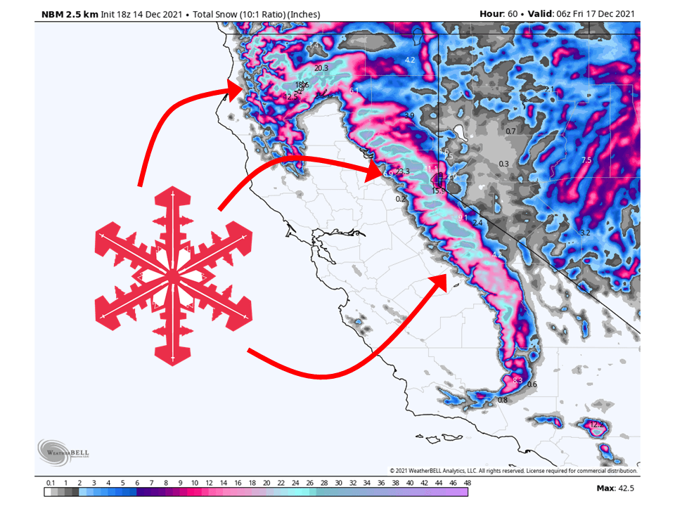
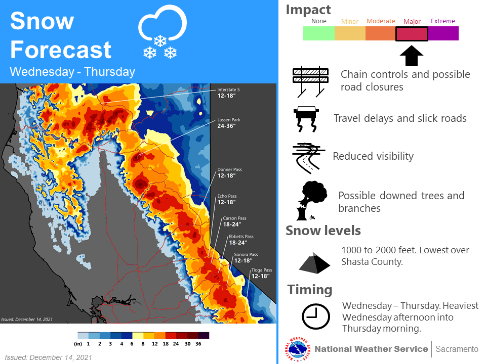
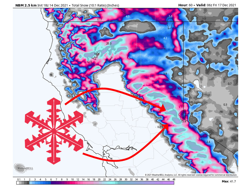
Another trough will move into California Wednesday night and bring an additional 1-2 FEET of snow to the Sierra through Thursday.
Snow will start Wednesday afternoon and continue through the day Thursday.
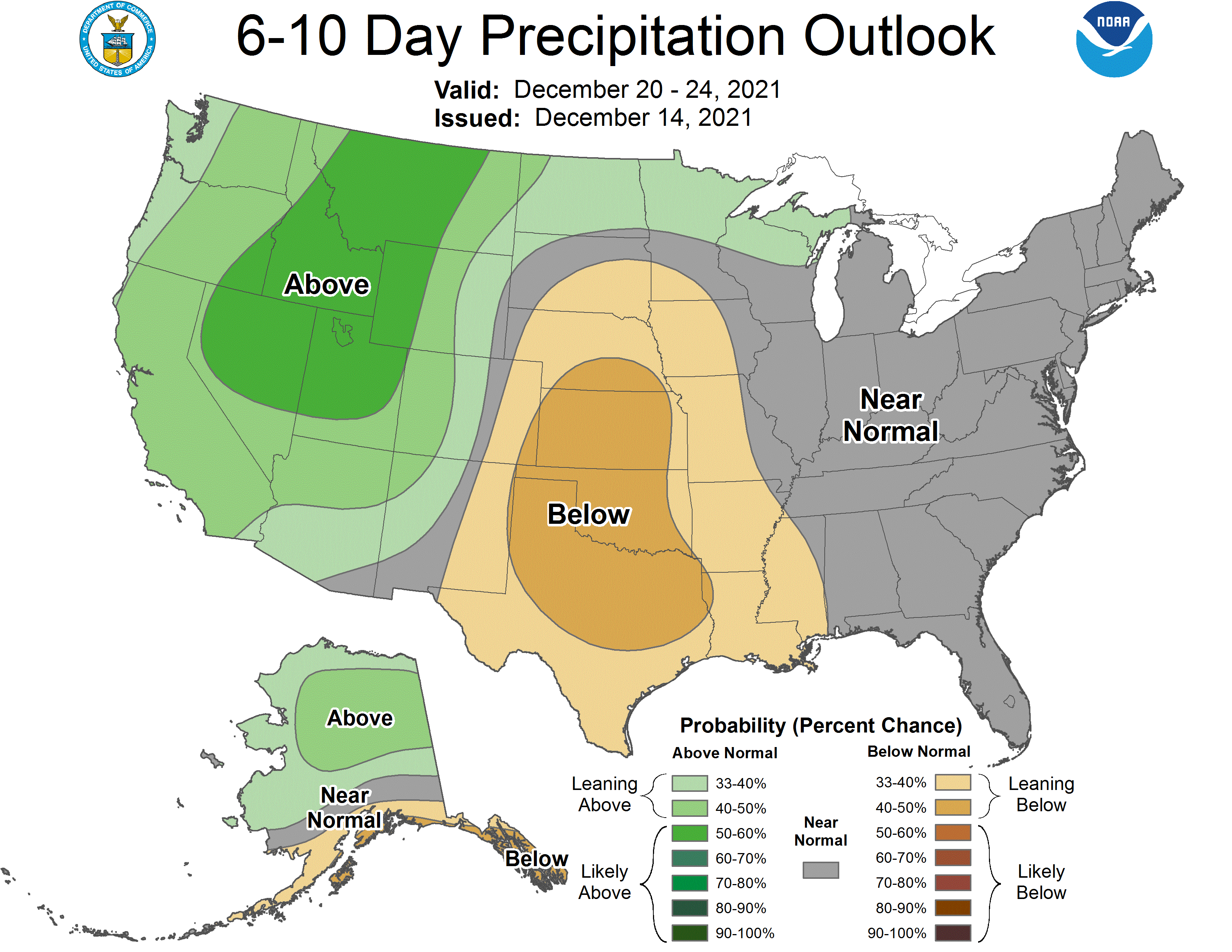
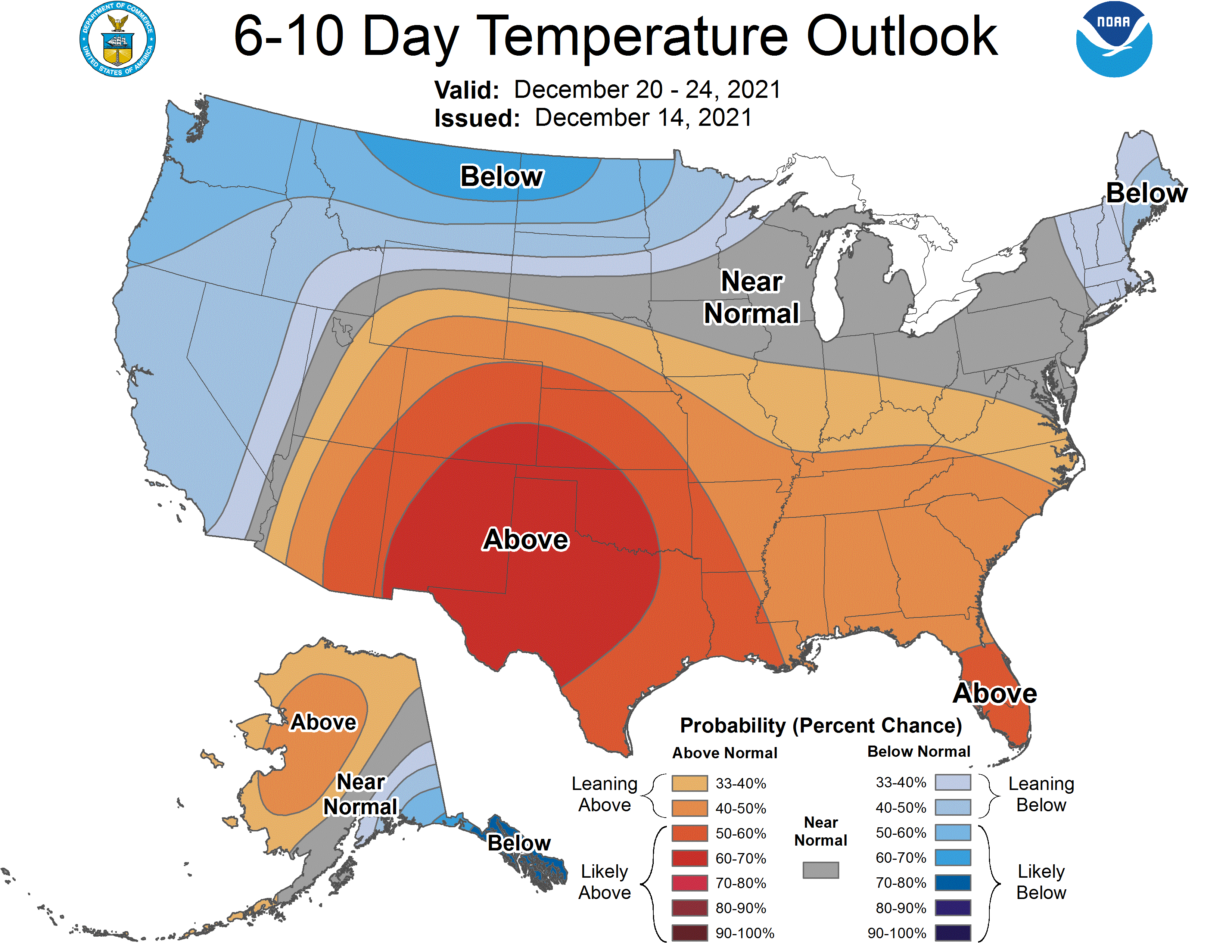
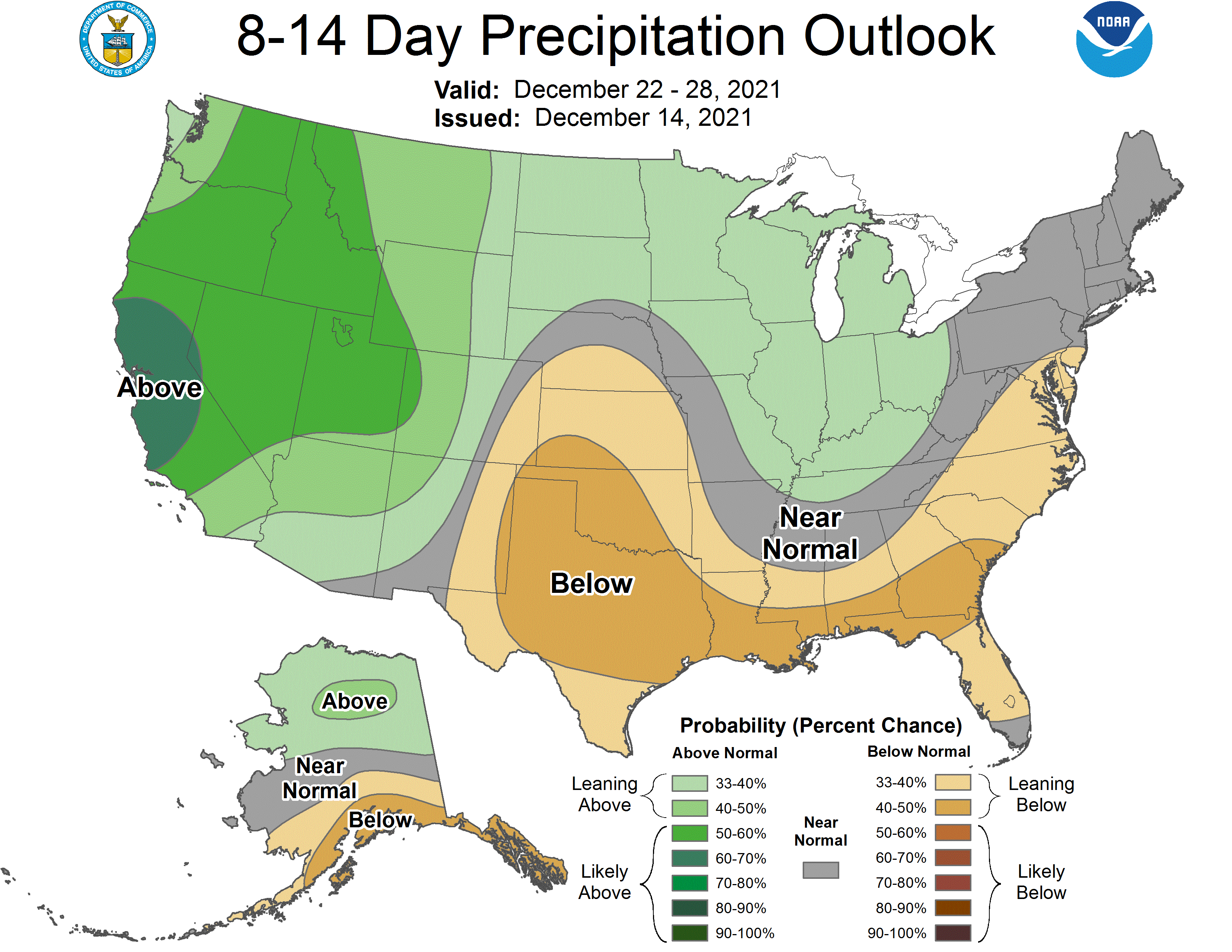
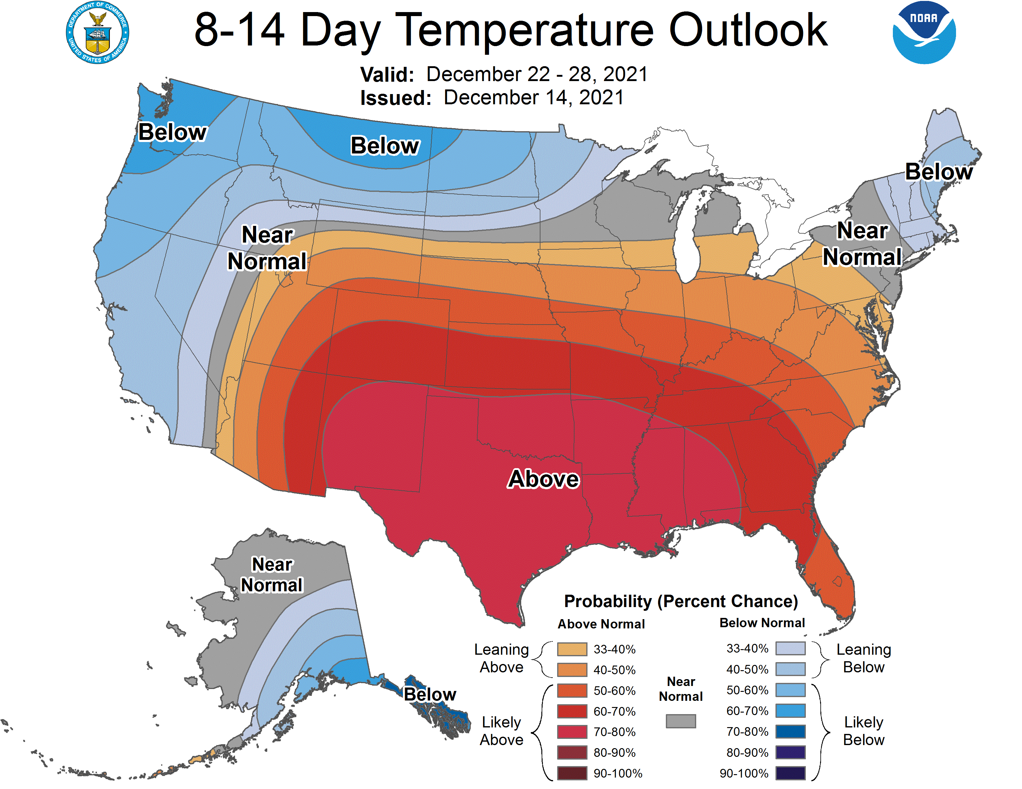
An active pattern looks to be in place in the long term and extended.
Resorts that will see the most snow are Heavenly, Homewood, June, Kirkwood, Palisades Tahoe, Alpine Meadows, Northstar, Sierra at Tahoe, Sugar Bowl, and Mammoth.
Short-Term Forecast:
Tuesday-Thursday:
Another trough will move into California Wednesday night and bring an additional 1-2 FEET of snow to the Sierra through Thursday.
Snow will get going Wednesday afternoon as the trough moves onshore from the Pacific.
Snow will then fill in during the night Wednesday and continue on Thursday.
By Thursday night, snow will taper off as the trough moves off to the east.
Winter Storm Warnings have been issued in anticipation of this.
Long-Term Forecast:
Saturday-Monday:
Getting into the weekend conditions will clear out as high pressure builds over the area.
However, this will be short-lived as another trough will move into the state Monday Tuesday.
Snowfall totals are uncertain at this time.
Extended Forecast:
Monday and Beyond:
Global ensembles indicate above-average precipitation and below-average temperatures across California through the extended.
