SnowBrains forecaster Clay Malott – 1:30 pm PT 3/3/23
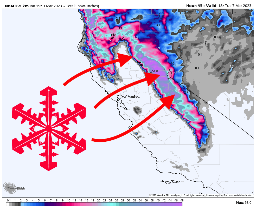
Yet another massive storm will hammer California this weekend, bringing 2-5 feet of fresh snow. This storm will rage from Saturday morning through Monday afternoon with the best ski day being Sunday and will bring excellent skiing to the region, especially for the northern Sierra and Lake Tahoe.
Snowfall will gradually increase throughout the day on Saturday and drop solid accumulations around the region. Keep in mind that Saturday will bring gusty winds, so upper mountain lifts may not be running. Between 8 am and 4 pm on Saturday, here are what I see as realistic totals:
- West Tahoe basin (Palisades, Sugar Bowl, Kirkwood): 8-12″
- Central Tahoe basin (Northstar, Homewood): 6-10″
- East Tahoe basin (Heavenly, Mt. Rose): 3-5″
- Mammoth: 2-4″
Strong snowfall will continue on Saturday night and bring some excellent overnight reports on Sunday:
- West Tahoe basin: 16-22″
- Central Tahoe basin: 10-18″
- East Tahoe basin: 5-10″
- Mammoth: 10-14″
Sunday will bring another 2-6″ around the lake with decreasing snowfall rates throughout the day. Precipitation will continue to diminish overnight and will be light by the time resorts open on Monday. Expect overnight totals to be 5-8″ for west Tahoe resorts, 3-6″ for the central Tahoe basin, and just a few inches for Mt. Rose and Heavenly. Lingering showers will bring a couple of extra inches during the day on Monday but no significant accumulation.
Looking ahead, another storm is brewing for Tahoe on Tuesday night and Wednesday morning. Accumulations from this system will be light, with expected totals in the 2-8″ range for Tahoe and just a trace for Mammoth.
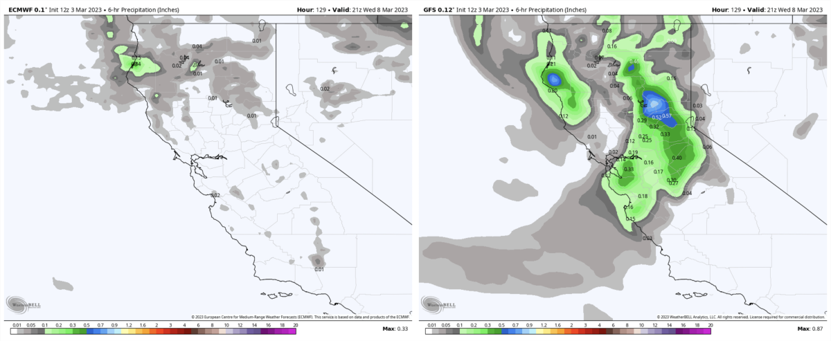
Some models bring in a stronger system on Wednesday night, but disagreement remains high and the ensemble support is relatively weak, so it remains to be seen whether this storm will materialize or not. Fingers crossed for the best!

