Forecast By SnowBrains Meteorologist – Eric McNamee
11:35 AM MST, 4/9/2021
Forecast Summary:
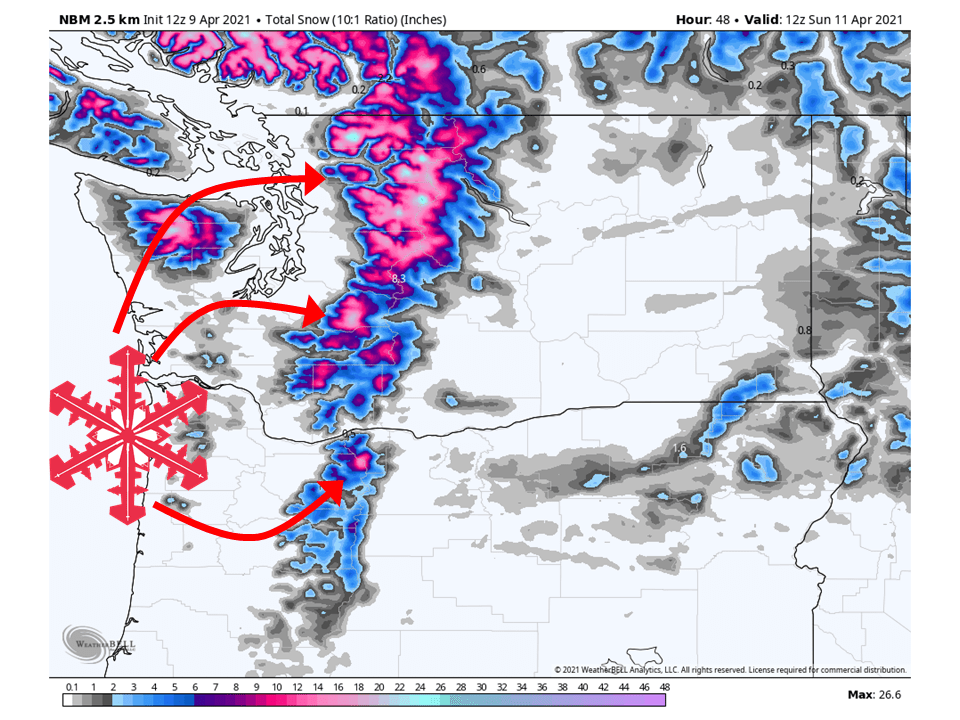
A shortwave trough will move through the PNW today and tomorrow, bringing 6-18″ of snow along the Cascades.
Snow will pick up in intensity tonight, become showery tomorrow, and then taper off by Sunday morning.
Conditions look to clear out and remain dry through next week as higher pressure builds over the West Coast.
Resorts that look to see the most snow are TImberline, Crystal Mountain, Stevens Pass, Alpental, and Mt Baker.
Short-Term Forecast:
Friday-Sunday:
A shortwave trough will make its way through the region today and tomorrow, bringing 6-18″ of snow to the Cascades.
Snow will start late tonight and pick up in intensity before it becomes showery tomorrow afternoon as the shortwave trough moves off to the east.
Winter Weather Advisories have been issued by the National Weather Service for this system.
Conditions will then clear out Sunday as high pressure builds over the West Coast.
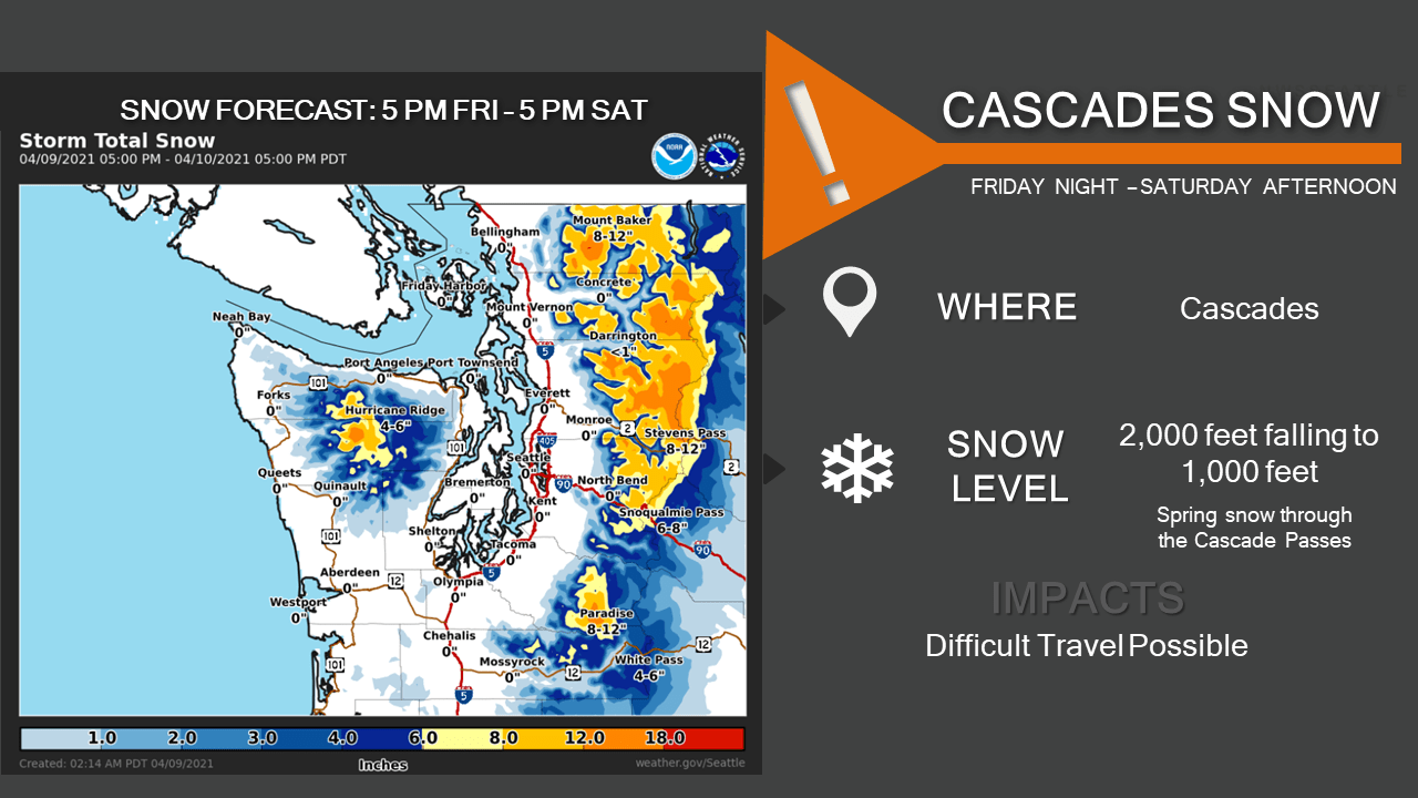
The next weather system arrives late this afternoon and into
Saturday with another round of rain and mountain snow. Snow levels
remain low, around 2000 feet, with more accumulating snow
expected at the highway passes - a Winter Weather Advisory is in
effect. The Cascade highway passes could see another 6-12" of snow
through the period. A convergence zone, aimed at Stevens and
Snoqualmie Passes, will maintain snow showers through Saturday
afternoon. The lowlands will see around 0.05-0.25" of rain along
with gusty south winds (mainly this evening).

Snow levels are very low Saturday morning, dropping to 500-1000
feet, with a rain/snow mix possible in the lowlands (especially
over the higher hills and areas near the mountains). However,
significant lowland snow accumulations are not anticipated with
mostly light precip amounts, surface temperatures above freezing,
and highs around 50. Showers across the region will diminish
Saturday evening as the trough departs and onshore flow eases.

Long-Term Forecast:
Monday-Thursday:
A very weak shortwave trough will brush by the region Monday and bring some light snow showers, not much in the way of accumulation is expected.
Besides that, high pressure will build over the region and keep conditions dry through the remainder of the week.
Extended Forecast:
Thursday and Beyond:
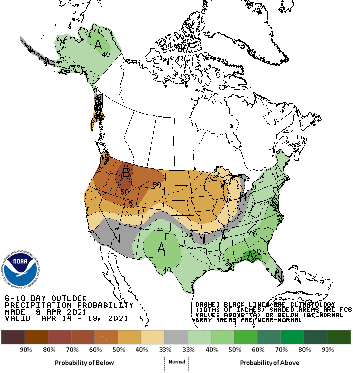
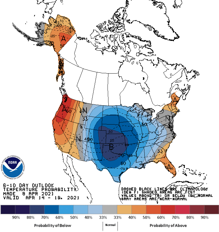
Global ensembles indicate below-average precipitation and above-average temperatures across the Pacific Northwest in the extended.
