Forecast By SnowBrains Chief Meteorologist – Eric McNamee
7:45 pm MST, 3/2/2022
Forecast Summary:
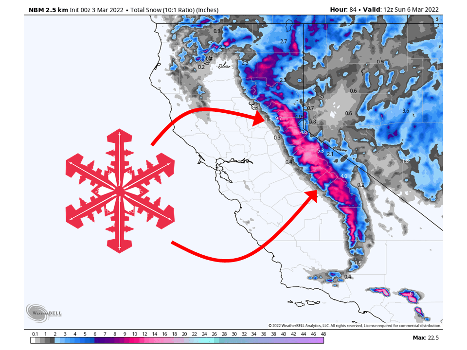
Two shortwave troughs will move through California and bring 6-12″ of snow to the Sierra through Saturday.
Snow will start Thursday night and continue through the day Saturday.
The heaviest of the snow will come Friday night with the second shortwave trough.
Resorts that will see the most snow are Heavenly, Homewood, June, Kirkwood, Palisades Tahoe, Alpine Meadows, Northstar, Sierra at Tahoe, Sugar Bowl, and Mammoth.
Short-Term Forecast:
Thursday-Saturday:
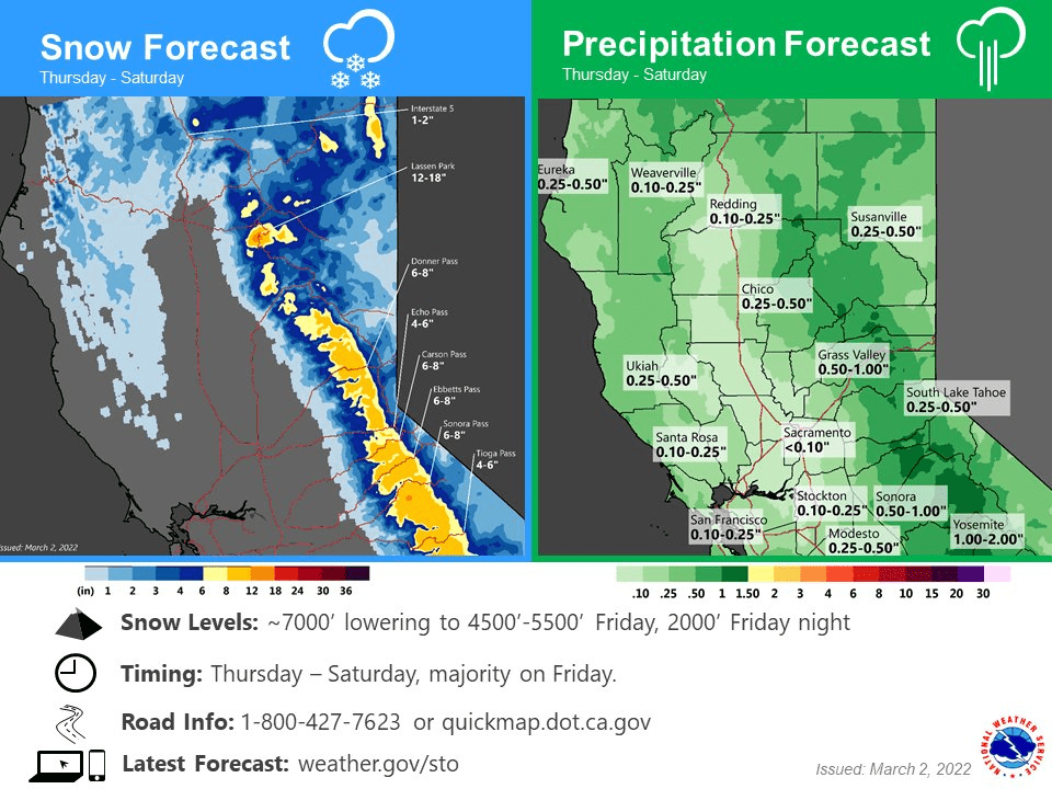
A couple of shortwave troughs will move through California and bring 6-12″ of snow to the Sierra through Saturday.
Snow will start Thursday night and continue through the day Saturday.
Snow levels will initially start around 7000′ and then drop to 4500-5000′ Friday morning.
The heaviest of the snow will come Friday night as the second shortwave trough draws an abundance of moisture and colder temperatures to California.
Snow will then taper off through the Saturday as the second trough moves to the east.
Winter Weather Advisories have been issued in anticipation of this.
Long-Term Forecast:
Sunday-Wednesday:
Dry weather is expected Sunday ahead of weak disturbance Monday.
This will bring some light snow showers to the area with no accumulations expected.
Dry weather is expected for the first part of next week.
Extended Forecast:
Monday and Beyond:
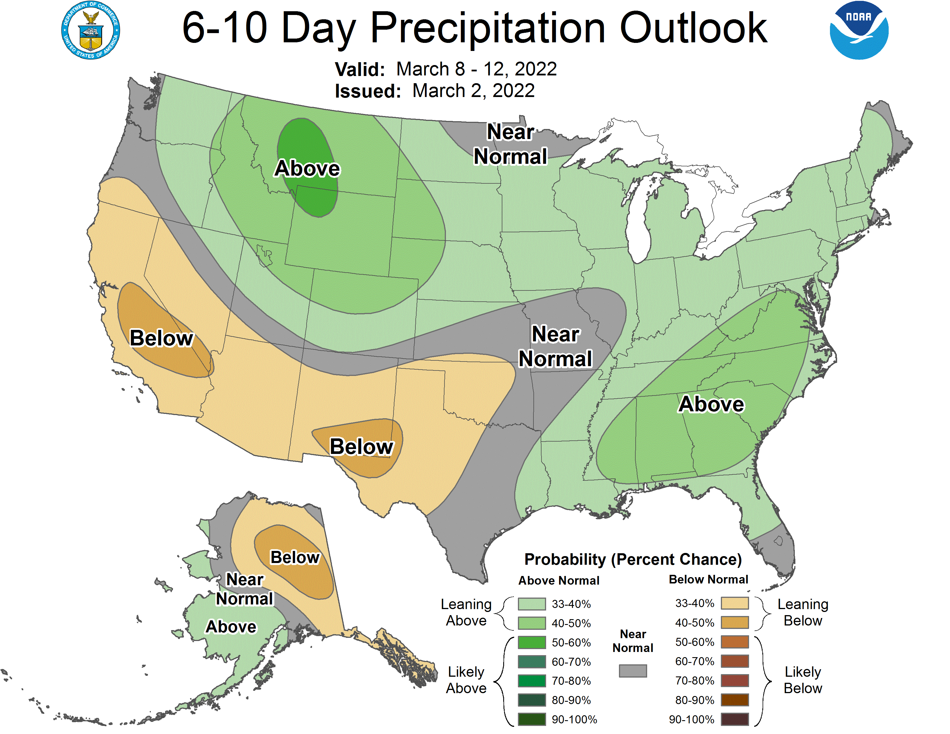
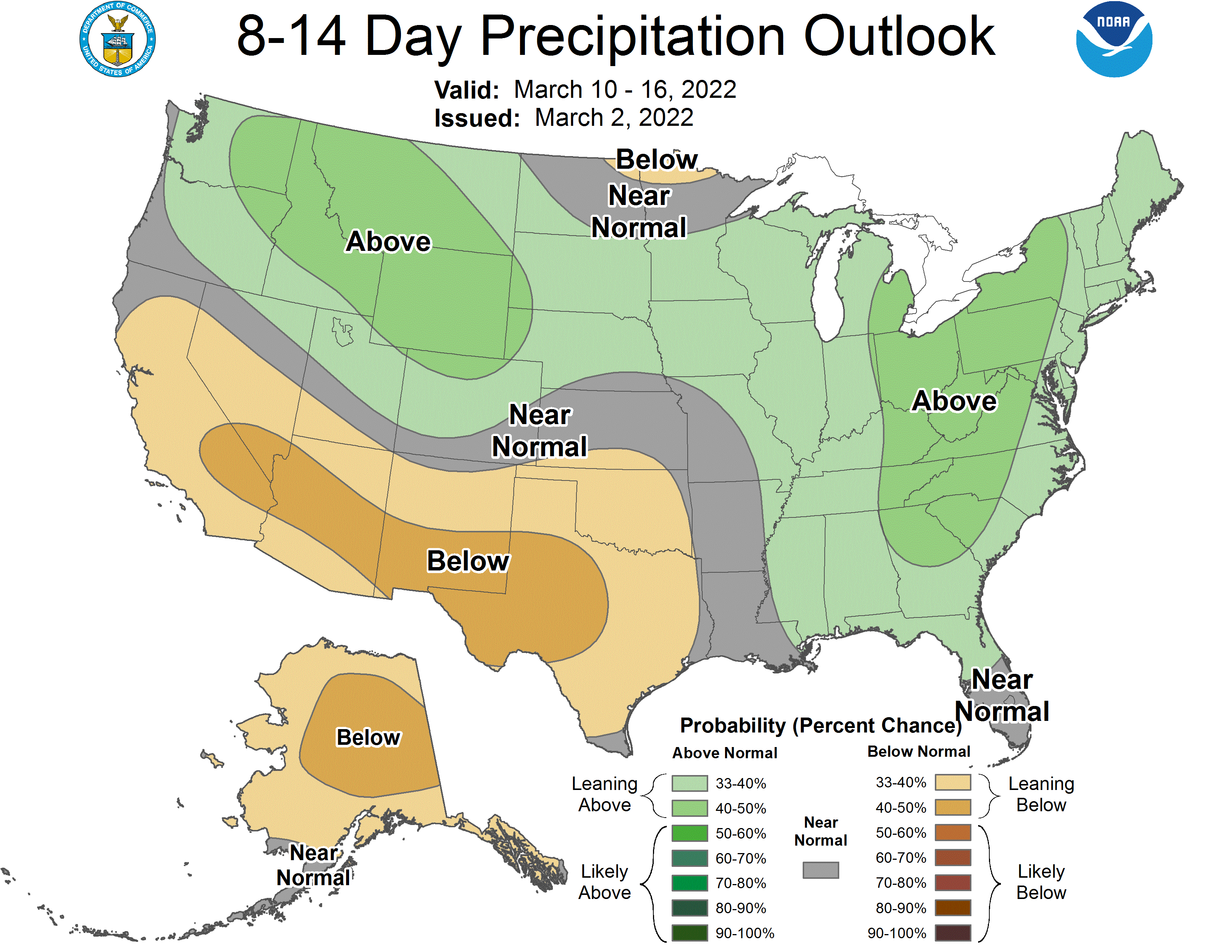
Global ensembles indicate below-average precipitation across California through the extended.
