Forecast By SnowBrains Meteorologist – Eric McNamee
10:45 AM MST, 2/10/2021
Forecast Summary:
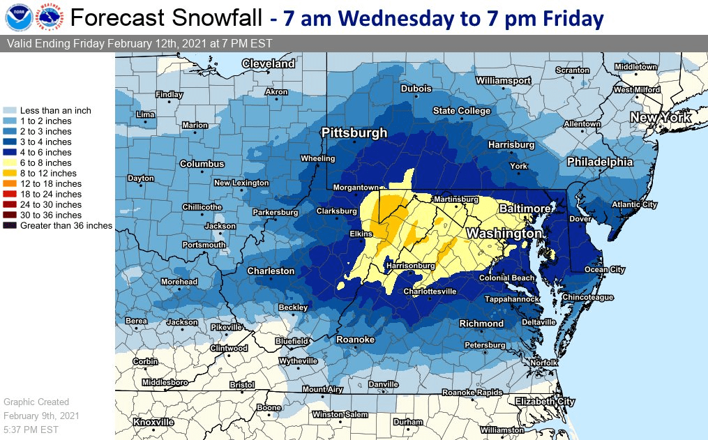
Two disturbances will move through the region today through Friday, bringing 6-12″ of snow for some mountain locations.
Active weather looks to continue through the remainder of the forecast.
Resorts that look to see the most snow are Snowshoe Mountain and Canaan Valley.
Short-Term Forecast:
Wednesday-Friday:
6-12″ of snow is expected to fall in some mountain locations of central Appalachia through Friday.
This will come from two disturbances that will the region tomorrow and Friday.
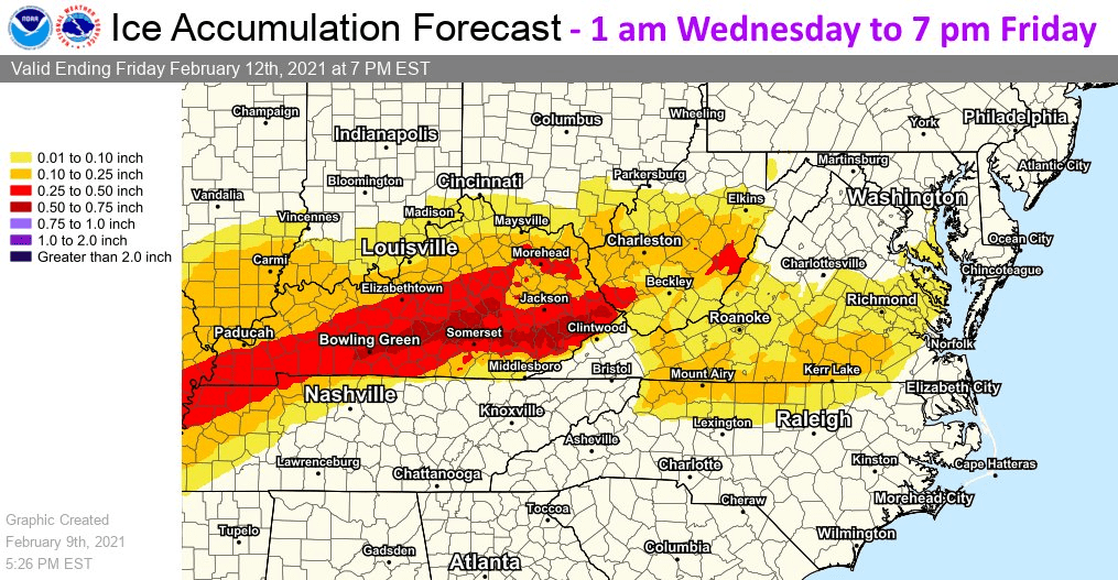
The biggest question will be precipitation type for most of the region as warmer air could change snow over to sleet and freezing rain.
This is has shown up in recent model runs so the may be the case for a broader area.
However, if colder air does creep in, there could be a broader area for snow across the region.
Long-Term Forecast:
Saturday-Thursday:
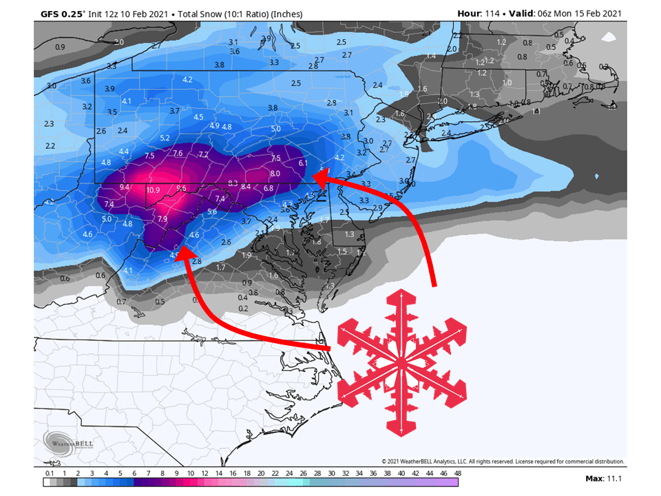
Active weather will continue through the long-term across the eastern US as shortwave troughs move through the region.
The biggest question will be where the rain/snow line sets up with these systems.
Extended Forecast:
Thursday and Beyond:
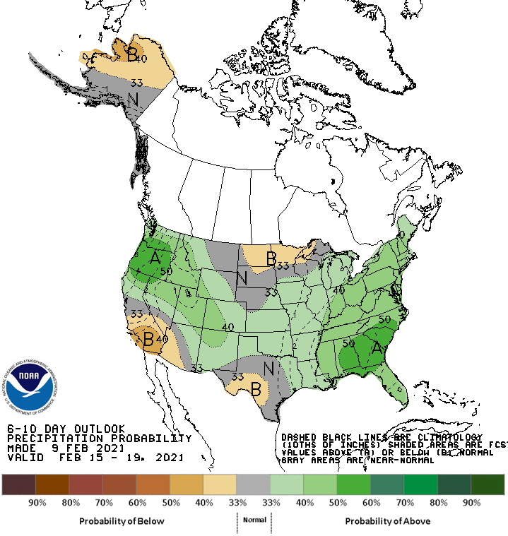
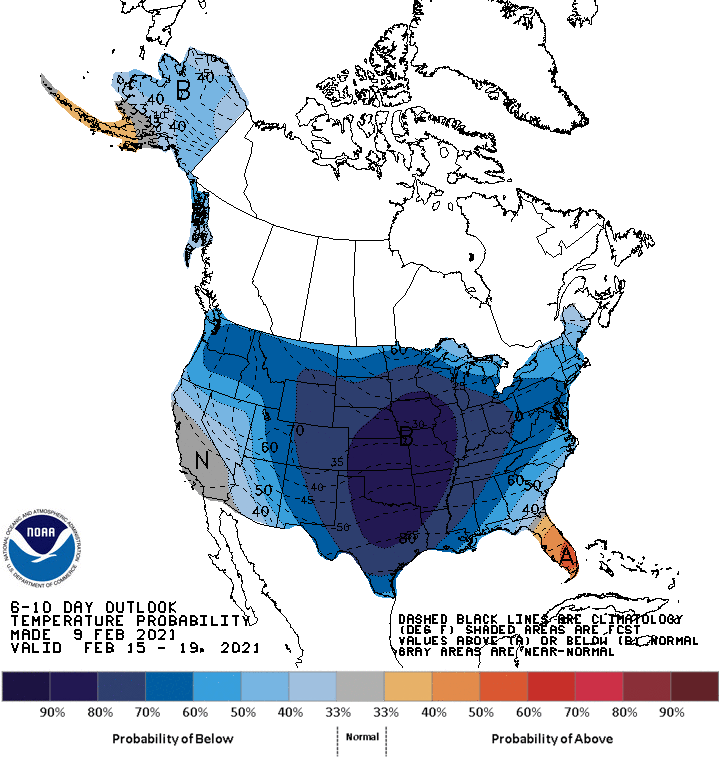
Global ensembles are indicating below-average temperatures and above-average precipitation across the East and most of the US through the extended.
