Brought to you by Squaw Valley Alpine Meadows, CA
Forecast By SnowBrains Meteorologist – Eric McNamee
10:30 AM MST, 3/4/2021
Forecast Summary:
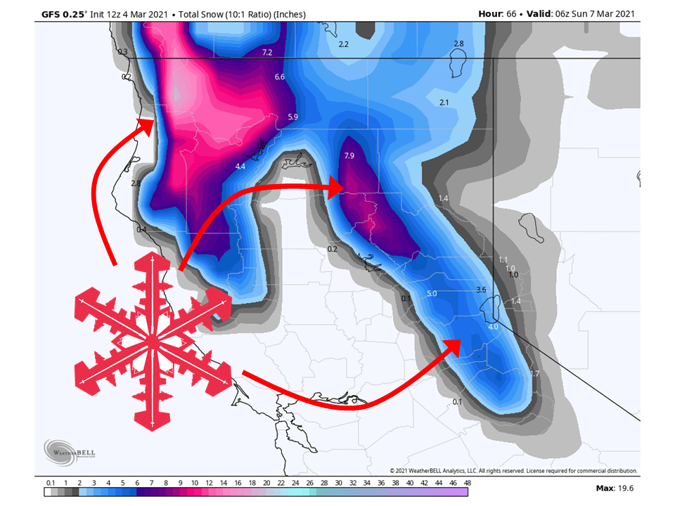
An upper-level trough will move into California tomorrow night and bring 4-8″ of snow around Tahoe through Saturday, with higher amounts in the Coastal Range and Mt. Shasta.
Conditions will dry out Sunday before more shortwave troughs move through the state next week and bring more snow.
Resorts like to get the most snow are Boreal, Kirkwood, Sugar Bowl, Squaw, Alpine, and Mt. Shasta Ski Bowl.
An active pattern looks to continue into the extended period.
Short-Term Forecast:
Thursday-Saturday:
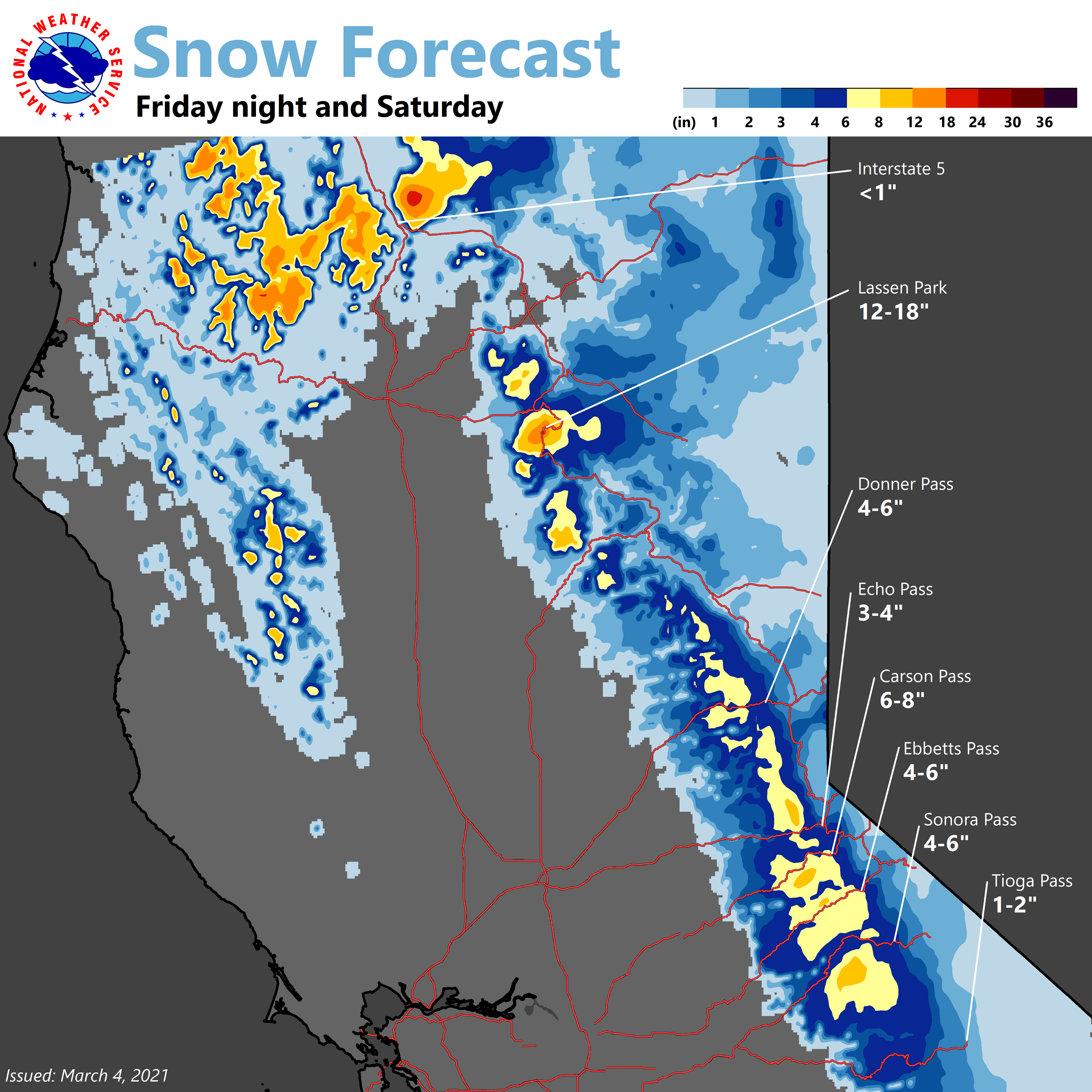
An upper-level trough off the coast of California will move onshore tomorrow night and bring 4-8″ of snow to the Sierra through Saturday.
Upwards of 12″ is expected in the Coastal Range and Mt. Shasta with snow levels starting at around 5,000 since mild air is in place.
Currently, there are no winter weather advisories or warnings out for the higher elevations, but travel conditions could be tricky at times.
Conditions will dry out Sunday as the low moves off to the east.
Rain and mountain snow will spread east over NorCal Friday night.
The heaviest snow over the Sierra will fall after midnight into
Saturday morning. Snow levels will be around 5000 feet with 4 to 8
inches likely at pass level. Sref ensembles show 5 inches at Blue
Canyon(5280ft). This will likely cause a brief period of mountain
travel delays and chain controls. Valley rainfall amounts will
range from 0.25 to 0.75 inches, heaviest over the Northern
Sacramento Valley and lighter progressing southward.  A brief
period of gusty winds possible Friday night with a few gusts to 30
mph, especially over the Central Sacramento Valley.
-NWS Sacramento 3/4/2021
Long-Term Forecast:
Sunday-Wednesday:
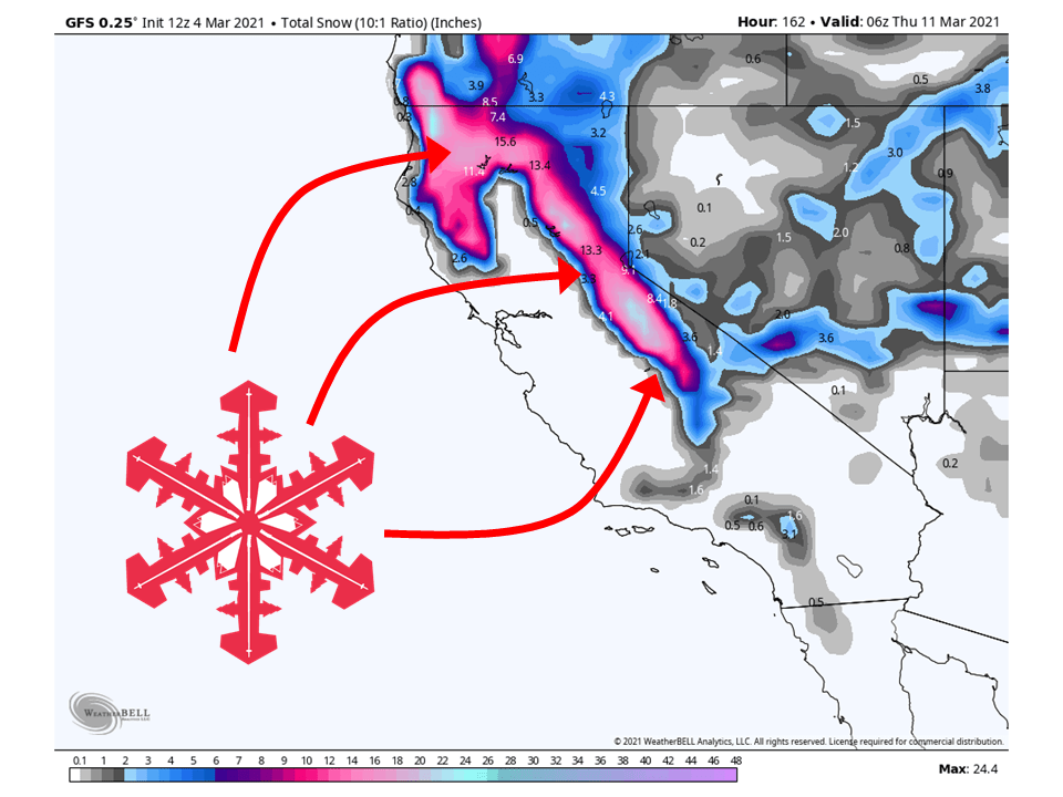
Heading into next week, a couple of shortwave troughs will move through the state and bring additional snowfall.
Right now, the first looks to move through Monday, and the second Tuesday/Wednesday.
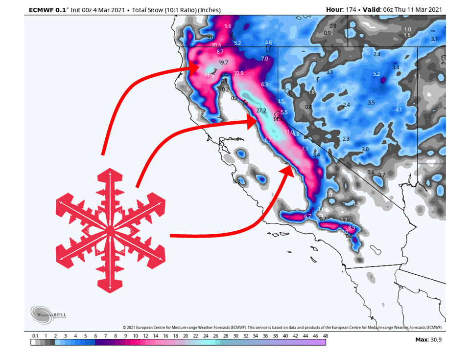
There is some disagreement between models on how much snow will fall, but it does look promising.
The ECMWF wants to bring more snow across the state than the GFS.
Also, the ECMWF has been historically more accurate than the GFS further out so I am leaning towards the wetter solution.
Extended Forecast:
Thursday and Beyond:
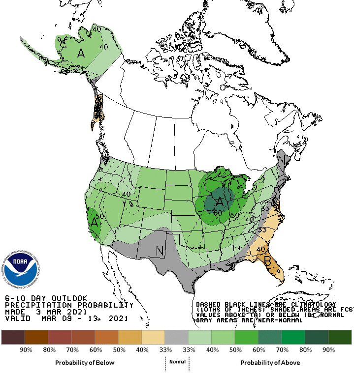
Global ensembles are indicating an active and wet pattern to continue over most of the western US in the extended.
