Forecast By SnowBrains Meteorologist – Eric McNamee
Brought to you by Alta Ski Area
11:10 AM MST, 2/12/2021
Forecast Summary:
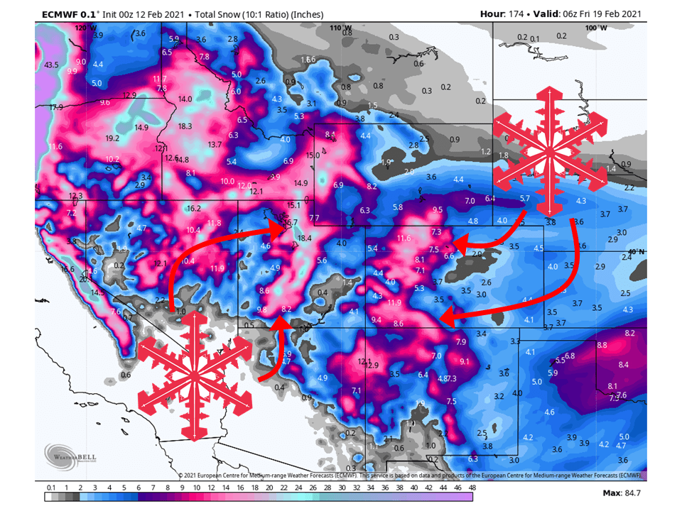
3-6 FEET of snow is expected across Utah and Colorado mountains over the next seven days as a series of shortwave troughs make their way through the region.
The first of said shortwave troughs will move through the region today and tomorrow, bringing widespread mountain snowfall.
The next shortwave will be right on its heels as it will move through tomorrow and Sunday.
Another will move through early next week, potentially bringing SIGNIFICANT snow totals.
The pattern looks to remain relatively active through the extended period of the forecast.
Short-Term Forecast:
Friday-Sunday:
The first in a series of shortwave troughs is moving through the region, bringing 1-2 FEET of snow to mountain locations today and tomorrow.
This shortwave will quickly move east, but moist northwest flow will keep snow showers going in mountain locations between shortwave troughs.
The next shortwave trough will move through the region tomorrow and Sunday, bringing another 1-2 FEET of snow to mountain locations through Sunday.
This trough looks to have a more moisture-rich air mass, which will allow for widespread precipitation.
It will also take a more southern track than the first trough, which will allow for the Arctic air over the midwest to be drawn into the region.
This will result in higher SLR ratios and fluffier snow.
Long-Term Forecast:
Monday-Thursday:
Getting into Monday, another shortwave trough will dig in from the northwest, possibly bringing SIGNIFICANT snow totals to the region through Wednesday.
This is still 4 days out so things could change, but models have been pretty consistent on high snow totals the last few days.
By Thursday, conditions look to dry out temporarily.
Extended Forecast:
Sunday and Beyond:
Global ensembles are indicating the pattern to remain relatively active, but there is some disagreement with trough positioning late next week.
Utah:
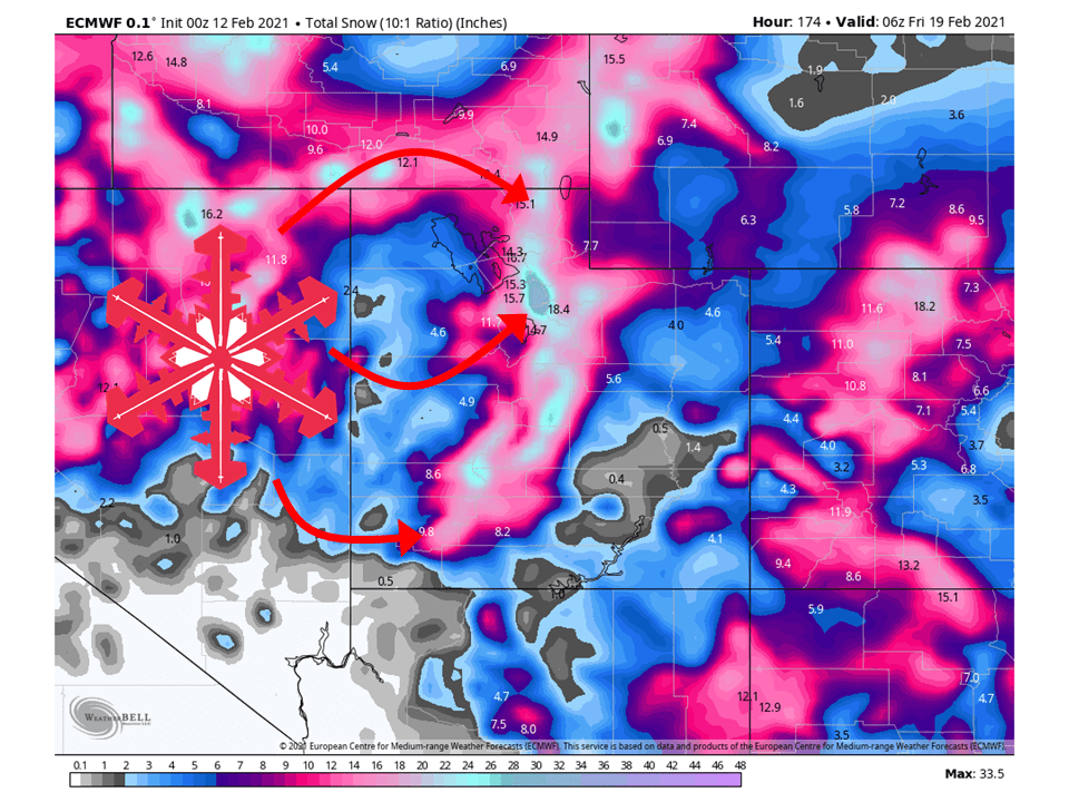
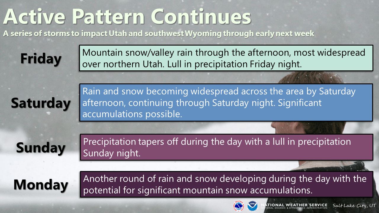
The first of three shortwaves has already brought 6-10″ of snow at the time of this post, with another 6-12″ of snow to fall through tonight and tomorrow morning under northwest flow.
The next shortwave trough will move through the state tomorrow and Sunday morning, bringing 1-2 FEET to mountains across the state.
Another shortwave will move into the region early next week, with the possibility of SIGNIFICANT snow accumulations.
Resorts that look to be favored are Alta, Snowbird, Brighton, Solitude, Park City, Canyons, Deer Valley, Snowbasin, Powder Mountain, Beaver Mountain, and Brianhead.
**Alta Forecast**
Snow has already been falling at Alta since last night with 8 inches already being reported.
Another 6-12″ will fall through tomorrow morning as flow turns northwest later today and tonight.
The next shortwave will move into the state tomorrow, dropping 1-2 FEET on the mountain through Sunday morning.
The next chance of snow will come next week as another shortwave trough digs into the region, possibly bringing SIGNIFICANT snow accumulations.
Colorado:
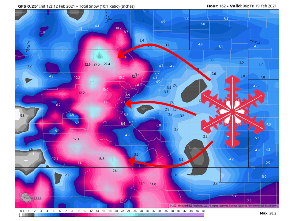
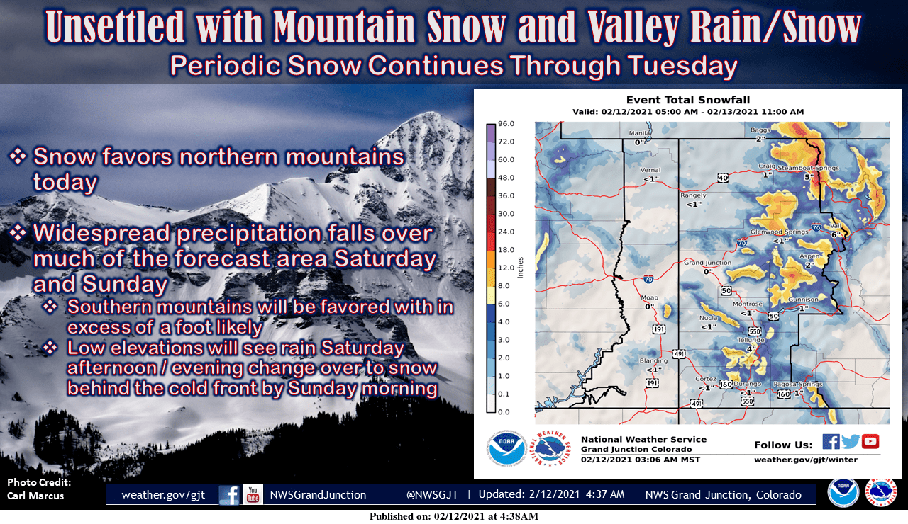
Colorado will see 1-2 FEET of snow from this first shortwave trough, with snow already falling in many mountain locations.
The next shortwave trough will move through the state late Saturday and early Sunday, with another 1-2 FEET of snow falling.
Another shortwave trough will move into the region early next week, possibly bringing SIGNIFICANT snowfall.
Resorts that look to see the most snow are Aspen, Steamboat, Wolf Creek, Vail, Loveland, Breckenridge, Copper Mountain, Keystone, Arapahoe Basin, Telluride, Monarch, and Winter Park.
USA:
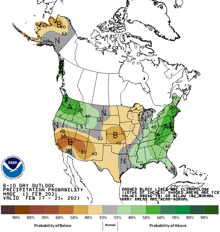
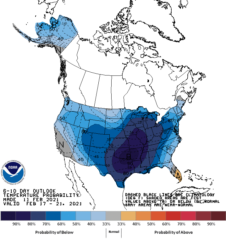
Global ensembles are indicating the pattern to remain across the Northwest, with above-average precipitation and below-average temperatures.
