Forecast By SnowBrains Meteorologist – Eric McNamee
1:10 PM MST, Jan. 7, 2021
Forecast Summary:
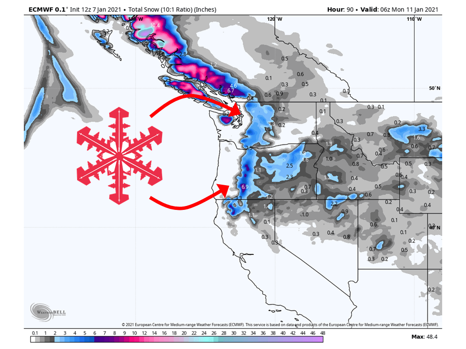
A couple of weak storms will make their way through the Pacific Northwest by Sunday, bringing 2-8″ of snow along the Cascades.
The Oregon Cascades look like they will see the most snow through Sunday.
By next week, a strong ridge of high pressure will develop over the Western US.
This will shift the storm track along the US/Canadian border.
Resorts that look to see the most snow are Mt. Bachelor, Hoodoo Ski Area, Crystal Mountain, Alpental, and Mt Baker.
Short-Term Forecast:
Thursday-Saturday:
The first of two weak shortwave troughs will move through the region tomorrow, primarily bringing 2-8″ of snow to the Oregon Cascades.
Only a couple of inches of snow, at most, are expected across the Washington Cascades from this system.
Some residual snow showers will last through the day Saturday before drying out by the evening.
Long-Term Forecast:
Sunday-Wednesday:
The second weak shortwave will move in from the Pacific, bringing 2-6″ of snow along the Washington Cascades.
Oregon will be in the same position as Washington in the previous system, only seeing a couple of inches of snow.
By early next week, A ridge of high pressure will develop over the western US and shift the storm track northward.
More snow is expected next week, but only for northern portions of Washington.
Extended Forecast:
Tuesday and Beyond:
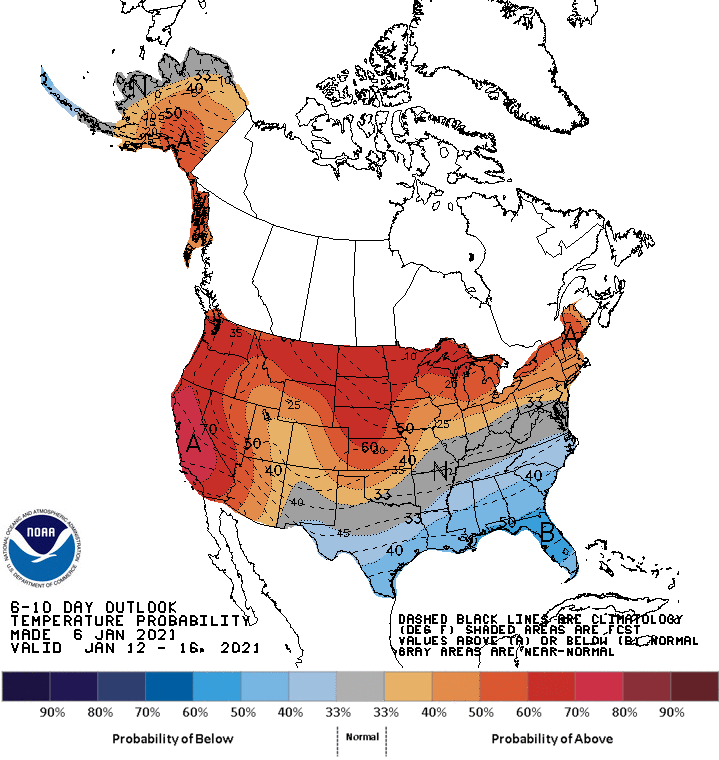
Global ensembles indicate well-above-average temperatures are expected across the entire western US.
Below-average precipitation is also expected across the West, except along the US/Canadian border.
Oregon:
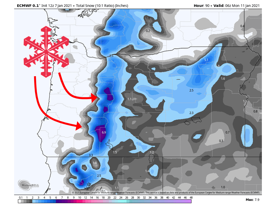
The first of two weak shortwave troughs will move through the region tomorrow, primarily bringing 2-8″ of snow to the Oregon Cascades.
The second shortwave will move through Sunday and only bring a couple of inches of snow.
Resorts that look to see the most snow are Mt. Bachelor, and Hoodoo Ski Area.
Washington:
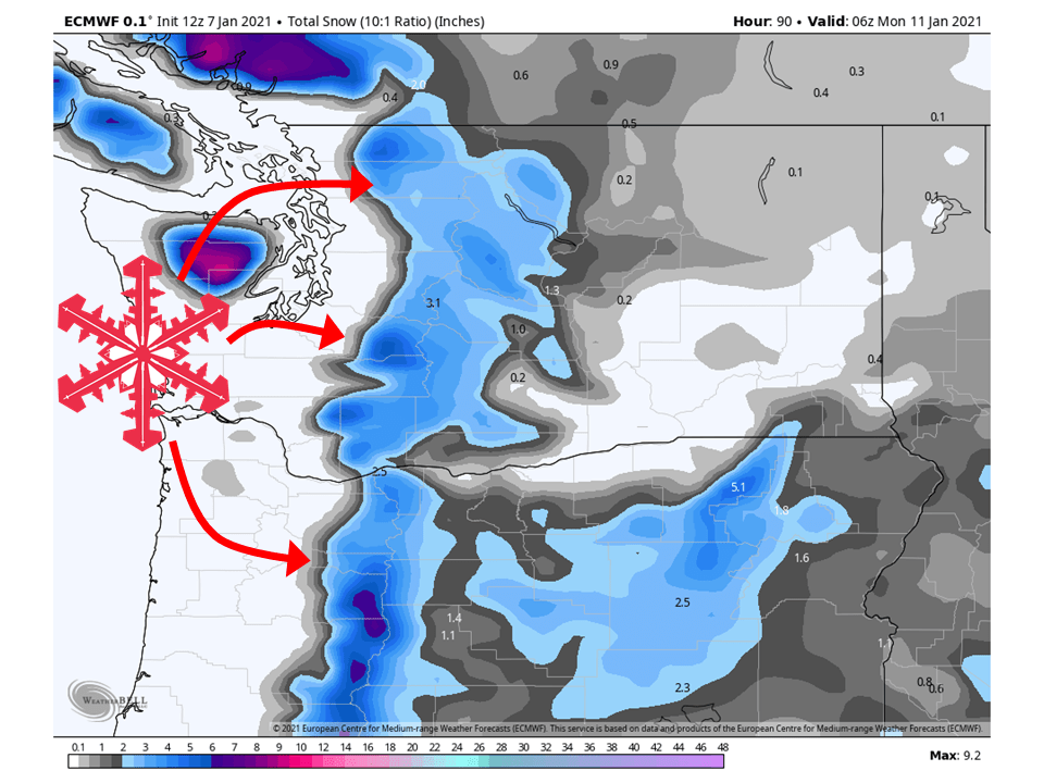
2-6″ of snow is expected along the Washington Cascades through Sunday from two weak shortwave troughs.
The first trough will move through tomorrow and bring a couple of inches, at most, to the Washington Cascades.
The second system will move through Sunday, bringing 2-6″ of snow to the Washington Cascades.
Resorts that look to see the most snow are Crystal Mountain, Alpental, and Mt Baker.
USA:
Global ensembles indicate well-above-average temperatures and below-average precipitation is expected across the entire western US in the extended, except along the US/Candian border.
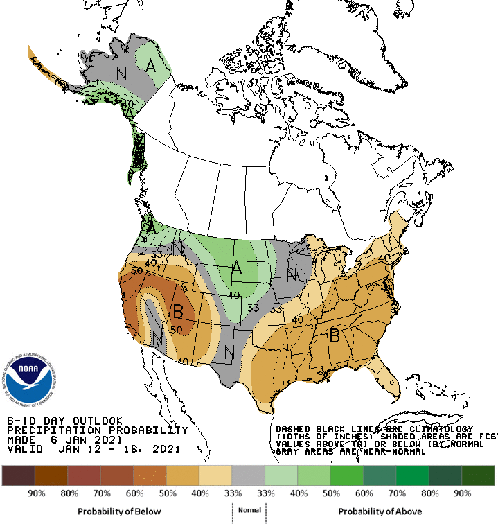

How does the weekend of the 15th look for the west?
Right now the ensembles are showing it looks pretty dry across most of the west except for northern parts of Washington, Idaho, and Montana. It’s pretty far out so this could change but the ensembles are in pretty good agreement with the majority of the West staying dry.