Source: maps.weatherbell.com
The Northern Rockies are continuing to get slammed by an atmospheric river that has already brought multiple feet of snow to the highest elevations of Idaho, Montana, and Wyoming. Currently, the atmospheric river is positioned over Central Idaho, bringing heavy snow to the mountains and rain to the valleys. Cold air is trapped in Northern Idaho and Montana, while strong southerly winds are bringing abnormally warm air to Southern Idaho and most of Wyoming.
This pattern will largely continue until Wednesday when a cold front drops further south and east and brings colder temps and snow to all of the Northern Rockies. Wednesday’s cold front will produce a few inches of snow across Southwest Montana and Northwest Wyoming, and it will keep a few scattered snow showers going across the region on Thursday.
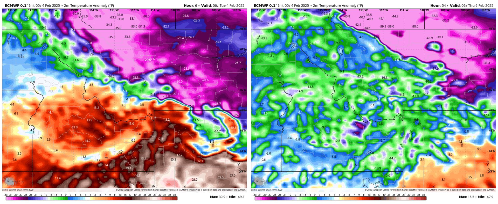
Temperatures compared to normal on Monday night vs Wednesday night. Source: maps.weatherbell.com
Another cold front then moves across the region on Friday, with even colder temperatures following that front. Ahead of the front, a band of snow will set up over Southern Idaho and Western Wyoming on Thursday evening. This band sits over that area most of the day until the front pushes it to the Southeast Friday night. Overall, Thursday evening through Friday night sees heavy snow over the Teton resorts, with about 2 feet expected at Grand Targhee during that period alone.
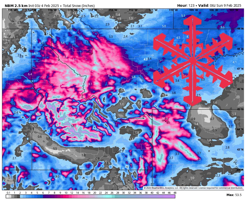
Snow Totals Now Through Saturday:
- Tamarack (ID): 20″-32″
- Schweitzer (ID): 3″-10″
- Sun Valley (ID): 28″-45″
- Big Sky (MT): 8″-20″
- Jackson Hole (WY): 24″-45″
- Grand Targhee (WY): 28″-50″
Beyond Saturday, cold air remains over the Northern Rockies through next week. This is accompanied by several storms that are on track to sweep across the region, leading to below-normal temperatures and above-normal snowfall.
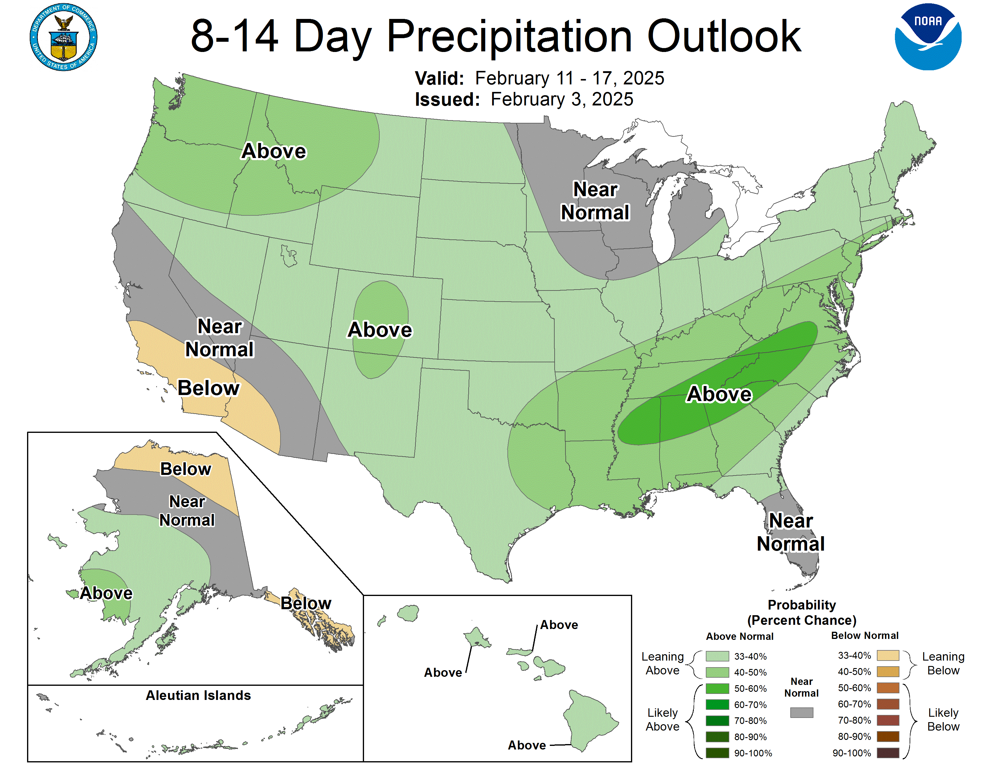
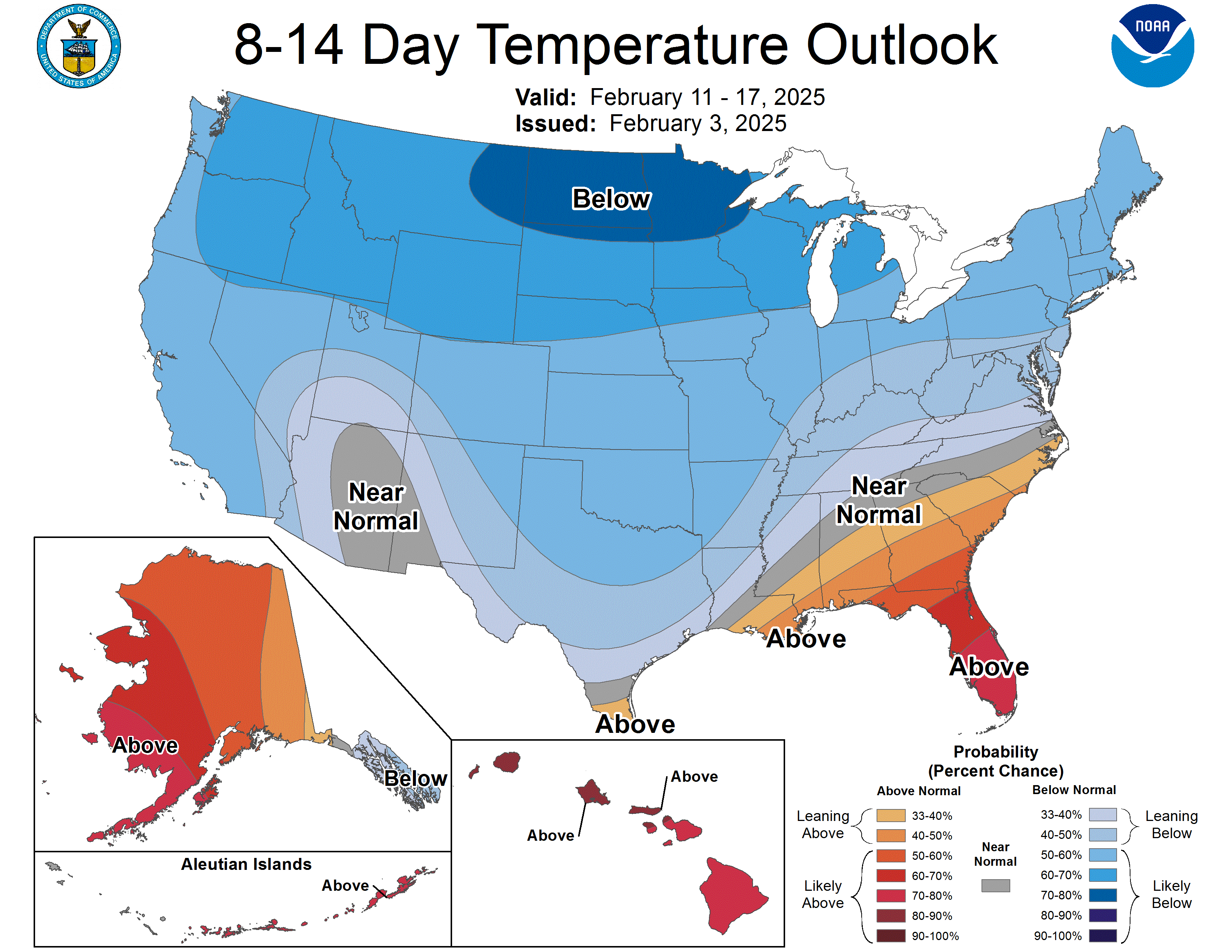
8 to 14-day outlook. Source: https://www.cpc.ncep.noaa.gov/products/predictions/814day/