Forecast By SnowBrains Meteorologist – Eric McNamee
Brought to you by Alta Ski Area
10:15 AM MST, 2/26/2021
Forecast Summary:
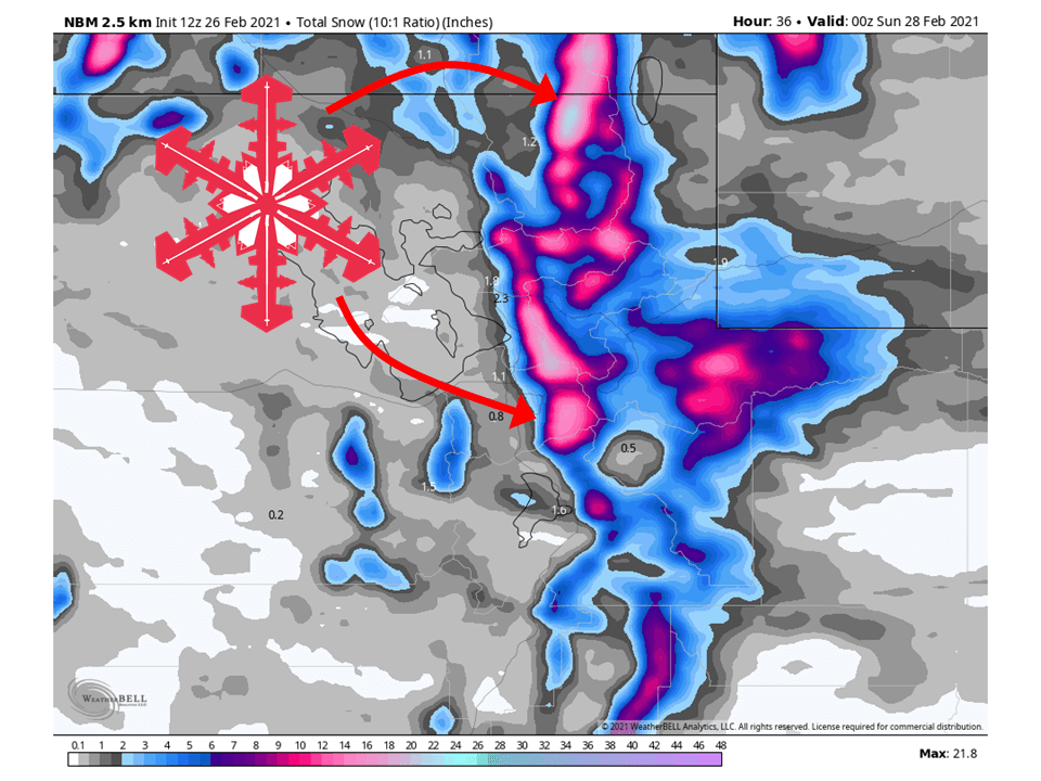
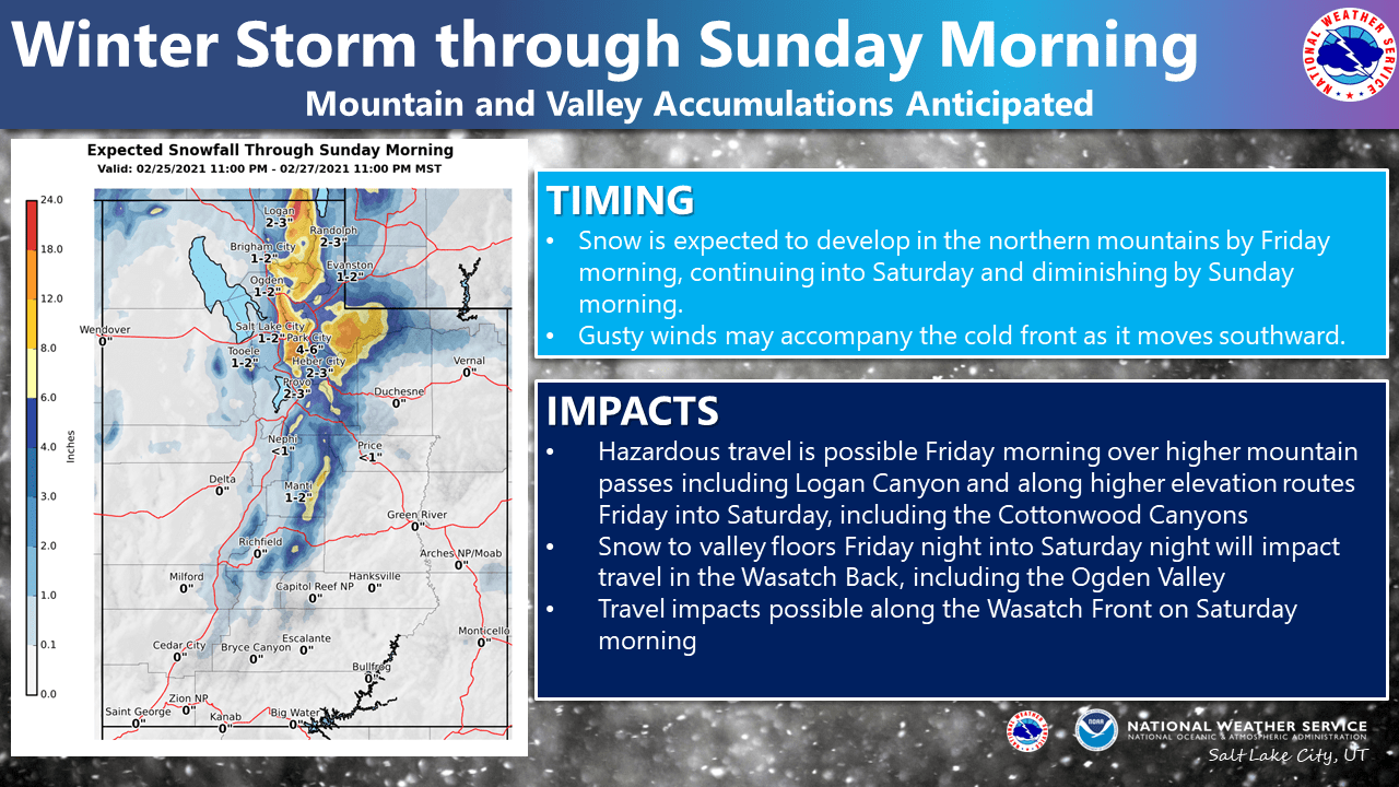
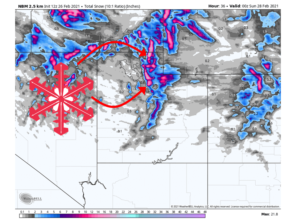
A couple of disturbances will bring 1-2 FEET of snow to Utah’s Wasatch through Sunday.
Conditions will clear during the day Sunday and remain dry heading into next week.
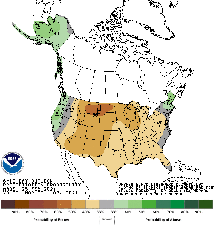
Dry conditions look to persist through the extended period.
Resorts that look to see the most snow are Alta, Snowbird, Brighton, Solitude, Park City, Canyons, Deer Valley, Snowbasin, Powder Mountain, and Beaver Mountain.
Short-Term Forecast:
Friday-Sunday:
1-2 FEET of snow is expected to fall across the Wasatch through Sunday as a couple of disturbances move through Utah.
Snow is expected to start filling in later this afternoon and fall throughout the night.
A brief break in the action tomorrow morning before more snow Saturday afternoon and evening.
Winter Weather Advisories have been issued for the mountains of northern Utah because of this.
Conditions will clear out Sunday and remain dry heading into next week as a ridge of high pressure builds over the west.
Long-Term Forecast:
Monday-Thursday:
The aforementioned ridge of high pressure will build over the western US next week and keep storms out of the area.
There are some indications of something moving through the end of next week, but there is too much disagreement between models to be certain.
Extended Forecast:
Thursday and Beyond:
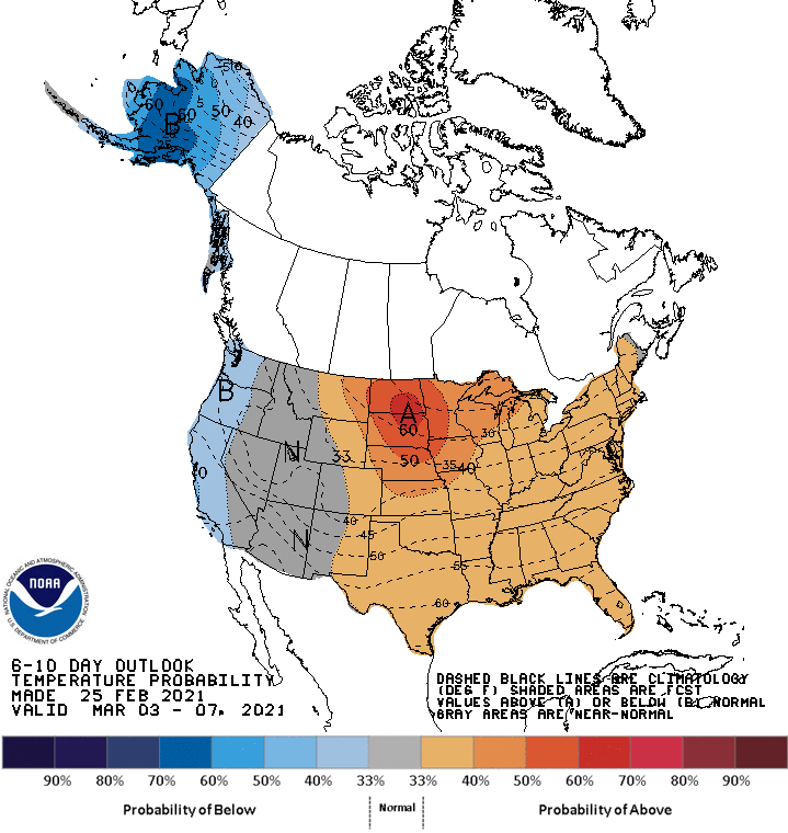
Global ensembles are indicating below-average precipitation and near-average temperatures in the extended.
**Alta Forecast**
1-2 FEET of snow is expected at Alta through Sunday as a couple of disturbances move through the state.
Light snow showers are expected during the day today, with snow filling in this evening.
This will continue through tonight before tapering off a bit tomorrow morning.
Snow will fill back in during the afternoon and continue through tomorrow night.
Conditions will clear out Sunday.
