Forecast By SnowBrains Meteorologist – Eric McNamee
Brought to you by Monarch Mountain
2:45 PM MST, 3/22/2021
Forecast Summary:
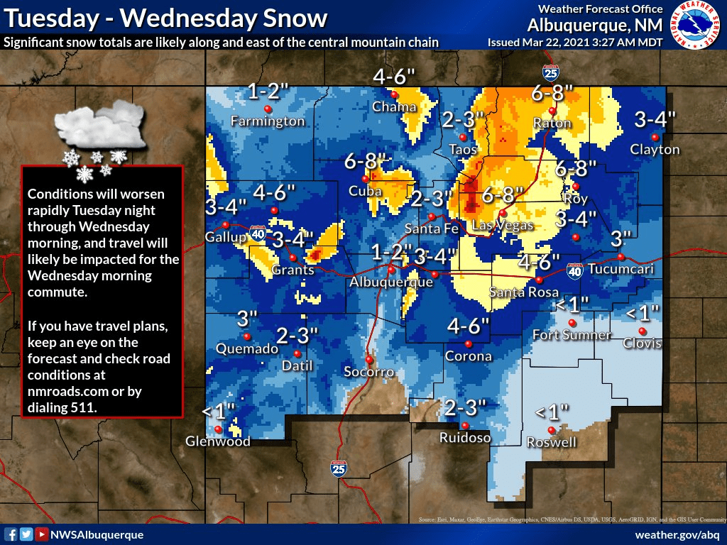
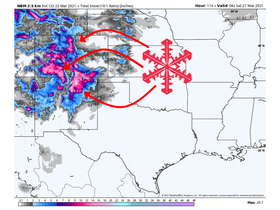
A series of troughs will move through the Southwest this week and bring 1-2 FEET of snow to parts of Colorado and New Mexico on top of what has fallen today.
The first round will come Tuesday/Wednesday and bring snow primarily to New Mexico and Southern Colorado.
The second round will come Thursday/Friday and bring snow to Colorado.
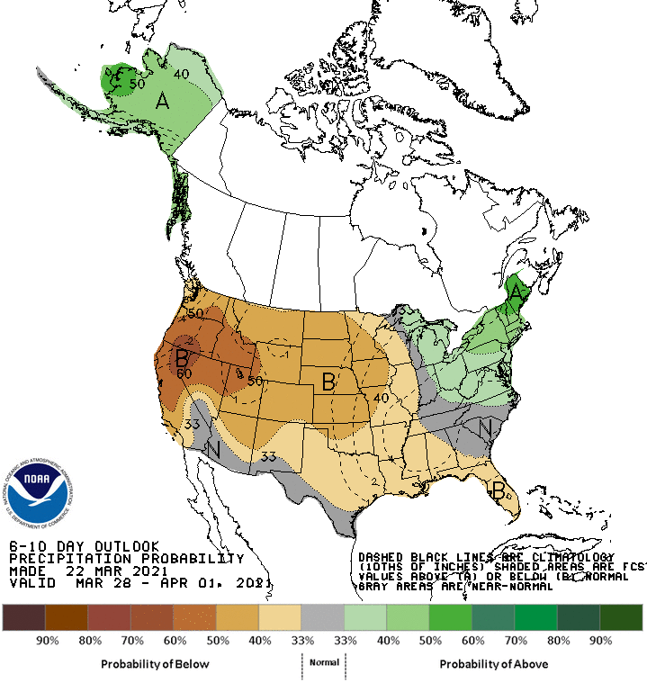
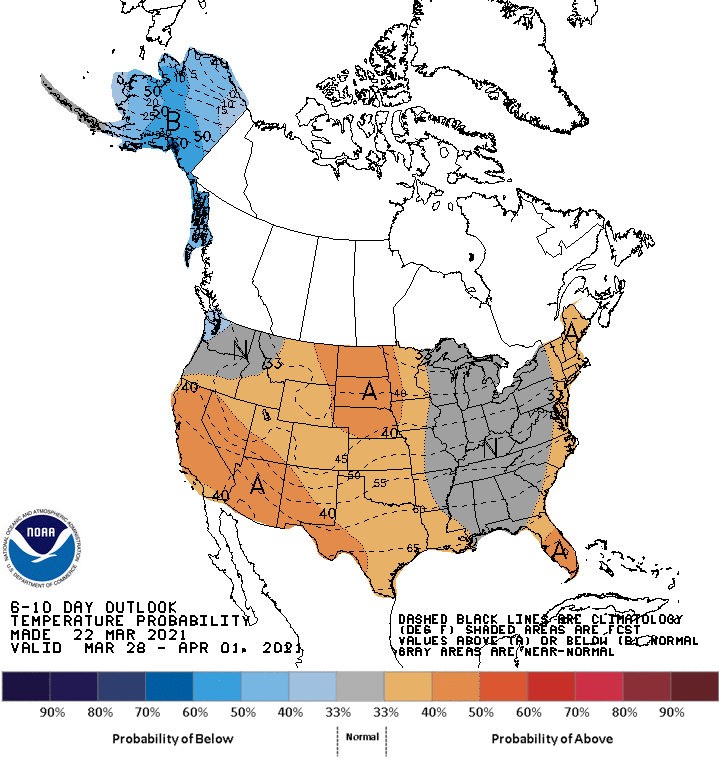
Above-average temperatures and below-average precipitation are likely in the extended.
Resorts that look to see the most snow are Aspen, Vail, Arapahoe Basin, Keystone, Copper Moutain, Breckenridge, Telluride, Monarch, Wolf Creek, Winter Park, Crested Butte, Taos, and Ski Santa Fe
Short-Term Forecast:
Monday-Wednesday:
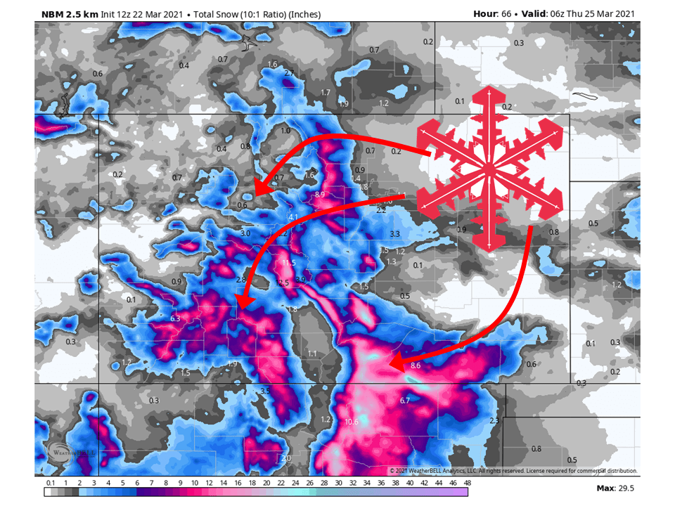
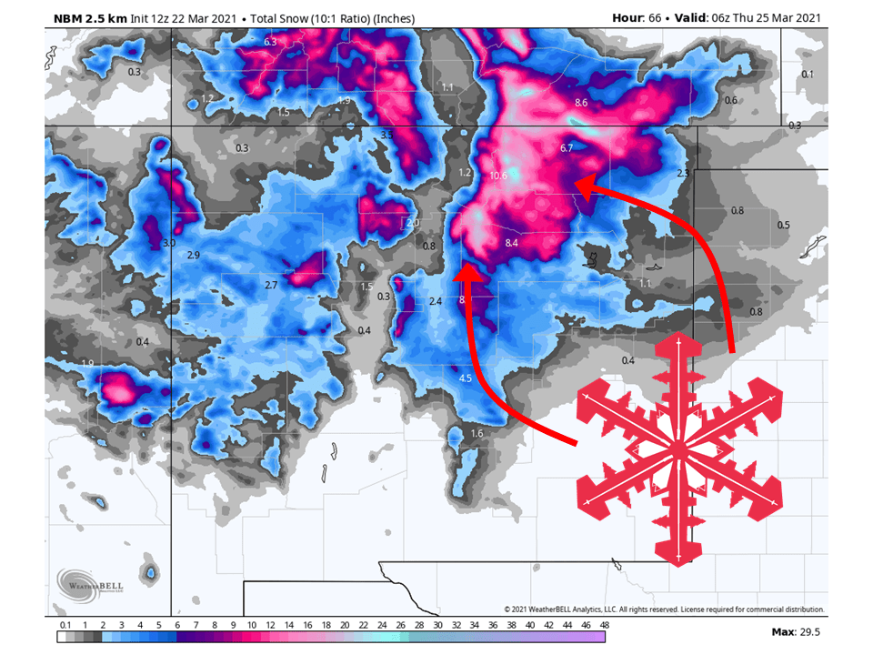
The first of a couple of troughs will move through the southwest US tomorrow and Wednesday, bringing 1-2 FEET of snow to southern Colorado and New Mexico.
Snow will begin late in the afternoon and pick up in intensity tomorrow night.
This will continue through the day Wednesday before tapering off Wednesday night.
Mountains that will be affected by this are the Sangre de Cristo, Culebra, and San Juans.
Long-Term Forecast:
Wednesday-Sunday:
Conditions will temporarily dry out Thursday morning before the next system moves in, possibly bringing another FOOT of snow to the western Colorado mountains.
Snow will start Thursday evening and fill in that night.
This will continue through the day Friday before tapering off Friday night.
Conditions will dry out this weekend as the troughs move off to the East.

Extended Forecast:
Sunday and Beyond:
Global ensembles are indicating below-average precipitation and above-average temperatures across the region.
