Researchers at the Finnish Meteorological Institute and Environment and Climate Change Canada have developed a method to more accurately measure snow mass by reducing the error margins of various observations through determined data from satellite observations, measurements made from the ground, and computer modeling.
Warming surface temperatures have driven a substantial reduction in the extent and duration of the Northern Hemisphere snow cover. These changes in snow cover affect Earth’s climate system via the surface energy budget and influence freshwater resources across a large proportion of the Northern Hemisphere.
“The method can be used to combine different observations and it provides more accurate information about the amount of snow than ever before. The previous considerable uncertainty of 33% in the amount of snow has decreased to 7.4%.”
– Jouni Pulliainen, of the Finnish Meteorological Institute
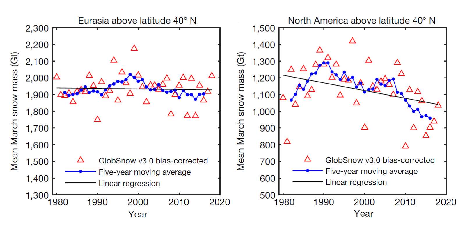
Although the snow mass has remained the same, the extent of snow cover has decreased. The researchers found that there has been little reduction in snow mass over the 40 years in the northern hemisphere when looking at the annual maximum amount of snow at the turn of February-March.
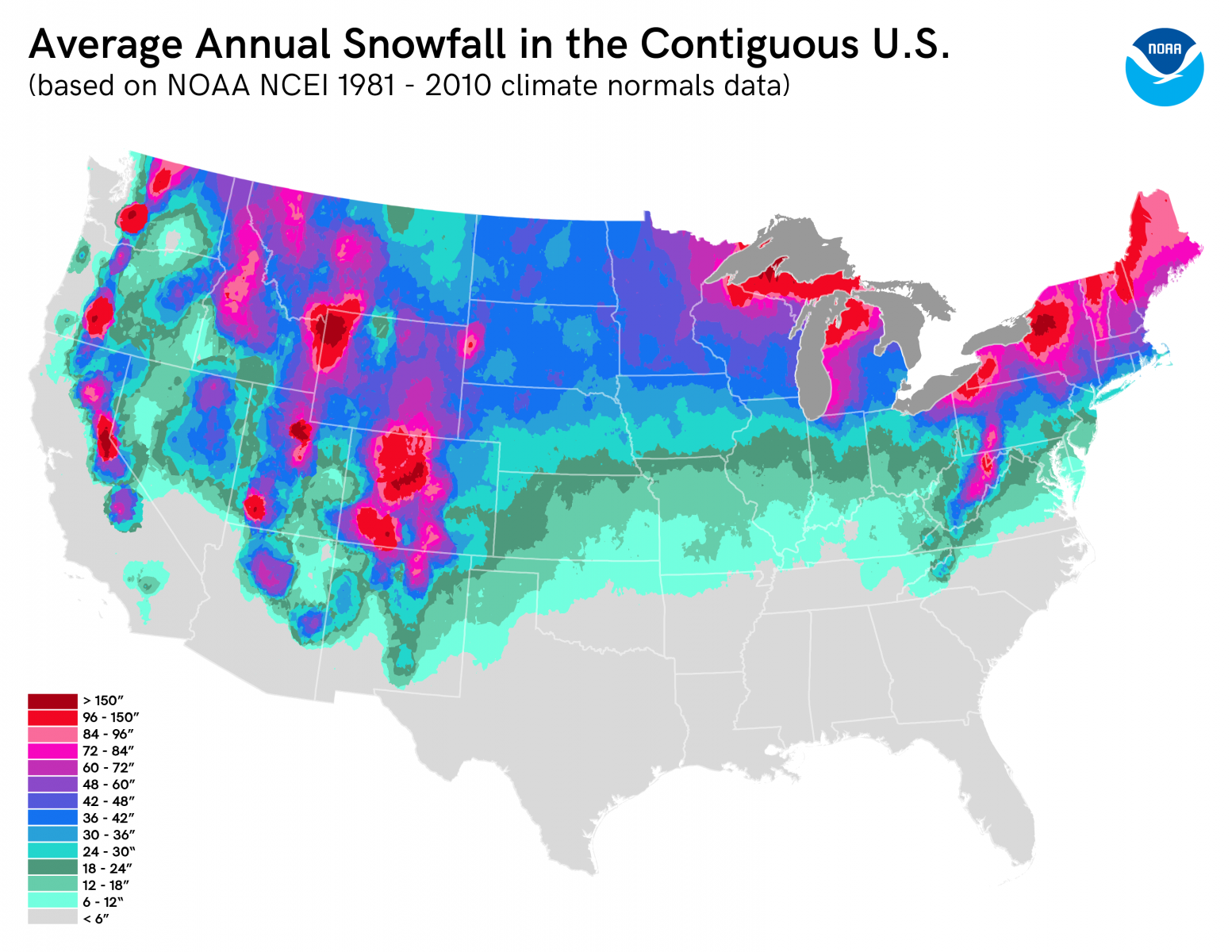
However, in North America since the ’80s, snow mass has been declining at a rate of 46 billion tonnes per decade. In the ’90s that trend has reversed – slowly to start, but accelerating rapidly in the last 10 years of the study period. While roughly one-quarter of the North American snowpack was lost from 1990-2018, most of that loss took place in the last decade. This is likely due to the expected rise in snowfall amounts due to having a warmer, wetter atmosphere.
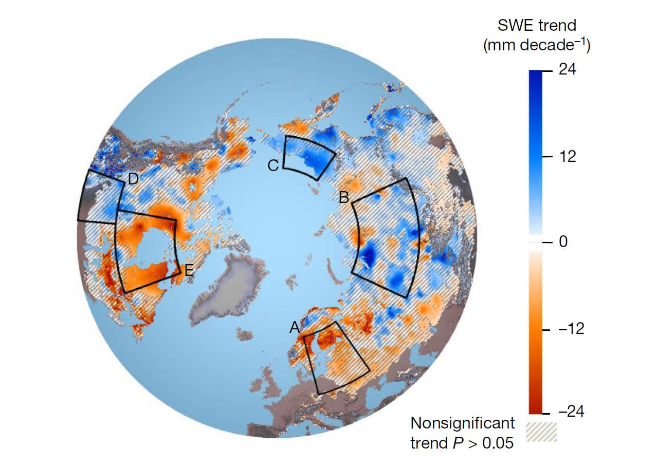
It looks like any increase in snowfall is being offset by a shorter snow accumulation season. As it gets warmer in fall the accumulation season is starting later; as it gets warmer in spring the accumulation season ends earlier.
During the period covered by the study, it was the snow mass measured in northern Europe and Siberia that largely offset the losses recorded in North America. While snow accumulations in Eurasia were fairly constant over the past four decades, it was much more variable in northern Canada and the United States.
According to the Canadien Scientists, the satellites currently in orbit are not dedicated to measuring snow mass. Instead, you have to learn to use existing satellite observations to your advantage. That is why the Environment and Climate Change Canada and the Canadian Space Agency are working in partnership with the Canadian industry to develop a new satellite radar mission specifically designed for snow mass measuring. The data that this could provide would help get more accurate information on flood risks and the and develop reliability of climate models.



They think they got it all figured out, but they dont know shit
How insightful