The next ten days are looking pretty dry for the majority of the western United States, with no precipitation and higher than normal temperatures on the way.
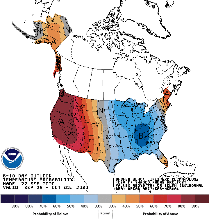
The NOAA discussion says:
Near normal temperatures are favored for southwestern Mainland Alaska and the Aleutians underneath predicted near to slightly below normal 500-hPa heights. Above normal temperatures are favored for most of Mainland Alaska and the Alaska Panhandle. Enhanced probabilities of above-normal temperatures are predicted for the western half of the CONUS and below normal temperatures are likely across much of the eastern half of the CONUS, in association with the trough over the central and eastern CONUS. Above normal temperatures are favored for parts of the Northeast, and over the southern Florida Peninsula.
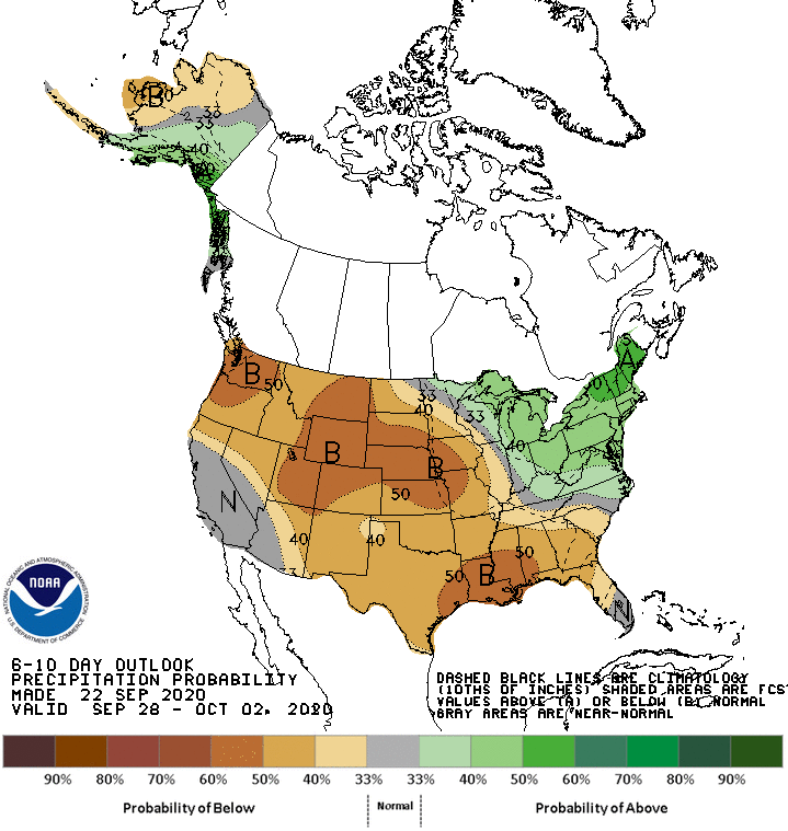
Above-normal precipitation is favored for central and eastern areas along the south coast of Alaska, southeastern Mainland Alaska, and the northern Alaska Panhandle. Below normal precipitation is favored over western areas of Mainland Alaska and parts of the Aleutians. Enhanced probabilities of below-normal precipitation are predicted for much of the western and Central CONUS into the Southeast Region. Above normal precipitation is likely from the Great Lakes region southward into the Ohio Valley and eastward into the Mid-Atlantic and Northeast. The greatest probabilities for above-normal precipitation exceed 50 percent for parts of the Northeast.
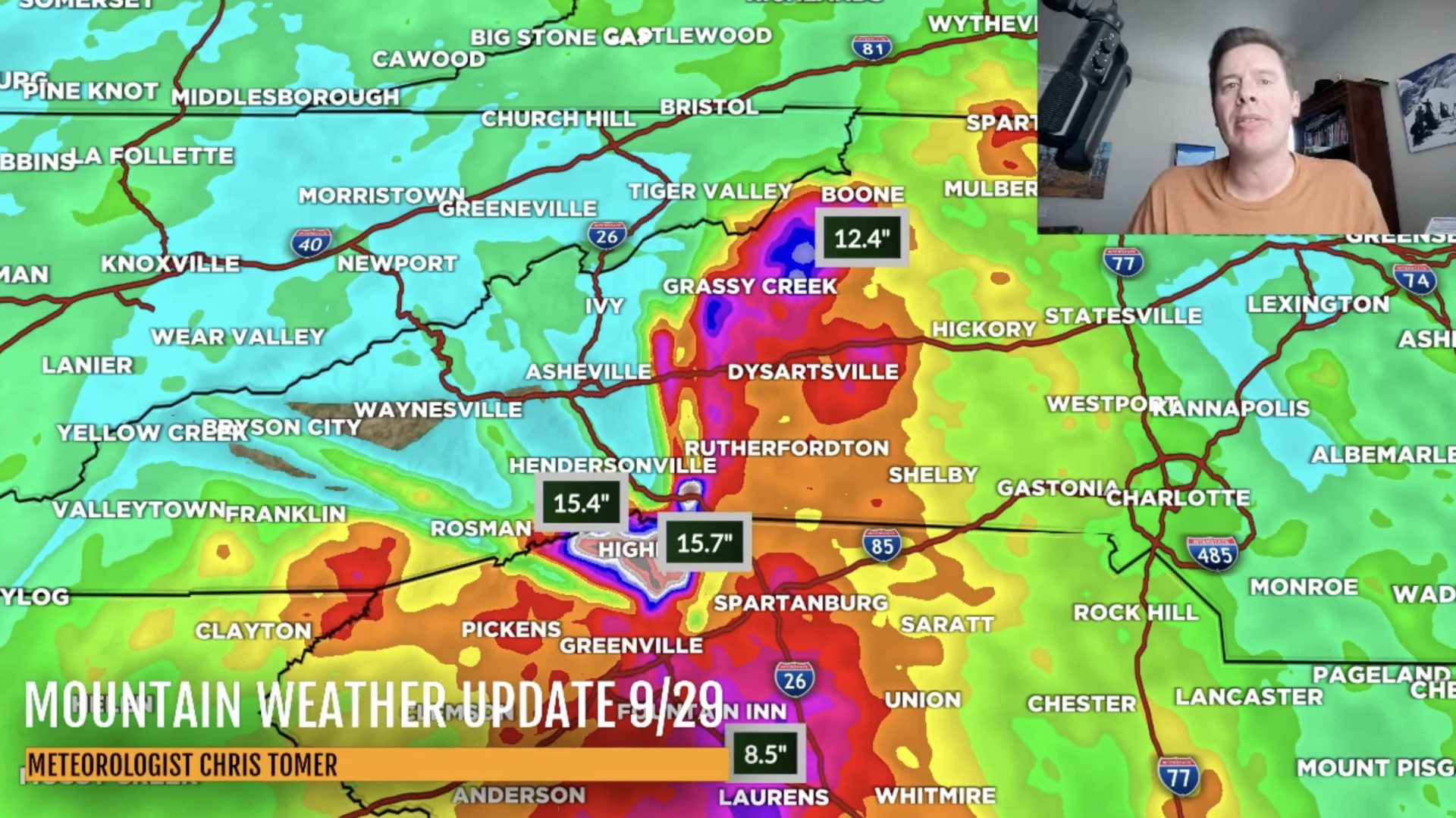
Denver meteorologist Chris Tomer has also shared a graphic with a similar message:
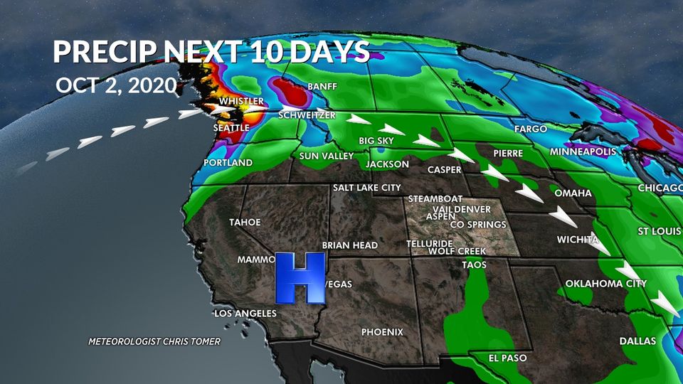
I talked about a late start to Winter this season and it’s playing out. We’re in for a long, dry stretch. The jet stream stays north of Colorado for the next 10 days. That carries us into very early October. Notice in my graphic below the big high-pressure dome. The areas of precip (green, blue, reds) all stay outside of Colorado.
– Chris Tomer