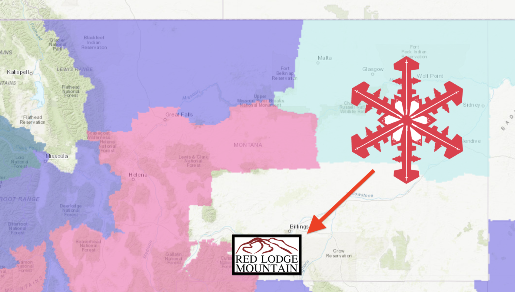
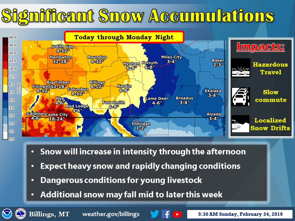
NOAA has issued a Winter Storm Warning for Red Lodge Mountain Ski Area in Montana that runs from today until Wednesday.
12-36″ of snow are forecast!
* WHAT...Heavy snow. Total accumulations of 1 to 3 feet.
- NOAA Billings, MT today
The snow has already begun at Red Lodge Mountain with 3″ falling last night and 7″ in the past 7 days and it’s snowing right now.
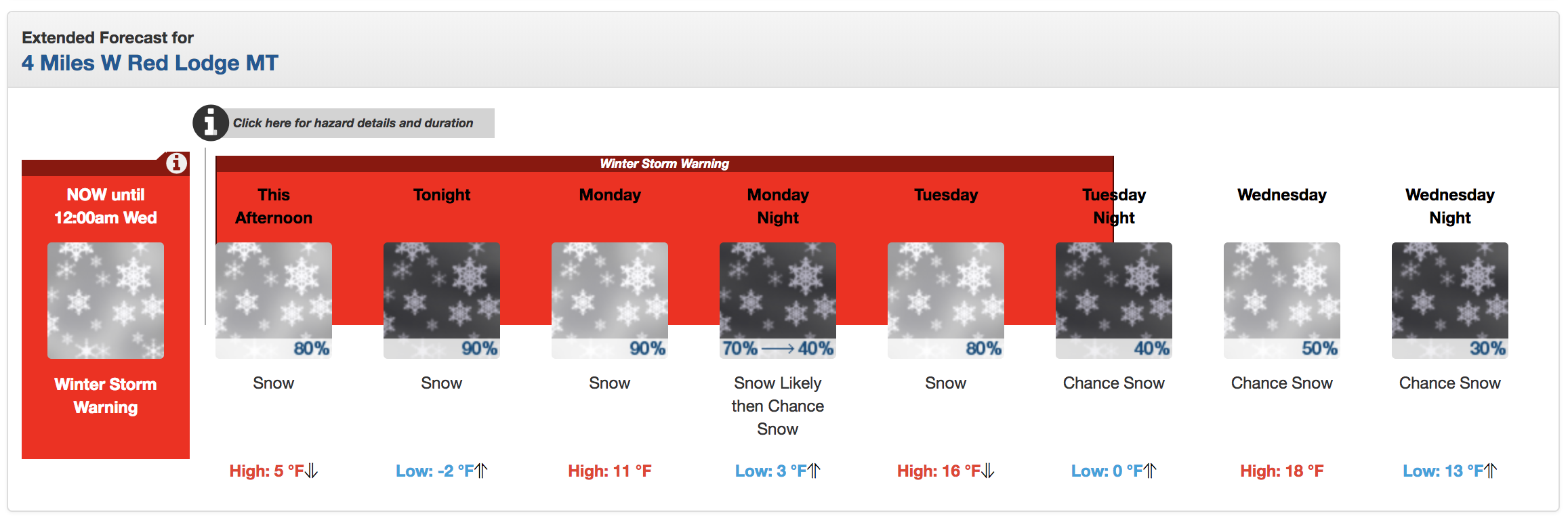
Winter Storm Warning for Red Lodge Mountain, MT
URGENT - WINTER WEATHER MESSAGE
National Weather Service Billings MT
1129 AM MST Sun Feb 24 2019

Absaroka/Beartooth Mountains-
Including the locations of  Cooke City
1129 AM MST Sun Feb 24 2019

...WINTER STORM WARNING REMAINS IN EFFECT UNTIL MIDNIGHT MST
TUESDAY NIGHT...

* WHAT...Heavy snow. Total accumulations of 1 to 3 feet.

* WHERE...Absaroka/Beartooth Mountains.

* WHEN...Until midnight MST Tuesday night.

* ADDITIONAL DETAILS...Access to the Cooke City area may be
  affected by heavy snowfall. Severe back country conditions are
  likely. Avalanche danger is expected to increase significantly.