Wet Weather Returns to California
Looking for more details on the upcoming wet weather pattern? Check out this quick 2-minute forecast briefing!
Posted by US National Weather Service Sacramento California on Wednesday, March 2, 2016
***
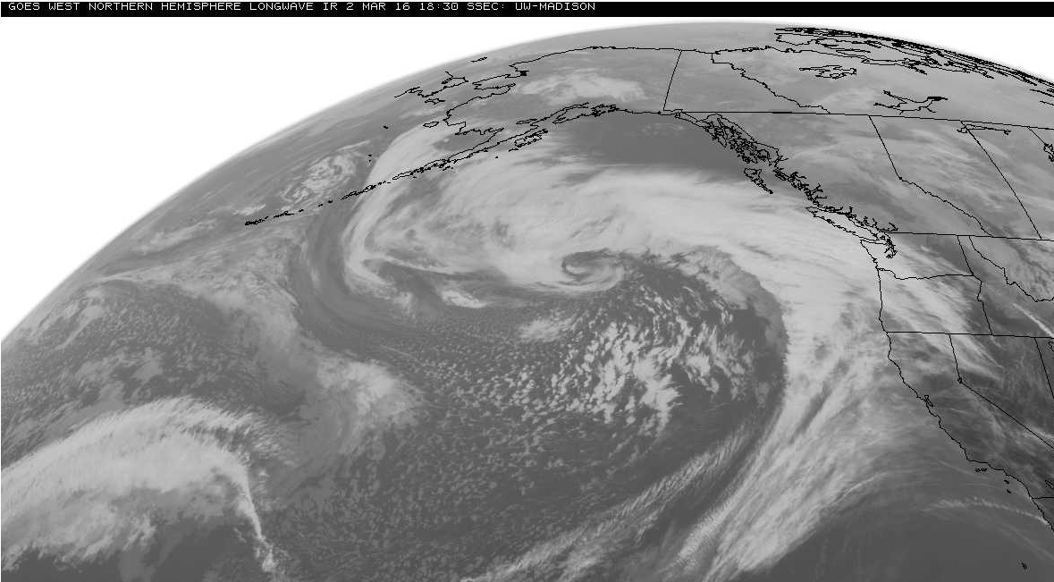
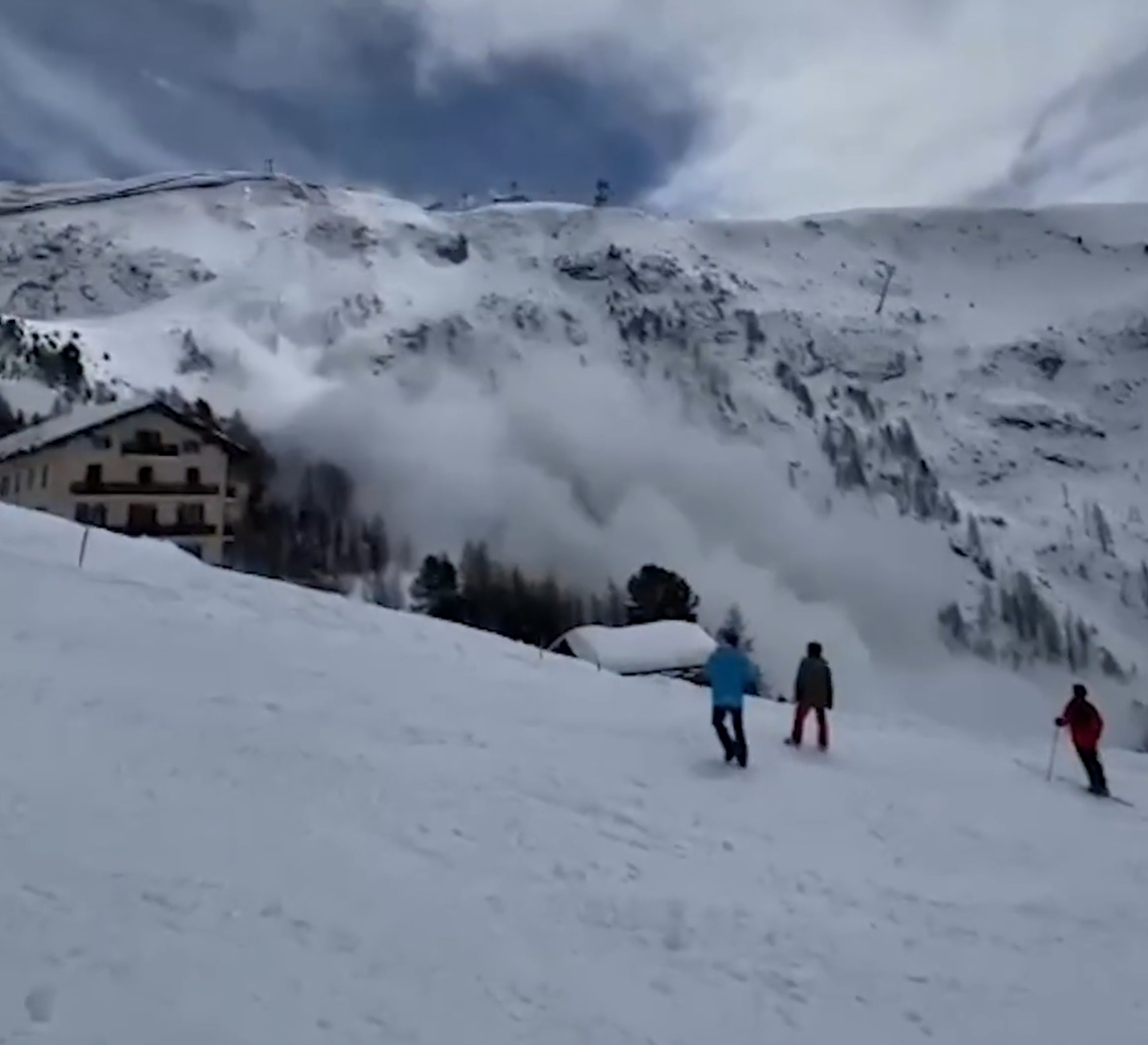
California is about to get hammered by storms this weekend.
NOAA made the above video to keep us informed as to exactly what will is going to happen in California in the coming days.
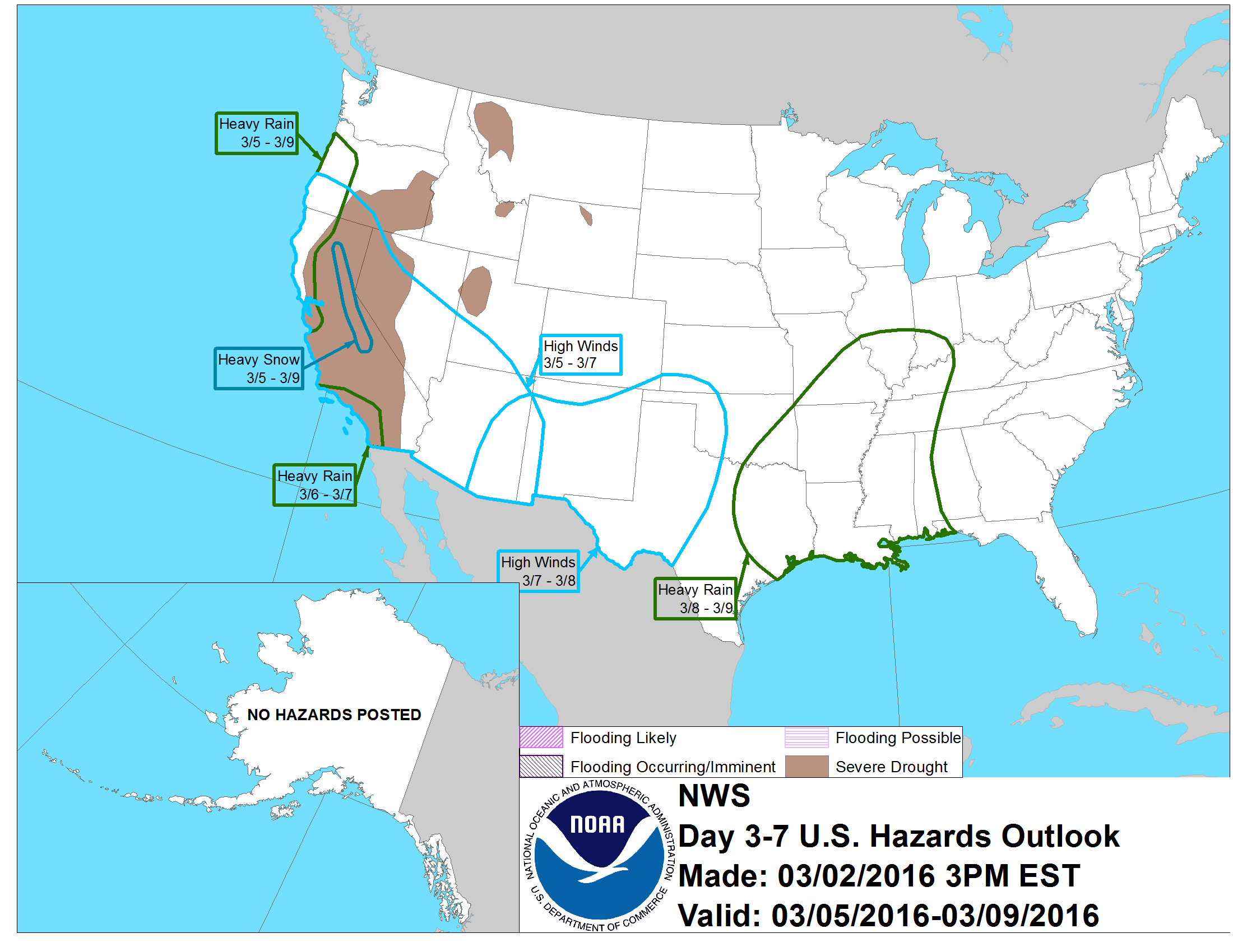
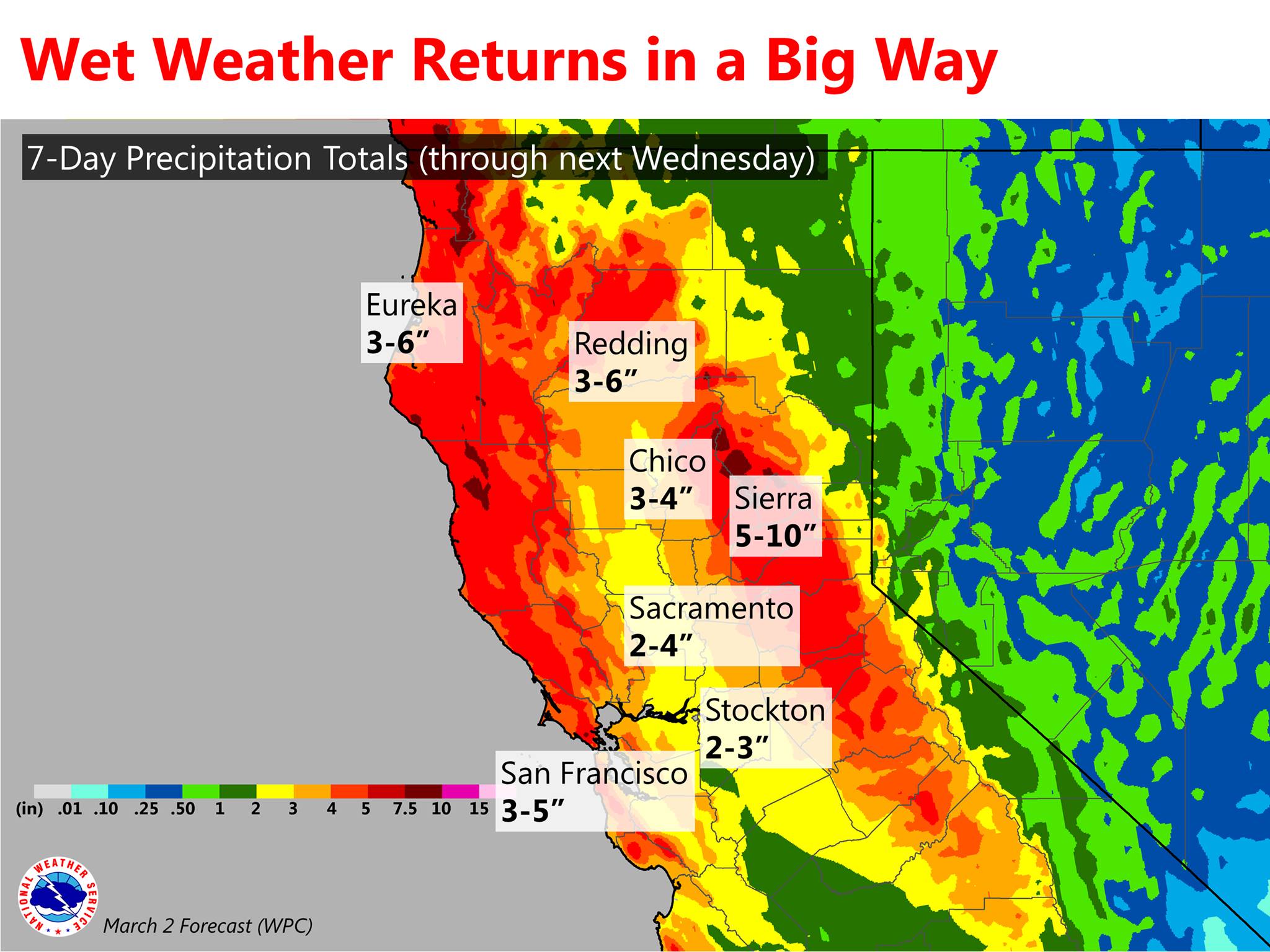
Below is some more detailed information about very wet weather headed to California:
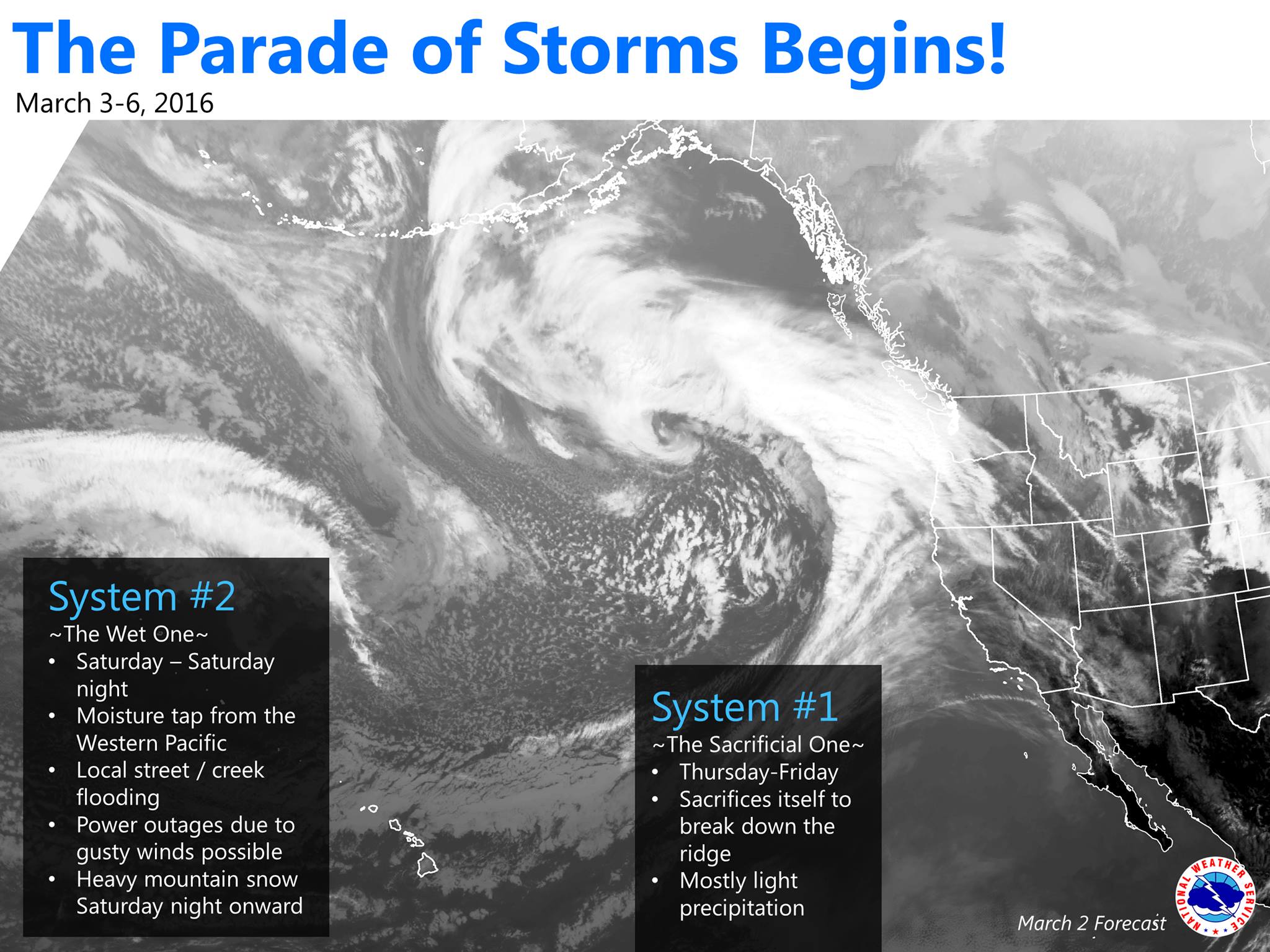
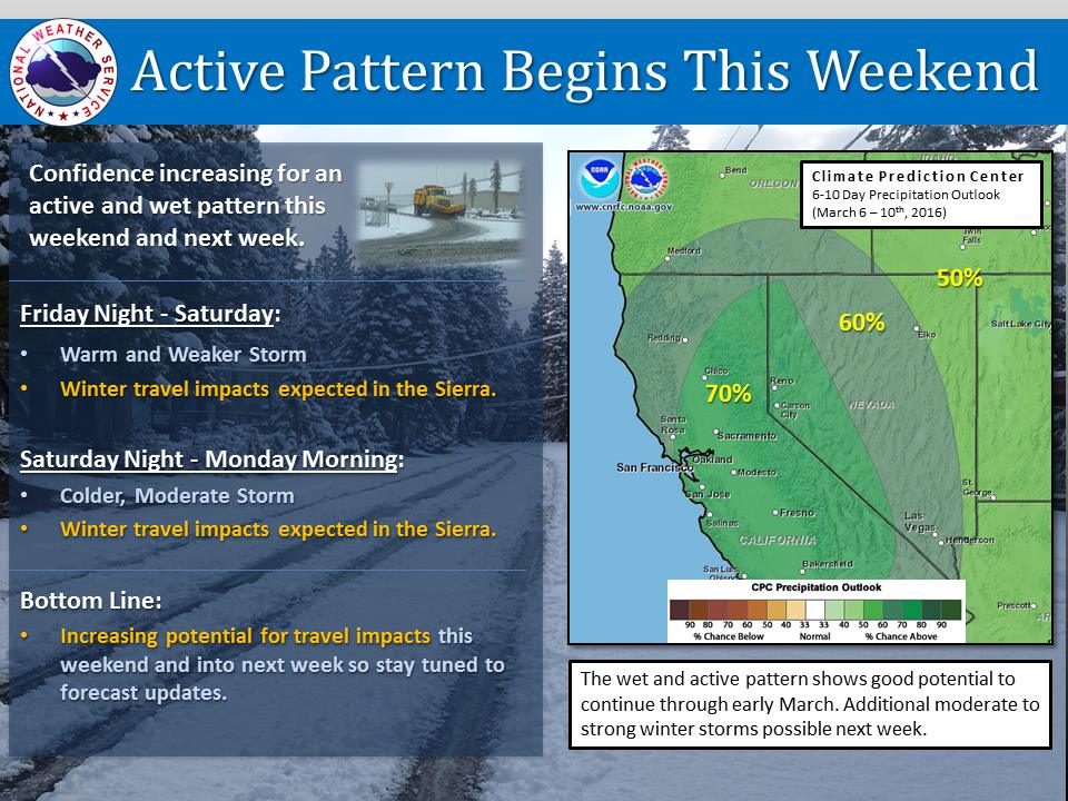
California Storms This Weekend:
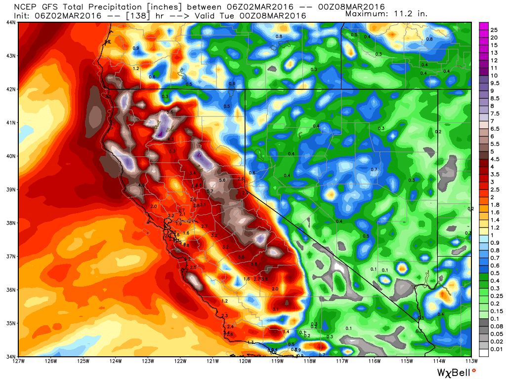
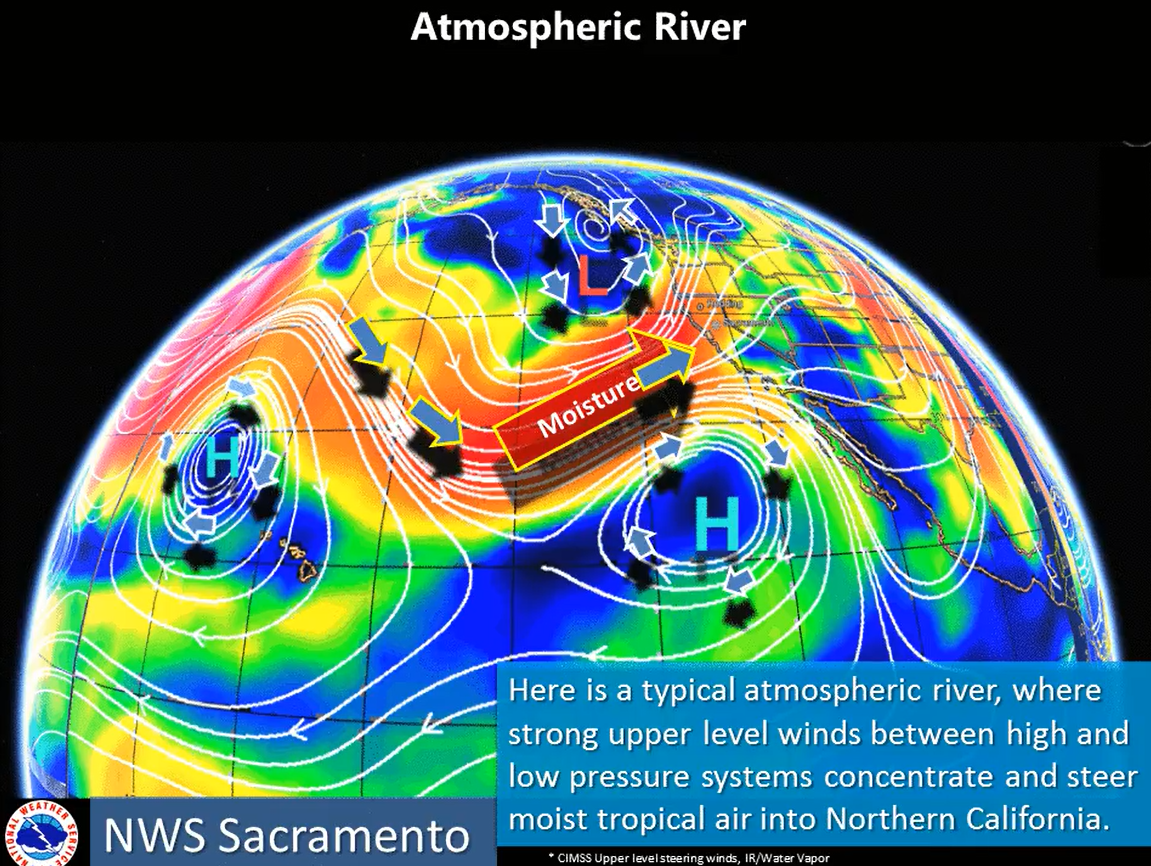
- NOAA is calling for a “Good Atmospheric River” to hit California on Saturday/Sunday with up to 3″ of liquid precipitation (potentially 3-feet of snow) forecast on the Sierra Crest near Lake Tahoe, CA by Sunday evening .
"The precip will be intense for a 12 hour period Saturday night into Sunday morning
with a good atmospheric river and strong forcing. First guess
precip amounts of 3+ inches along the Sierra Crest." - NOAA Reno, NV today
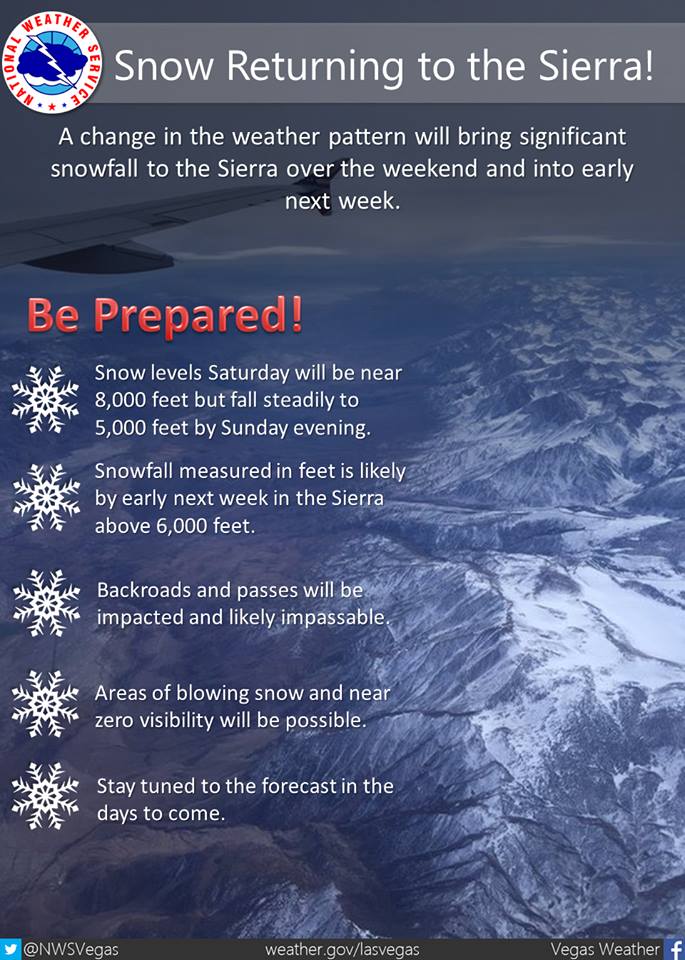
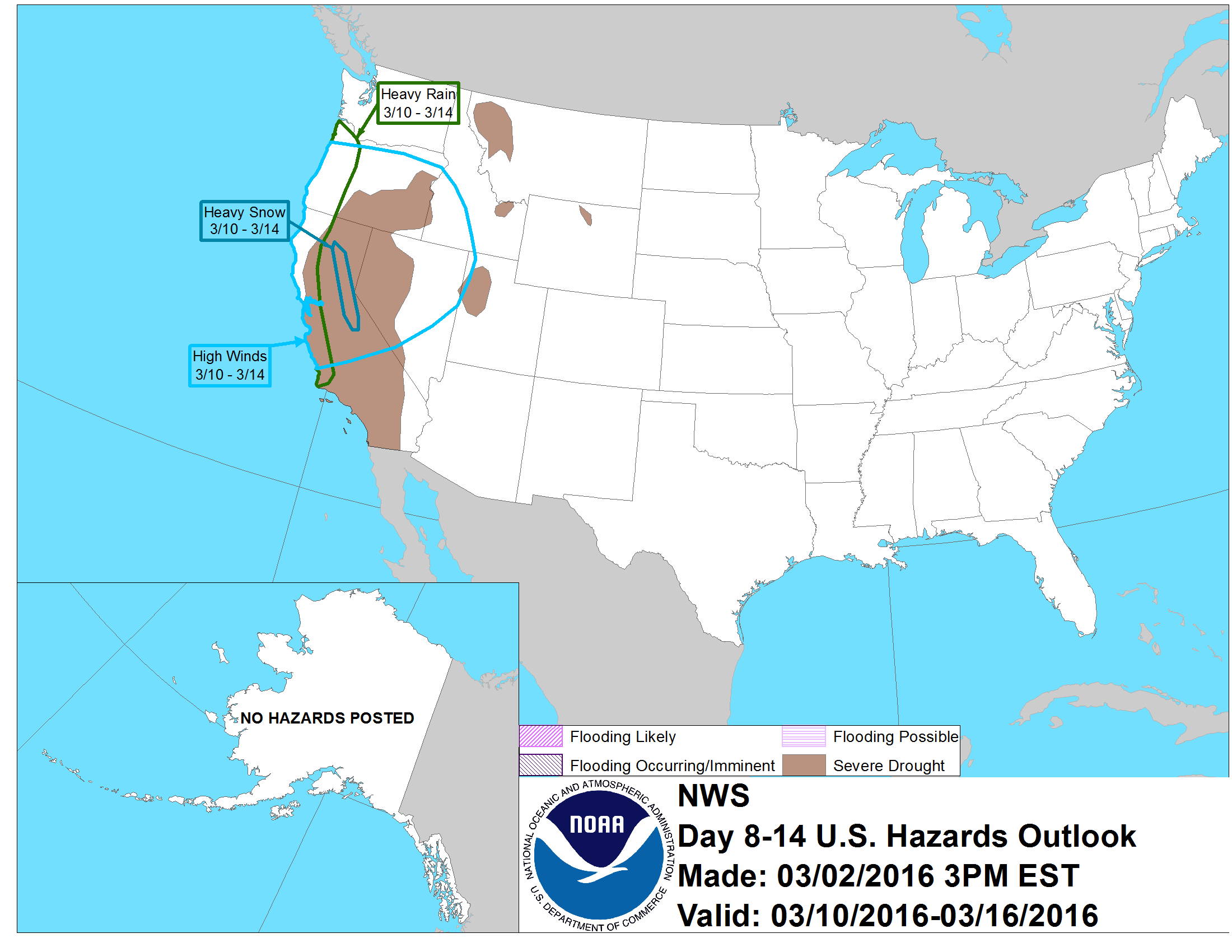
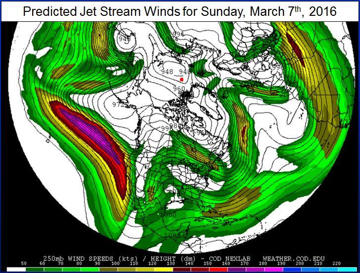
- NOAA’s long range hazard forecast is calling for “Heavy Snow” in the Sierra Nevada everyday from March 5th – March 14th (see images near bottom of article). That would be one helluva long cycle…
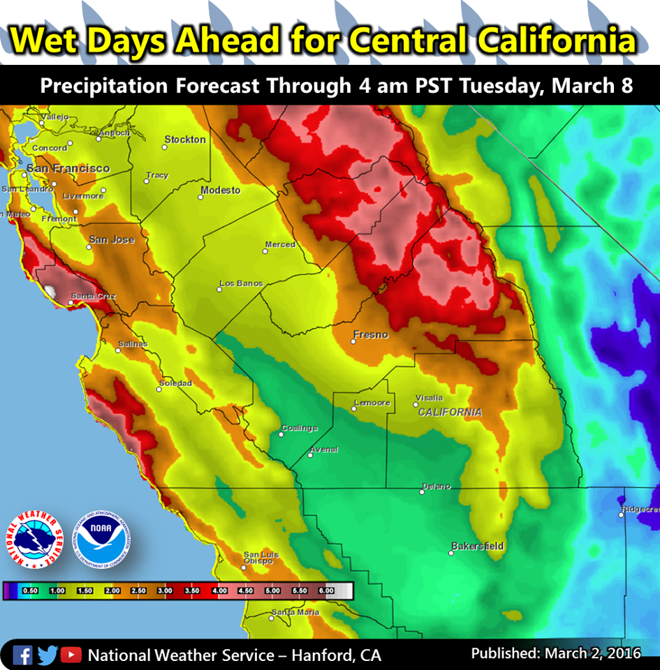
- NOAA’s liquid precipitation forecast for the northern Sierra Nevada is showing 10″ of liquid precipitation falling in the next 7-days. 10″ of liquid precipitation would translate to 10-feet of snow if it all comes in as snow.
- Brian Allegretto of Opensnow.com is forecasting 26-40″ of snow above 8,000-feet in Lake Tahoe, CA by Monday.
- Mammoth Mountain Weather Guy is forecasting 120-150″ of snowfall for Mammoth, CA in the month of March.
MORE CALIFORNIA STORM INFO:
The heaviest precipitation will arrive on Saturday, but periods of light to moderate precipitation are likely between Thursday and Monday.” – NOAA Sacramento, CA today
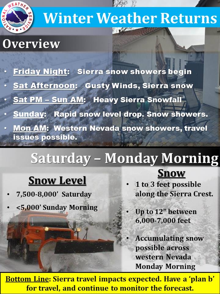
Precipitation may begin to push across the Sierra as early as Friday night with snow levels remaining near 7,500-8,000 feet through Saturday. The main push of moisture is expected Saturday night into Sunday morning where snow levels will rapidly drop behind a strong cold front.
Snowfall accumulations of 1 to 3 feet are possible along the Sierra crest through Monday with up to 12 inches between 6,000 to 7,000 feet. Travel impacts are a near certainty in the mountains due to snow and wind. Across western Nevada valleys, some travel impacts are possible for the Monday morning commute with the potential for accumulating snow.” – NOAA Reno, NV today