
Today, NOAA released their latest El Nino update. Here is the summary of this latest report:
Most models predict El Niño to develop during October-December 2014 and to continue into early 2015 (Fig. 6). The consensus of forecasters indicates a 2-in-3 chance of El Niño during the November 2014 – January 2015 season. This El Niño will likely remain weak (3-month values of the Niño-3.4 index between 0.5°C and 0.9°C) throughout its duration. In summary, El Niño is favored to begin in the next 1-2 months and last into the Northern Hemisphere spring 2015 (click CPC/IRI consensus forecast for the chance of each outcome). – NOAA
FULL EL NINO REPORT:
EL NIÑO/SOUTHERN OSCILLATION (ENSO)
DIAGNOSTIC DISCUSSION
DIAGNOSTIC DISCUSSION
issued by
CLIMATE PREDICTION CENTER/NCEP/NWS
and the International Research Institute for Climate and Society
9 October 2014
ENSO Alert System Status: El Niño Watch
Synopsis: El Niño is favored to begin in the next 1-2 months and last into the Northern Hemisphere spring 2015.
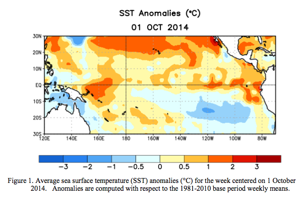
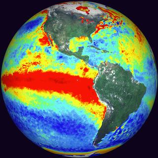
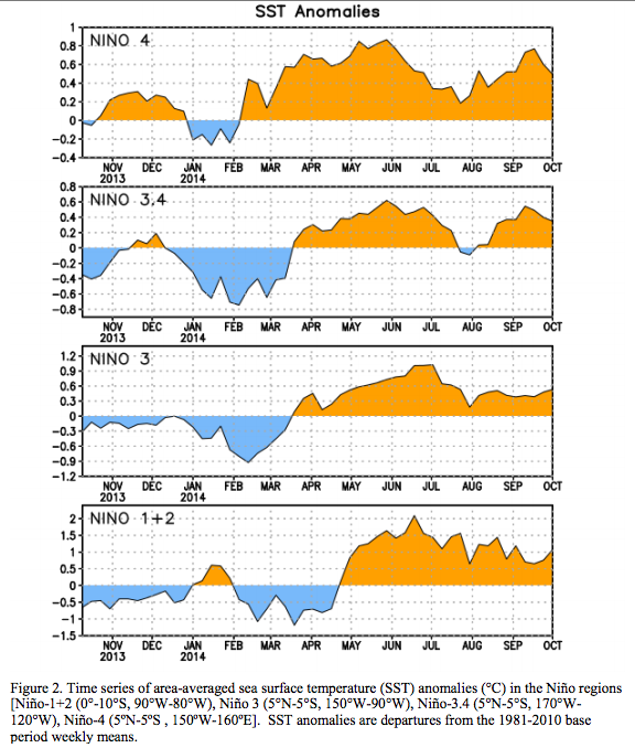
During September 2014, above-average sea surface temperatures (SST) continued across much of the equatorial Pacific (Fig. 1). The weekly Niño indices were relatively unchanged from the beginning of the month, with values ranging from +0.3°C (Niño-3.4) to +1.1°C (Niño-1+2) at the end of the month (Fig. 2).
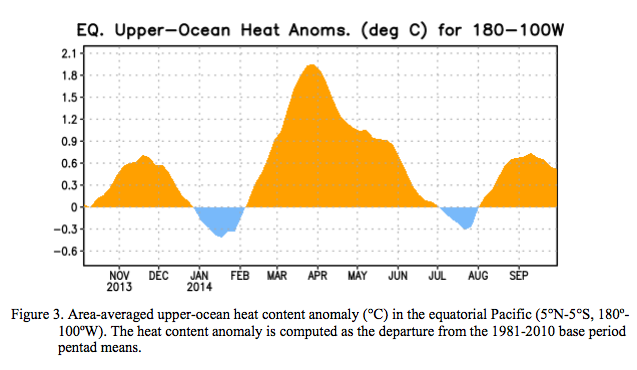
The change in subsurface heat content anomalies (averaged between 180º-100ºW) was also
minimal (Fig. 3) due to the persistence of above-average temperatures at depth across the central and eastern Pacific (Fig. 4).

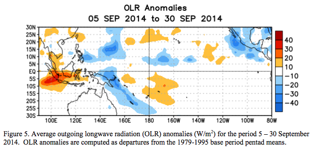
Equatorial low-level winds were largely near average for the month, though brief periods of westerly wind anomalies continue to arise. Upper-level winds were also close to average for the month. The Southern Oscillation Index has remained negative, and rainfall was near average around the Date Line, with a mix of positive and negative anomalies over Indonesia and Papua New Guinea (Fig. 5). The lack of coherent atmospheric and oceanic features indicates the continuation of ENSO-neutral.
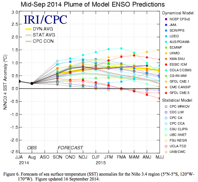
Most models predict El Niño to develop during October-December 2014 and to continue into
early 2015 (Fig. 6). The consensus of forecasters indicates a 2-in-3 chance of El Niño during the
November 2014 – January 2015 season. This El Niño will likely remain weak (3-month values of the
Niño-3.4 index between 0.5°C and 0.9°C) throughout its duration. In summary, El Niño is favored to
begin in the next 1-2 months and last into the Northern Hemisphere spring 2015 (click CPC/IRI
consensus forecast for the chance of each outcome).


I’m getting happier with every report. Now if the jet stream will cooperate to flow through California and hit Tahoe, we will be thrilled. I lived there in ’98; we had 15 feet of snow in the yard in Tahoma…