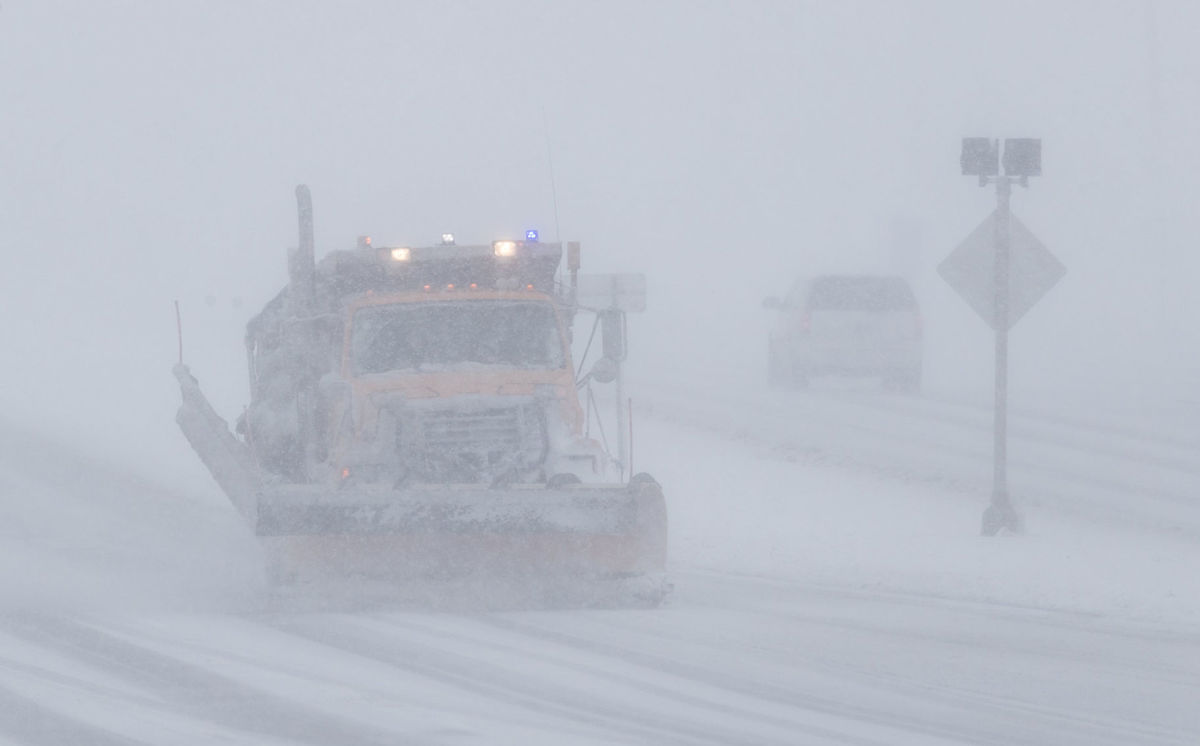
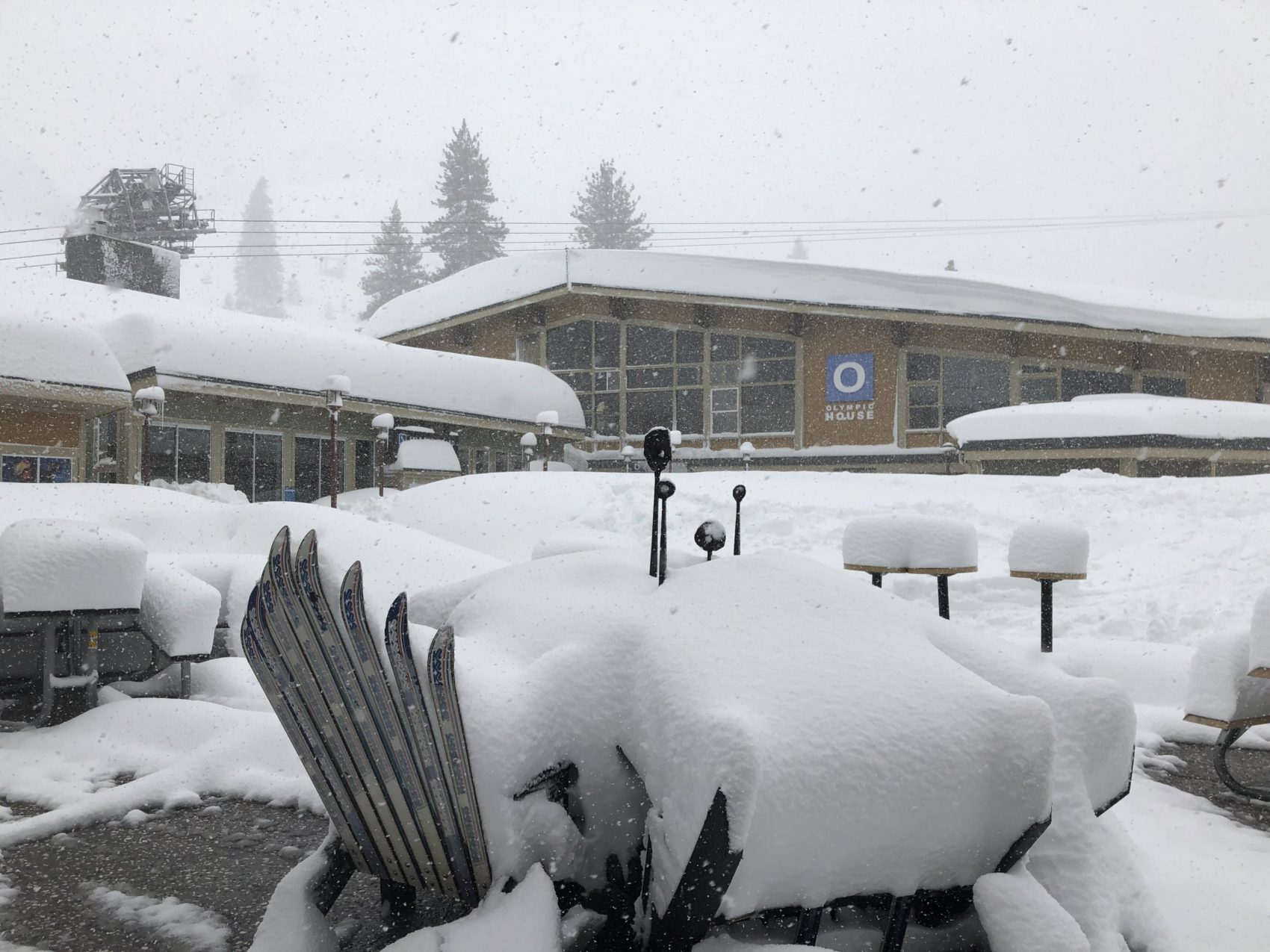
The National Weather Service has issued a Winter Storm Warning for California. It’s in effect through early Saturday Morning. Along with that, they’ve issued a Blizzard Warning that’s in effect until 4:00am Friday Morning. High winds, heavy snowfall, and avalanche danger is expected to impact the area throughout this time period.
2-5 FEET of Snow Above 7,000ft Through Saturday Morning.
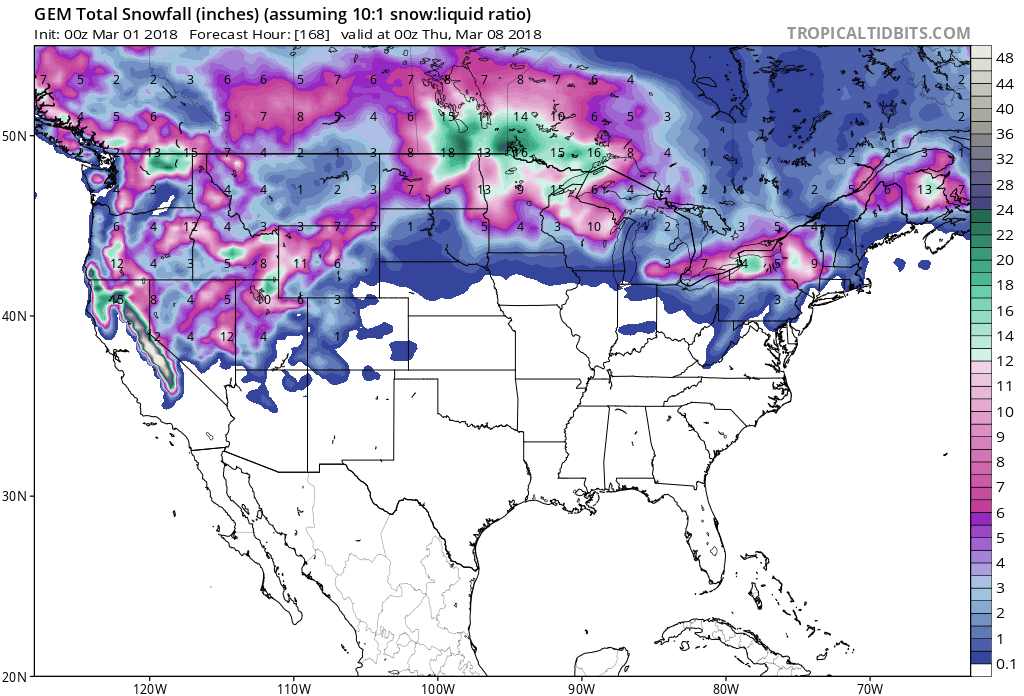
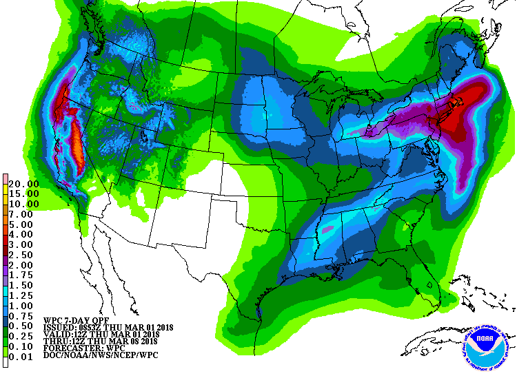
7 day snowfall totals are HUGE for CA. Image: Tropical Tidbits7 day precipitation totals. Image: NOAA
8-16″ of snow is possible all the way down to 2,000ft, but snow levels are forecasted to drop as low as 1,500ft at times.
Additional Storm Info:
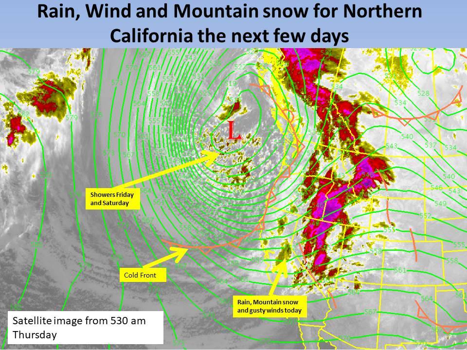
Unsettled weather pattern in CA looks like it will continue. Image: NOAA Sacramento, CABlizzard warning in effect. Image: NOAA Reno, NV
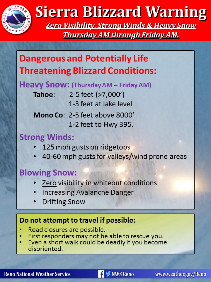
California: 2-5 FEET of Snow Above 7,000ft Through Saturday Morning
* Total snow accumulations of 2 to 5 feet
  in the Sierra above 7000 feet, with
  1 to 3 feet of snow below 7000 feet,
  including the Lake Tahoe basin.
- NOAA Reno, NV
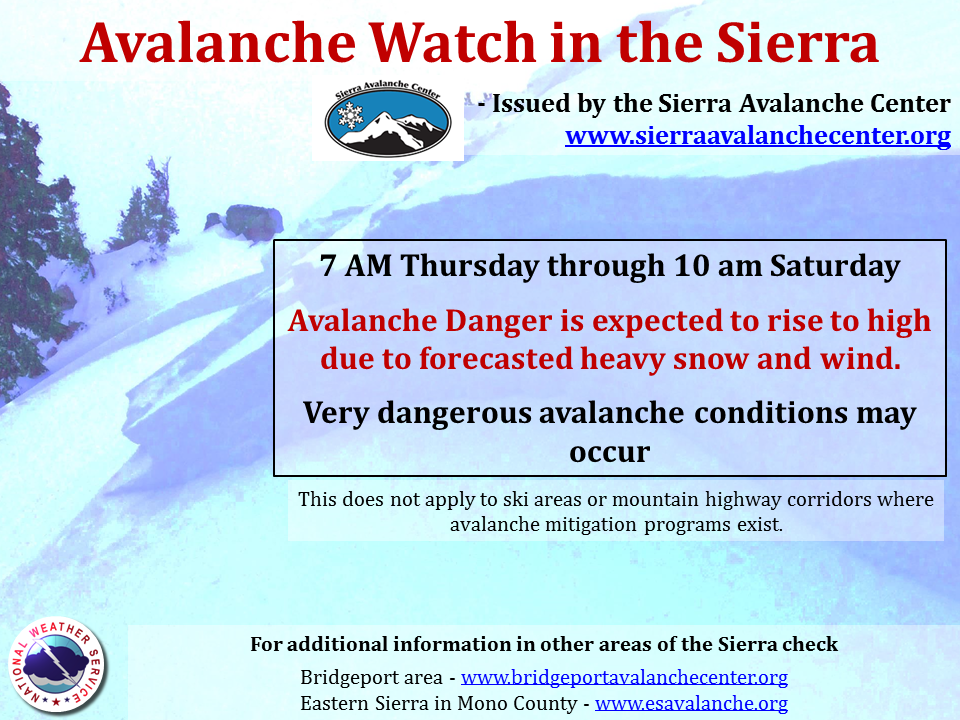
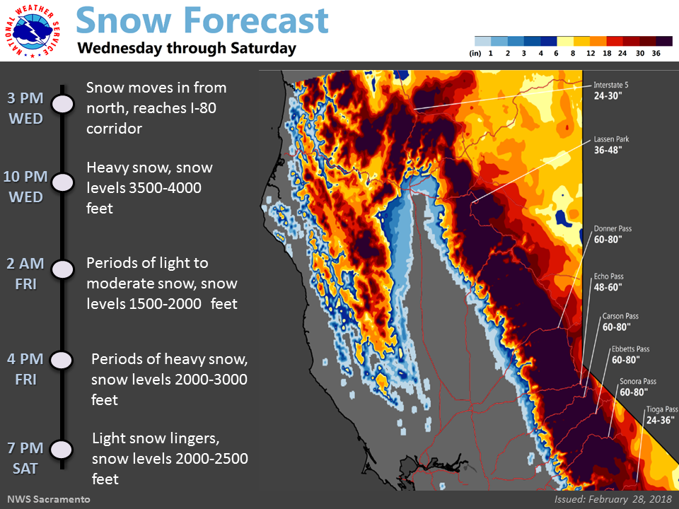
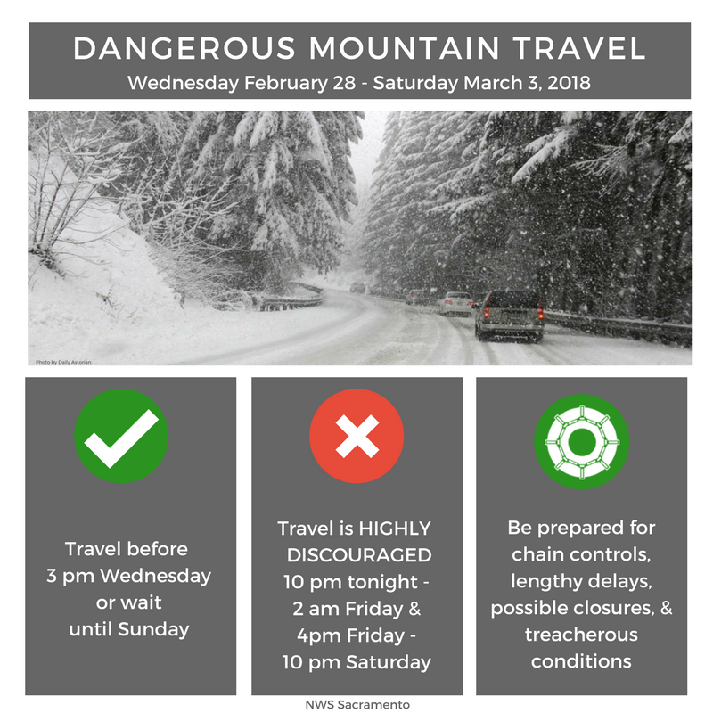
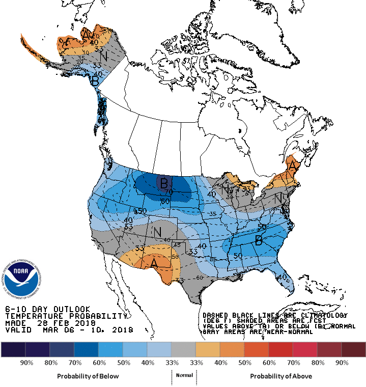
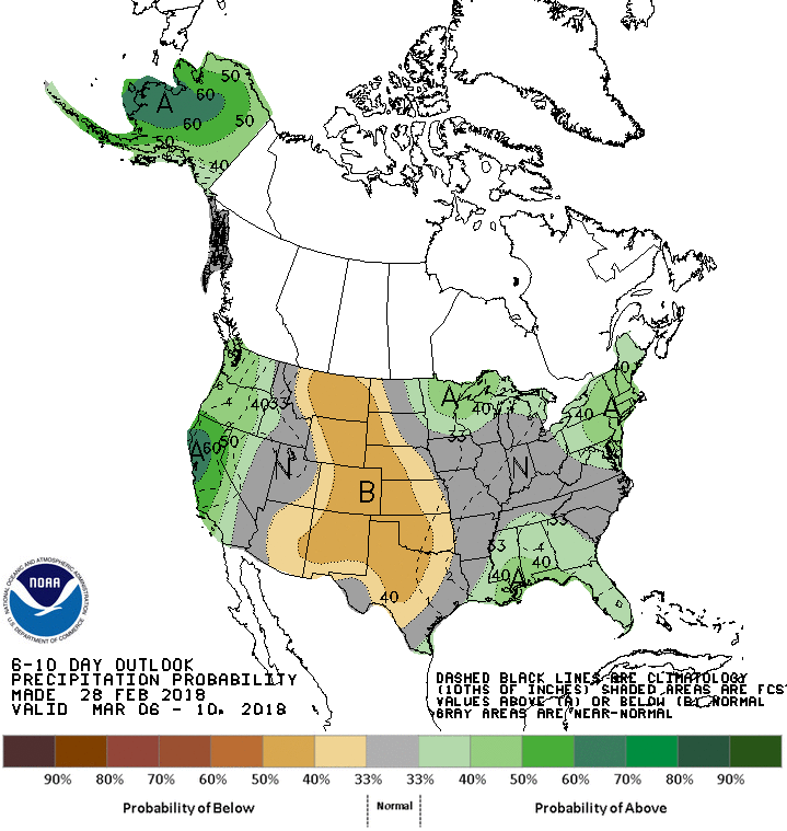
Avalanche watch in the Sierra. Image: NOAA Reno, NVSnowfall totals. Image: NOAA Sacramento, CADangerous mountain travel. Image: NOAA Sacramento, CA6-10 day temperature outlook. Image: NOAA6-10 day precipitation outlook. Image: NOAA
CA Blizzard Warning:
URGENT - WINTER WEATHER MESSAGE
National Weather Service Reno NV
414 AM PST Thu Mar 1 2018
Greater Lake Tahoe Area-
Including the cities of South Lake Tahoe, Truckee, Stateline,
and Incline Village
...WINTER STORM WARNING REMAINS IN EFFECT UNTIL 10 AM PSTSATURDAY...
...BLIZZARD WARNING REMAINS IN EFFECT FROM 8 AM THIS MORNING TO4 AM PST FRIDAY...
* WHAT...Heavy snowoccurring with periods of blizzard conditions
expected. Strong winds and heavy snowfall rates will cause
whiteout conditions with blowing snow. Total snow accumulations
of 2 to 5 feet in the Sierra above 7000 feet, with 1 to 3 feet
of snow below 7000 feet, including the Lake Tahoe basin.
* WHERE...Greater Lake Tahoe Area.* WHEN...For the Winter Storm Warning, until 10 AM PST Saturday.
For the Blizzard Warning, from 8 AM this morning to 4 AM PST Friday which is also when the heaviest snow is expected.
* ADDITIONAL DETAILS...Travel will be very difficult to impossible, including both the morning and evening commutes
today. Damage to some trees and power lines is likely. Be
prepared for significant reductions in visibility down to near zero at times especially in higher elevations.