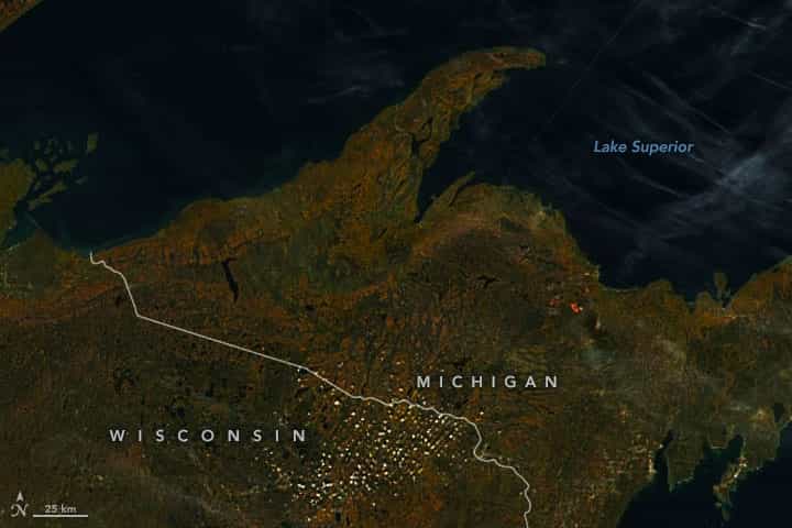
In mid-October 2022, autumn color was on full display in Michigan’s Upper Peninsula. Then, a storm moved in and blanketed the vibrant foliage with white—the area’s first heavy snowfall of the season.
The Visible Infrared Imaging Radiometer Suite (VIIRS) on the Suomi NPP satellite acquired this natural-color image (left) on October 10, 2022. At the time, leaves across the Upper Peninsula had reached peak color, with vibrant reds and oranges spanning much of the landscape.
- Related: Wild Mountain, MN, Will Open at Noon to Take ‘First to Open’ Title From Andes Tower Hills, MN
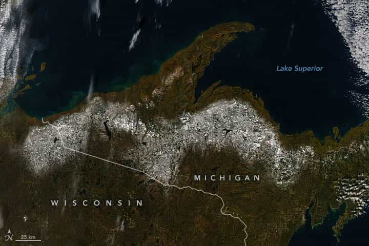
One week later, a low-pressure system moved into the central Upper Peninsula bringing winter-like weather to the area on October 10 and 11. More than a foot of snow fell in Baraga and Marquette counties, with some areas seeing almost 2 feet (0.6 meters) of accumulation. Along the shore of Lake Superior, precipitation fell as rain.
Skies eventually cleared and allowed the Moderate Resolution Imaging Spectroradiometer (MODIS) on NASA’s Aqua satellite to capture this post-storm image (right) on October 20, 2022. The snow was in the process of melting but persisted at many of the higher elevations.
Forecasters called for warmer air temperatures by the end of the week, meaning the blanket of white will not likely stick around. This gives leaf-peers a bit more time to enjoy autumn’s colorful displays. But they should look soon; color was still abundant but had already past its prime across the Upper Peninsula during the week of October 12–20.
This post first appeared on NASA Earth Observatory. NASA Earth Observatory images by Joshua Stevens, using MODIS and VIIRS data from NASA EOSDIS LANCE, GIBS/Worldview, and the Suomi National Polar-orbiting Partnership. Story by Kathryn Hansen.