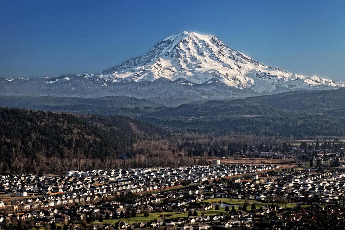
According to National Geographic, Mount Rainier might be the most dangerous volcano in the US. The volcano is often overshadowed by Yellowstone’s “supervolcano” hype, or by its neighbor, Mount St. Helens, which erupted in 1980. While an eruption at Yellowstone has the potential to be catastrophic, a major eruption hasn’t happened in 630,000 years and might not even happen again. And while Mount St. Helens remains more likely to erupt than Rainier, its shape and lesser snowpack wouldn’t allow for the super-devastating lahars that would result from an eruption on Rainier.
- Related: World’s Largest Supervolcano Sits Underneath California – Experts are Keeping a Close Eye On It
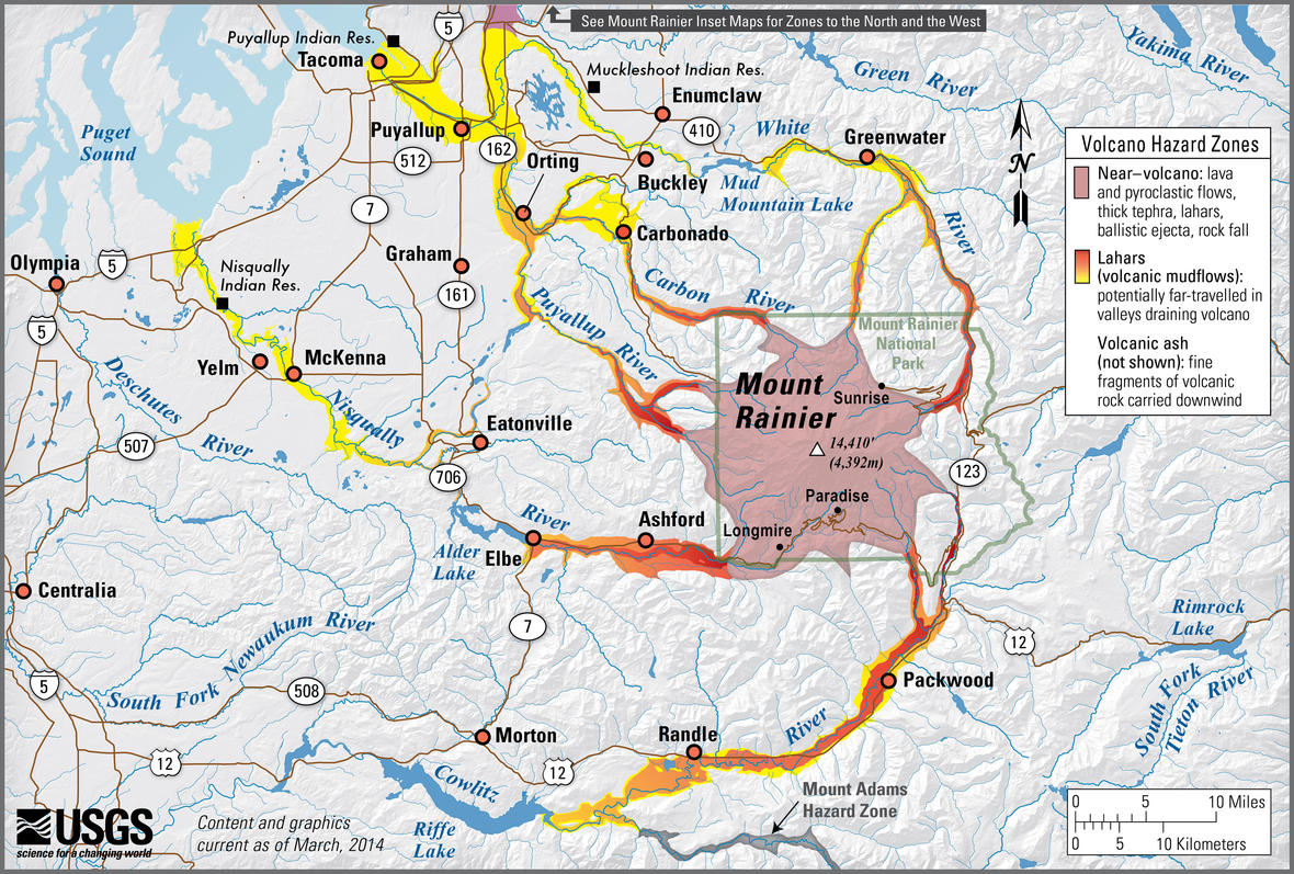
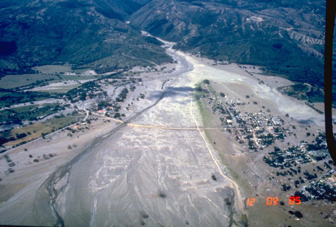
Lahars, a type of volcanic mudflow, are what make Rainier such a threat to nearby cities. These mudflows are often triggered by the heat of volcanic events that melt snow and glaciers. The rushing water collects dirt, rocks, debris, and speed as it travels through valleys down a mountain, annihilating whatever lies in its path. The destructive power of a lahar was demonstrated in 1985, when the town of Armero was struck by one from the Nevado del Ruiz stratovolcano, wiping out the town and resulting in the deaths of over 20,000 people.
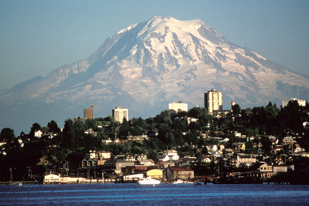
Due to a large amount of water stored in Ranier’s glaciers and snow, volcanic activity on the mountain could trigger lahars that reach all the way to the Puget Sound, wrecking suburbs of Seattle and Tacoma along the way. 5600 years ago a small eruption on Rainier caused lahars to deposit mud from the mountain all across the Puget Sound region. This event, referred to as the Osceola Mudflow, shows just how far lahars would go if a similar eruption were to occur.
“A mudflow from Mount Rainier is the most catastrophic natural disaster that could happen to this area,” Geoff Clayton, a geologist in Washington, explained to Seattle Weekly, stating that a lahar would “wipe out Enumclaw, Kent, Auburn, and most of Renton, if not all of it,” on its way towards Seattle.
The good news is that three of the four main river valleys surrounding Mount Rainier have dams. If reservoirs are able to be drained in time, these dams can be used to at least partially capture lahars. This method could reduce the devastation of such an event, however, there is no dam in the Puyallup Valley, leaving tens of thousands of people fully vulnerable.

The “most catastrophic natural disaster that could happen to this area”? I beg to differ. Heard of the Cascadia Subduction Zone?
Sweet!
Mt. Rainier is saturated with monitoring stations that are intended to detect minute seismic activity. An eruption will be preceded by numerous mini and not-so-mini earthquakes as the mountain prepares to burp. That activity will prompt an eruption alert…not the presence of some clouds that an overeager reporter declared was the mountain venting.