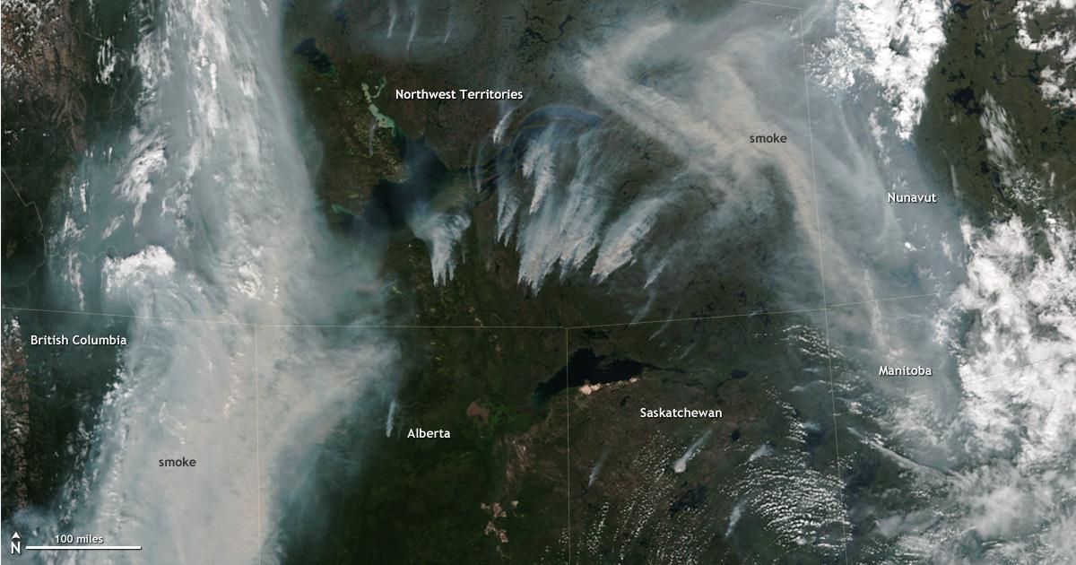
“A NOAA/NASA satellite captured an image of massive fires, giant rivers of smoke in Canada.
Normally, the fire danger in Canada’s Northwest Territories by this time of year is near the low end of the country’s national monitoring scale (http://bit.ly/2i6Z5QE). This summer, the fire danger ranged from high to extreme across much of the eastern half of Northwest Territories, as well as parts of northern Saskatchewan and Manitoba provinces, according to maps on the Natural Resources Canada website (http://bit.ly/2i5NeT4).
This image from the NASA/NOAA Suomi NPP satellite shows the intense fire activity in Northwest Territories on August 12, 2017, along with rivers of smoke more than a hundred miles wide in places. More than a dozen fires of at least 1,000 hectares (more than 2,000 acres) were burning in the area east-southeast of Great Slave Lake alone.
Not all of the smoke pictured is necessarily from the fires captured within this satellite view, however. Smoke can travel hundreds of miles and crisscross national borders, which means some of this smoke could have come from fires in the U.S. West.
NOAA tracks fire activity and issues smoke warnings for events like this as part of its hazard monitoring activities. The Environmental Protection Agency then uses this information as part of their daily air quality monitoring activities (http://bit.ly/2v1ynKC), which Americans can use to protect their health and safety by limiting exposure to smoke and other air pollution.” – NOAA, yesterday


