BrainsEvergreenHome Page [MAP] Every Ski Area on U.S. Forest Service Land Last updated: August 9, 2022 10:51 am SnowBrains Photo courtesy of USFS Photo courtesy of USFS 
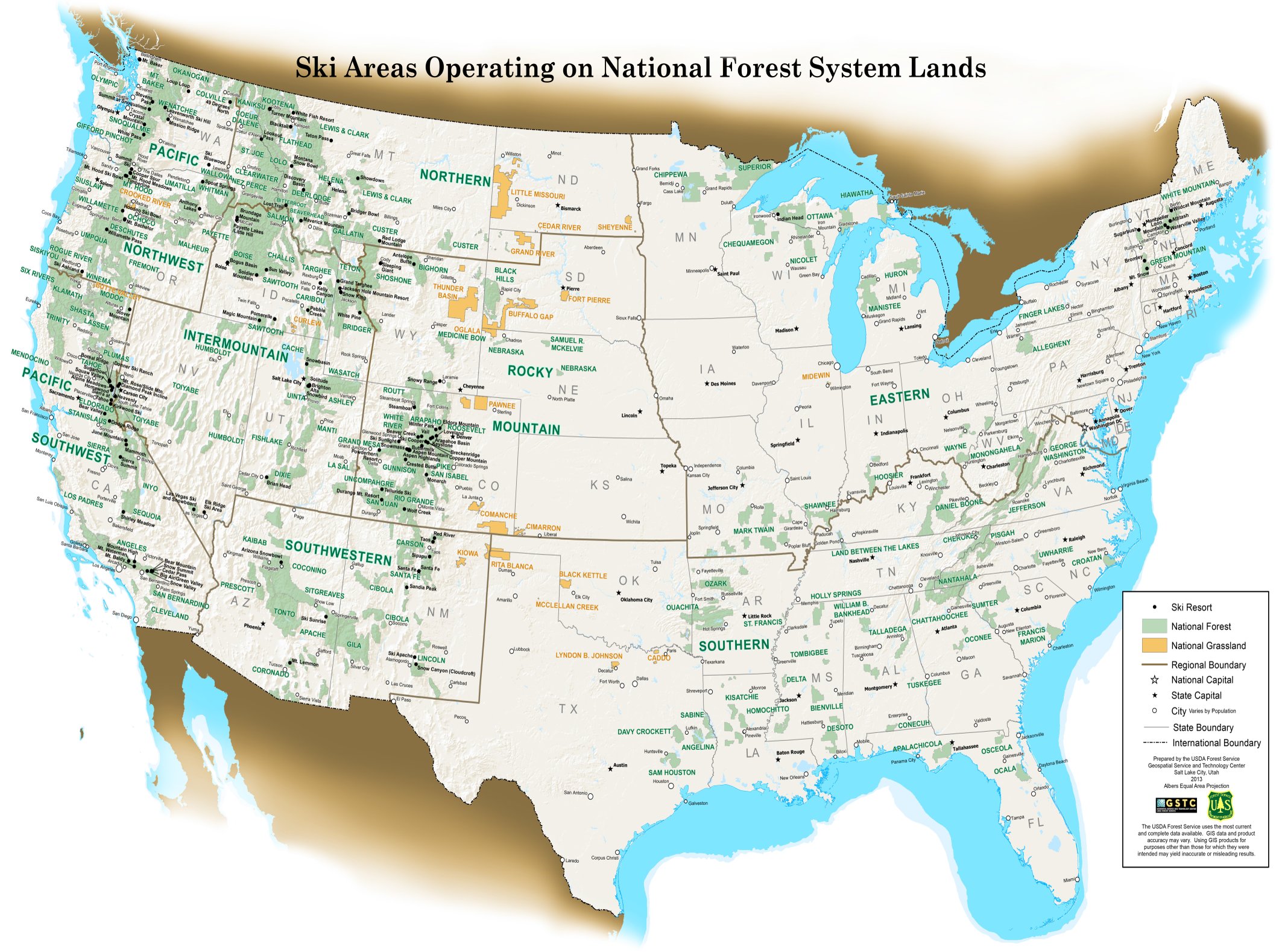
You might have to do some squinting, but above is a graphic of every ski area operating on U.S. Forest Service Land.ย Is your home mountain on USFS land? Related: Topographic Ski Maps: A New Way of Tracking Resort Days TAGGED:mapski areaSki Newsskiingusfs land BySnowBrainsThe ski and snowboard site with intelligence. 1 Comment Um, it’s kinda’ hard to read. Do you have a link to a larger version that you can zoom in on specific areas? Loading... Reply Got an opinion? Let us know...Cancel reply Get our top 3 articles emailed to you weekly! Share your story: Submit A Link Top 10 Trending right now: [UPDATED: June 20] NOAA Winter 2025-26 Outlook: Long-Lead Seasonal Outlook Gives Sneak Peek of Next Winter The 8 Coldest Ski Lifts in North America Skiing and Snowboarding Are Amongst the Most Expensive Sports for Kids, Study Finds The Man With Over 300 Pairs Of Skis NOAA: When to Expect the Warmest Day of the Year Where You Live Top 7 Steepest Chairlifts in the United States [PHOTOS] Landslide Tears Through Village Near Cortina dโAmpezzo in Italian Dolomites The Top 9 Highest Paved Roads in the United States 7 Ways to Up Your Game as a Resort Skier How Do You Define a โLocalโ?
Um, it’s kinda’ hard to read. Do you have a link to a larger version that you can zoom in on specific areas? Loading... Reply
Um, it’s kinda’ hard to read. Do you have a link to a larger version that you can zoom in on specific areas?