La Nina watch is on.
La Nina Watch, Update: October 12, 2017
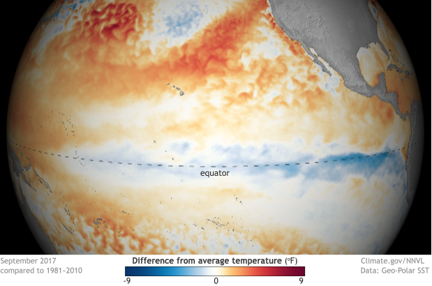
“The atmosphere over the tropical Pacific was La Niña-like in September, but the required cooling of the ocean surface was interrupted in the second half of the month. However, the deeper waters in the east cooled further, and forecasters say the odds of at least a weak La Niña by late fall or winter are 55-65%. The next update will be on November 9.”
The National Oceanic and Atmospheric Administration (NOAA) shows us precipitation during every La Nina pattern through the last 67 years.

“Precipitation patterns during every La Niña winter since 1950
When La Niña develops across the tropical central/eastern Pacific Ocean, it can affect areas thousands of miles away, including the United States. The effects are usually strongest in Northern Hemisphere winter. However, no two La Niña winters will have identical precipitation patterns.
This series of maps shows precipitation patterns across the continental United States compared to the 1981-2010 average for every winter season—December through February—since 1950 that coincided with La Niña conditions in the equatorial Pacific Ocean. The years are ranked by how far below average the temperatures were in the central/eastern tropical Pacific: strong (at least -1.5° Celsius colder than average), moderate (between -1° and -1.5°C), and weak (between -0.5° and -1°C colder than average.
In general, the stronger the La Niña, the more reliable the impacts on the United States. The typical U.S. impacts are warmer- and drier-than-average conditions across the southern tier of the United States, colder-than-average conditions across the north-central Plains, and wetter-than-average conditions in the Ohio Valley and Pacific Northwest/northern California.
However, as is evident in these maps, there is a great deal of variability even among strong La Niña events. And some impacts are more reliable than others. For example, 9 of the 11 strong and moderate events show wetter-than-average conditions in the Pacific Northwest—though the intensity of the anomaly varies—which is most winters, but not all. And 6 of the 11 events produced wet conditions in the Ohio Valley, which is slightly more than half, but far from a guarantee.
This “failure” of the typical pattern occurs because La Niña is never the only thing that influences the climate over the United States during the winter. Other climate phenomena, such as the Arctic Oscillation or the Madden Julian Oscillation, as well as the random nature of weather, can also play a large part in how a winter turns out.
For the latest United States winter forecast for temperature and precipitation, head to NOAA’s Climate Prediction Center. Or stay tuned to Climate.gov’s ENSO blog later this month for a post describing the winter forecast. For the latest monthly temperature outlook, check out Climate.gov’s Data Snapshots map gallery.” – NOAA

