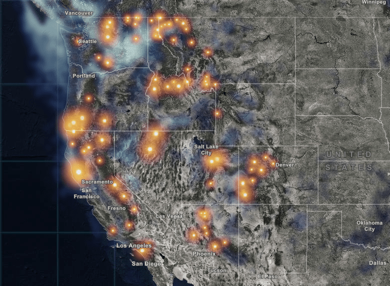
There are currently 85 active wildfires blazing in the USA, and this interactive, real-time map shows them all.
Esri’s mapping software is some of the most advanced and powerful available and puts the ability to filter down to individual blazes, or by the current magnitude and start date, at your fingertips. If you hover over each area, you’ll learn the name of every fire wildfire in the country, including the number of acres burned and percentage of containment.
This map is certainly an awesome way to delve in to and investigate the current state of the country’s wildfires, I’d recommend checking it out.


