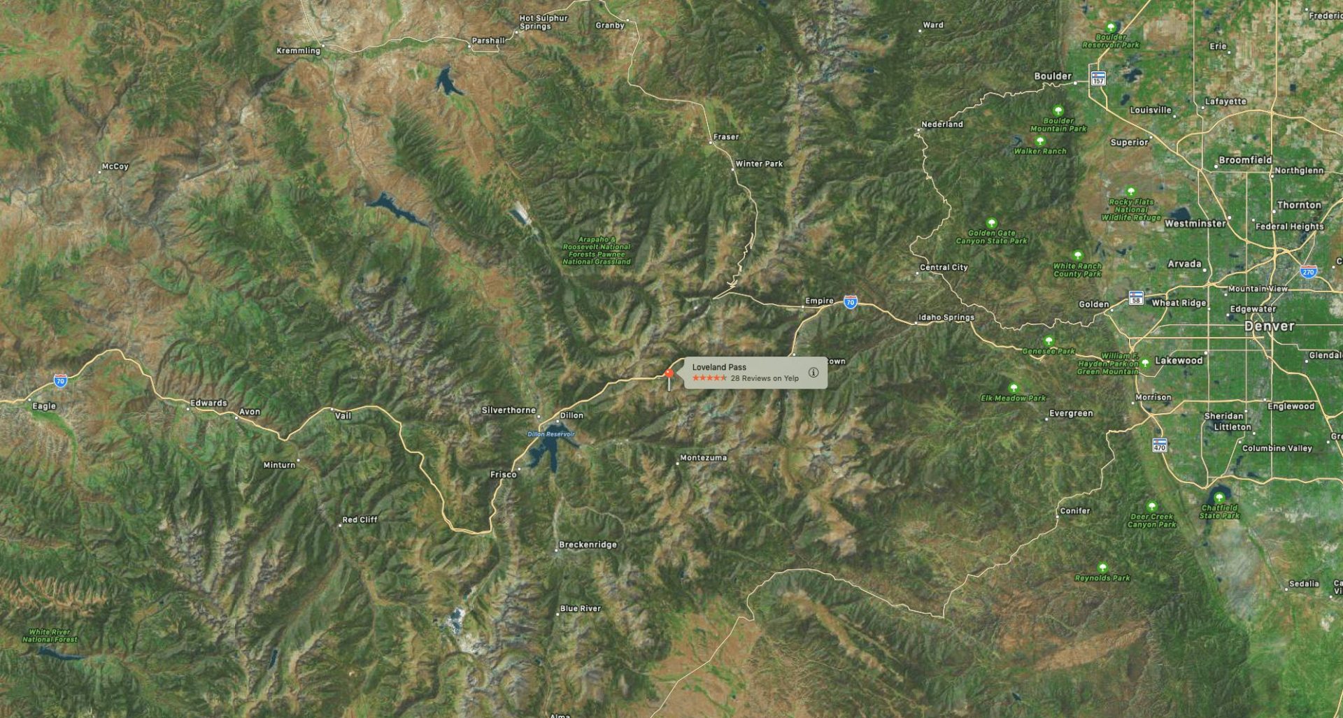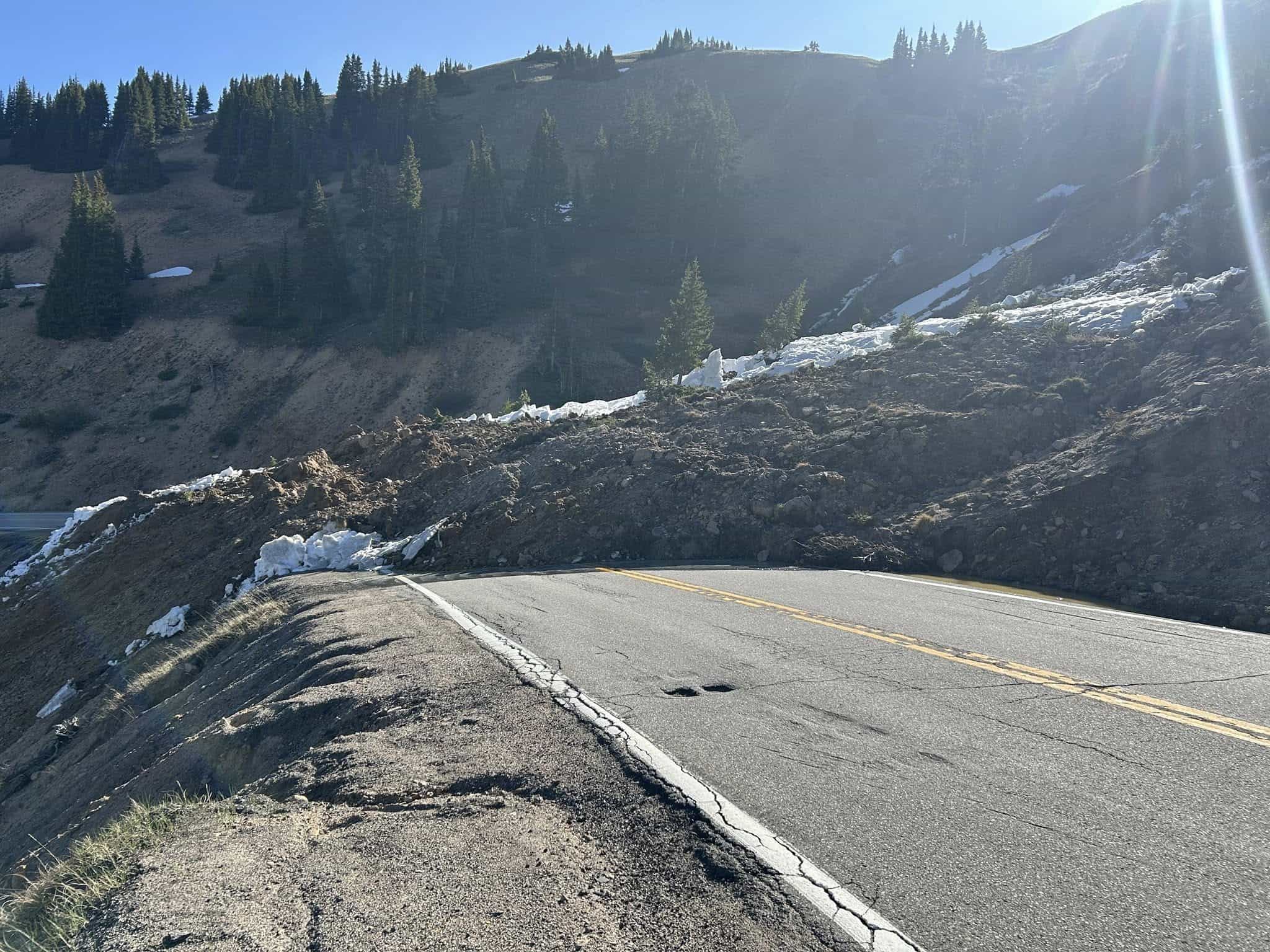
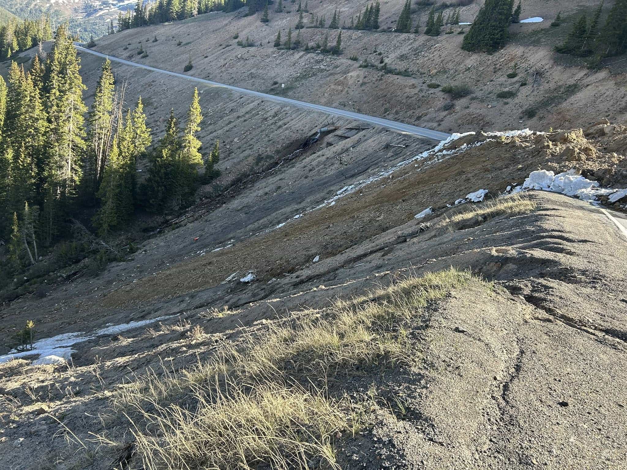
A significant landslide forced the closure of Loveland Pass, Colorado, early Sunday morning, blocking U.S. Highway 6 near mile marker 226, roughly one mile before the Summit County line. The slide, which measured approximately 100 feet wide and 20 feet deep, did not involve any vehicles or cause injuries, according to officials from the Clear Creek County Sheriff’s Office and the Colorado Department of Transportation.
The closure affects U.S. Highway 6 from just east of Arapahoe Basin to Loveland Ski Area. While access to Arapahoe Basin Ski Area from the Summit County side remains available, the highway east of the ski area is impassable. Motorists could still reach Arapahoe Basin for its closing day by traveling through Keystone, as the route between Keystone and the ski area remained open. Resort officials clarified that reports of Highway 6 being closed at Keystone are inaccurate.
“Highway Between A-Basin and Keystone Open: US Highway 6 from Keystone is OPEN.
The highway east of A-Basin is closed. Skiers and riders can join us for closing day, but they have to drive through Keystone. Loveland Pass is closed.
There is some reporting this morning that says Highway 6 is closed at Keystone. That is incorrect.”– Arapahoe Basin statement yesterday
As of Monday morning, the pass remains closed with no estimated reopening time. Crews continue to monitor the area as the mountain stabilizes, and authorities expect the closure to be extended. The public is urged to avoid the area due to ongoing instability and active slide conditions.
Photos released by the Summit County Sheriff’s Office and CDOT reveal the extent of the debris field. Officials say public safety remains the top priority as crews continue to monitor the situation.
Travelers are advised to check for updates before planning routes through the high country. Further information as conditions change and as crews make progress on clearing the slide.