Forecast by SnowBrains Meteorologist Nathan Tarino
Updated 12A MST Wed 10/18/22
Forecast Summary
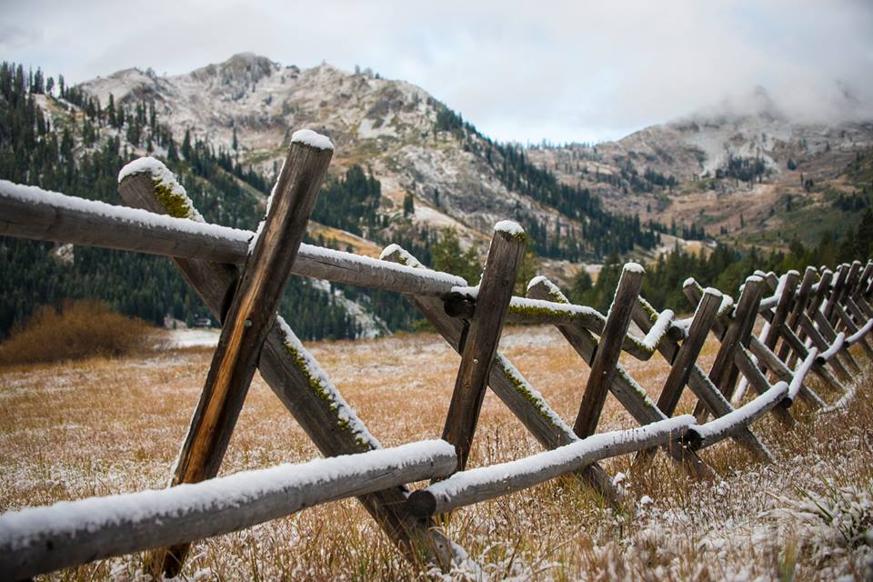
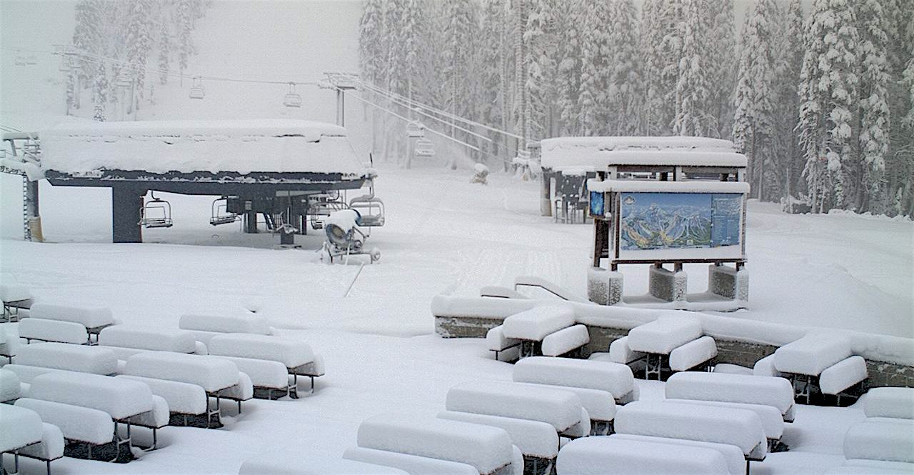
After an unseasonably warm start to October, a shot of winter will cool things down across the Cascades this weekend. Most resorts will see their first accumulating snow of the season.
Additional cold/wintry weather is likely on Sunday/Sunday night, and there will also be another chance for high-elevation snow around midweek next week.
Short Term Forecast
Pleasant (but smoky) weather will stick around through Thursday. On Friday, look for increasing cloud cover and the season’s first flakes atop the higher peaks.
In Washington:
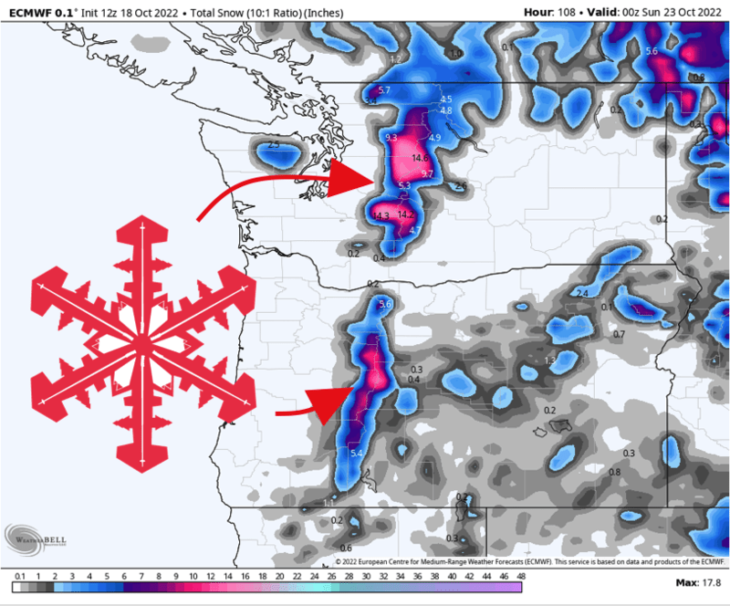
Snow begins above 5,000′ Friday afternoon. Snow continues through Friday night as snow levels drop closer to 4000′. A few snow showers linger until Saturday afternoon. Snow totals will be heavily elevation-dependent, with resort peaks getting dumped on while lower bases see periods of rain. Expect 3-6″ of denser snow above 4500′. The better accumulations will be found farther south; I’d pick Crystal Mountain to be the winner in Washington.
In Oregon:
Snow begins above 6500′ early Saturday morning. Snow continues through Saturday, with snow levels falling below 5000′. Snow will taper off through Saturday night. Snow totals will be heavily elevation-dependent, with resort peaks getting dumped on while lower bases see periods of rain. Expect 5-10″ of classic Cascade Concrete by Sunday morning above 6000′. I’m eager to watch webcams from Bachelor and Timberline on Sunday.
Further Out
More chances for snow will come Sunday night and again around the middle of next week. The latter of these two looks to be the better chance for heavier snow in the high Cascades.
The large-scale pattern is going to change quite a bit from the 1st to the 2nd half of October, with mean troughing (cool colors) developing over the Northwest and the Pacific Coast of Canada:
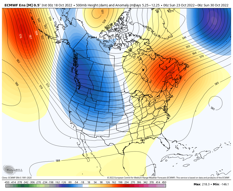
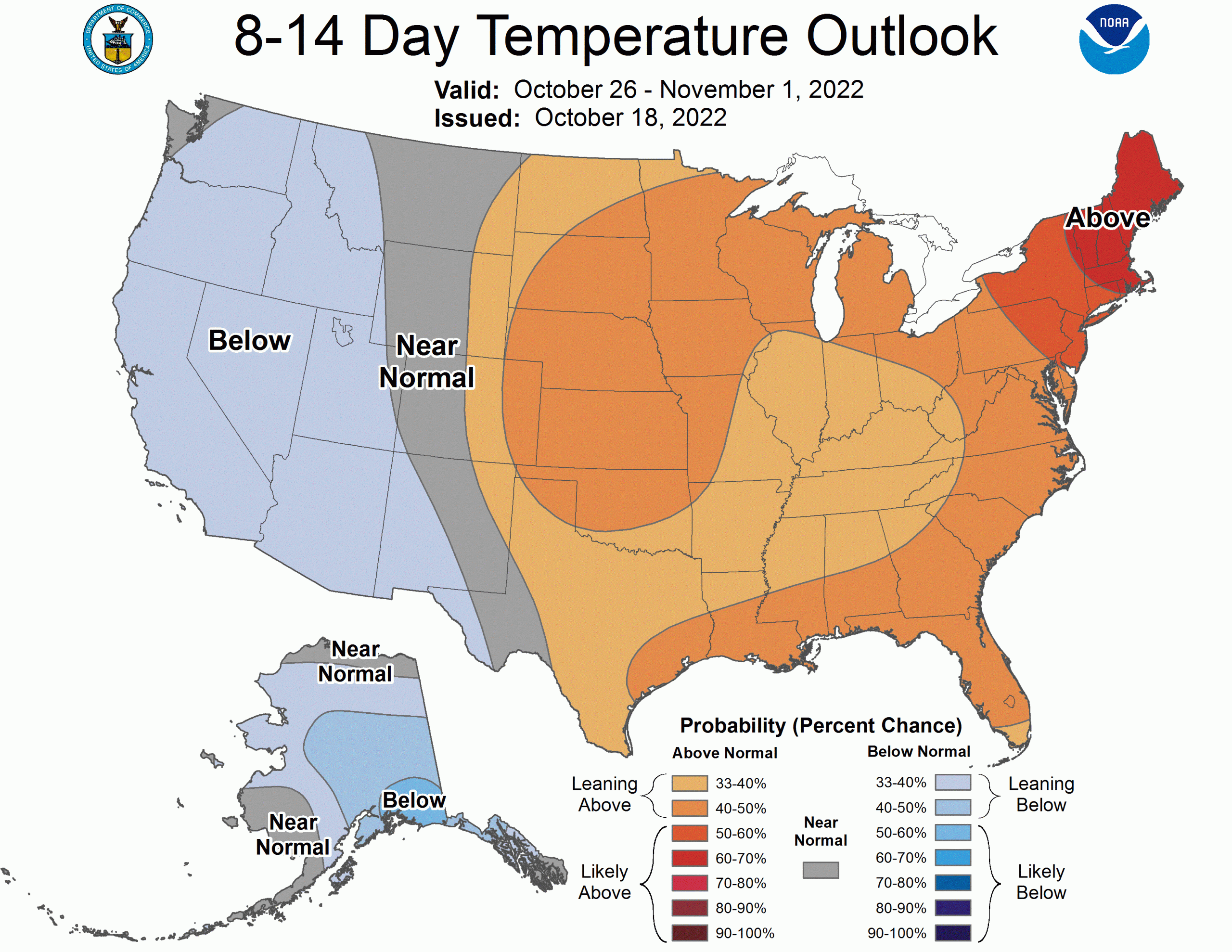
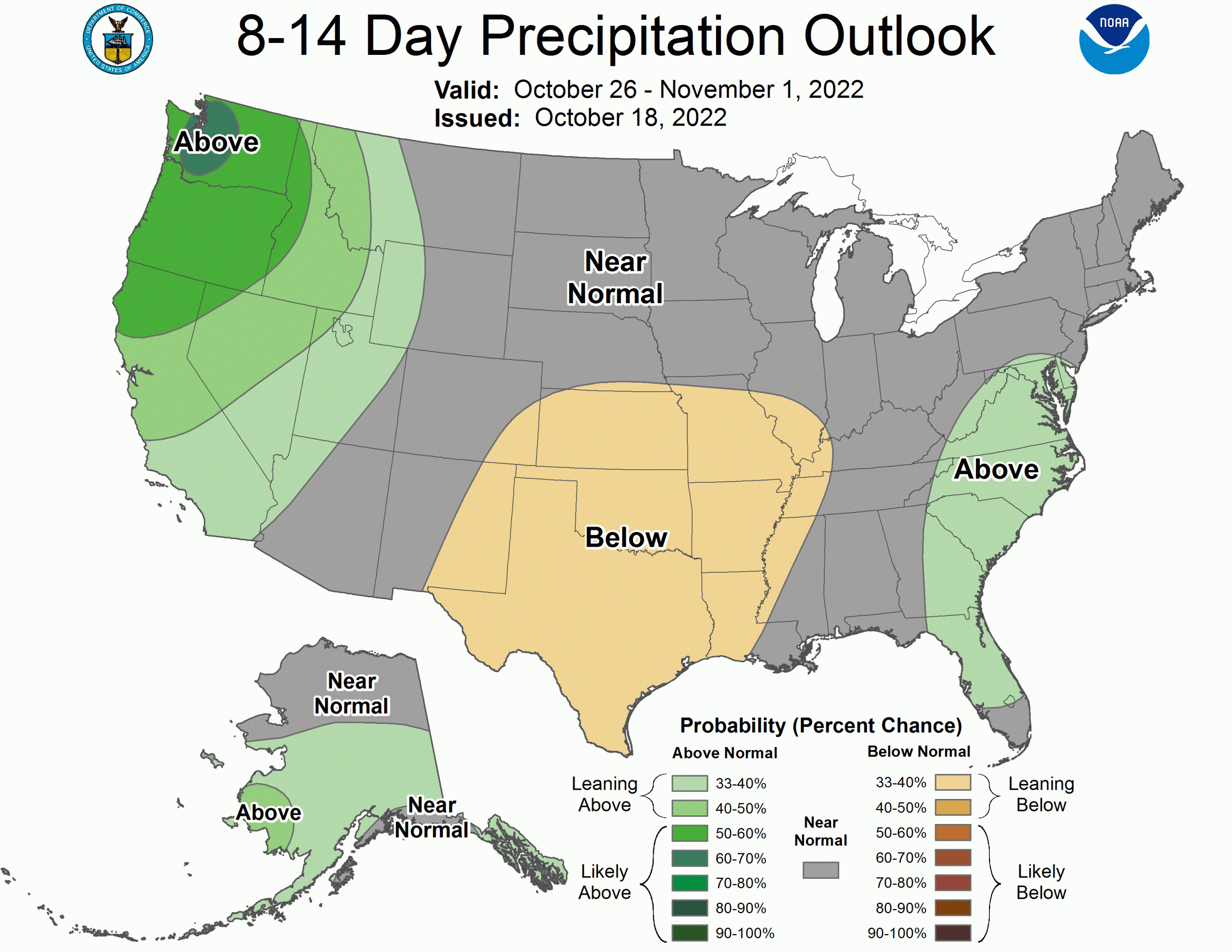
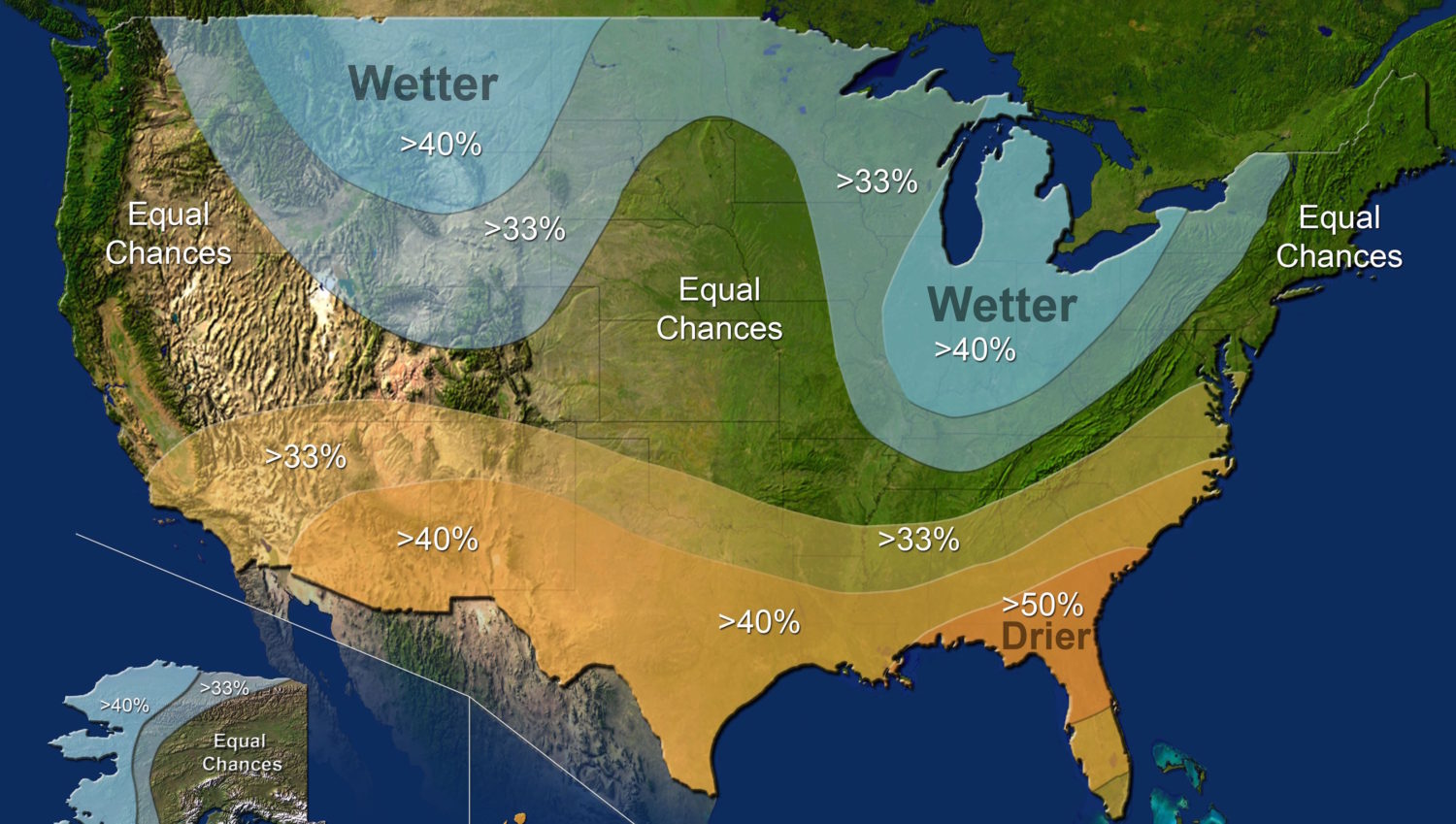
This will likely keep cool and stormy weather in the forecast until at least around Halloween. The CPC’s forecasts for the last week of the month are in line with this (see below).
It’s still October, so rain will be a continued issue at the lower elevations. Regardless, any October snowfall is to be celebrated. Enjoy.
