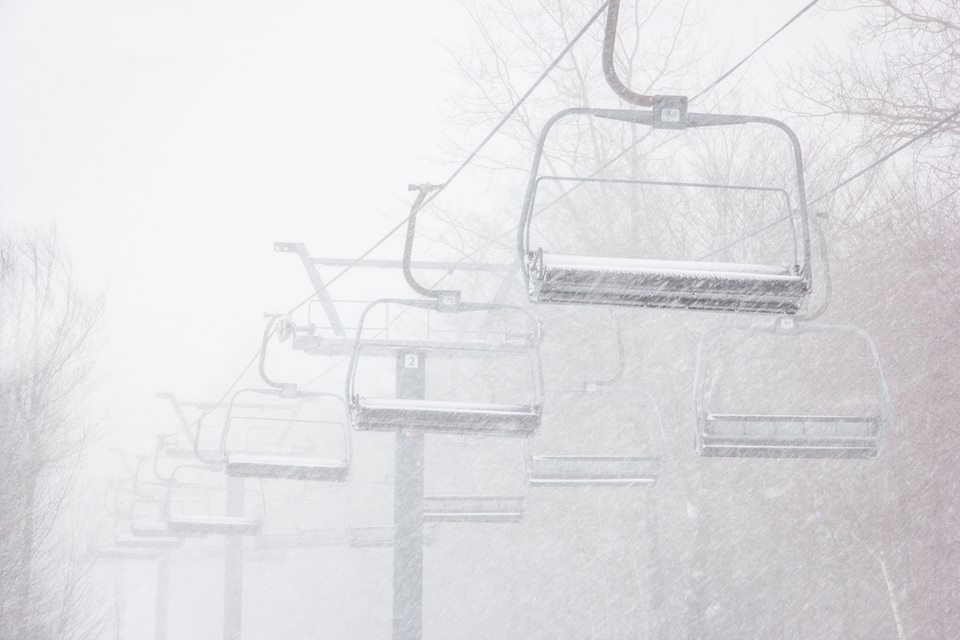
A strong winter storm system is making its way into the East Coast today. It is expected to drop snow and sleet along with some ice accumulations.
Contents
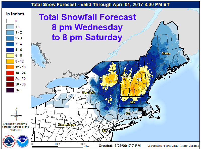
NOAA Has Issued Winter Storm Warnings For:Additional Storm Information:New York: 4-8″ of Snow Today-SaturdayMassachusetts: 6-9″ of Snow Today-SaturdayVermont: 8-12″ of Snow Today-SaturdayNew Hampshire: 6-10″ of Snow Today-SaturdayMaine: 6-10″ of Snow Tonight-Saturday NightVermont Winter Storm Warning:Winter Storm Warning
8-12″ of snow forecasted to fall in Vermont Today-Tomorrow.
NOAA Has Issued Winter Storm Warnings For:
- New York
- Massachusetts
- Vermont
- New Hampshire
- Maine
The highest snow accumulations will occur over 1000ft, but lower elevations will still see some heavy snowfall.
Additional Storm Information:
New York: 4-8″ of Snow Today-Saturday
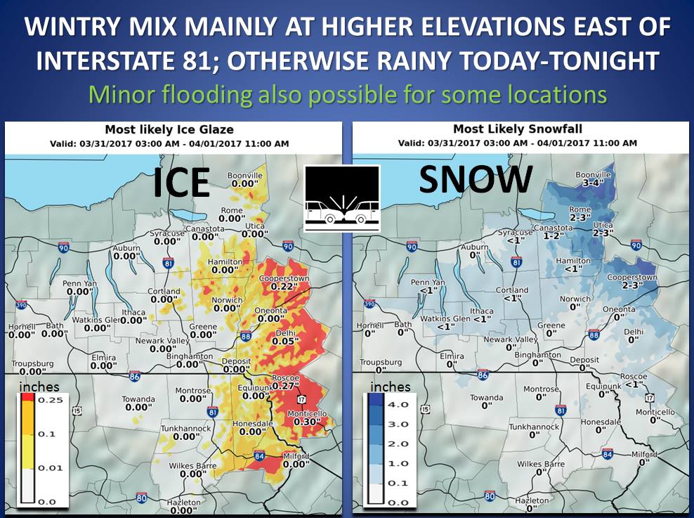
* Accumulations...4 to 8 inches in Orange, Washington and
  Caledonia Counties. 6 to 10 inches in eastern Rutland, Windsor
  and Essex Counties with a mix with sleet expected tonight into
  Saturday morning. The greatest accumulations will occur above
  1000 feet.
-NOAA Binghamton, NY
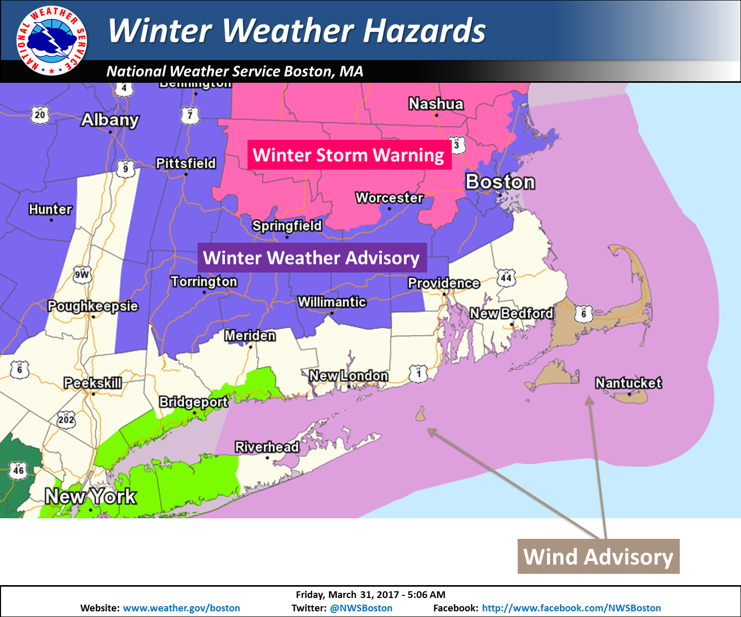
Massachusetts: 6-9″ of Snow Today-Saturday
* ACCUMULATIONS...6 to 9 inches of snow and sleet with the highest
  amounts near the New Hampshire border in far northeast
  Massachusetts.
- NOAA Boston, MA
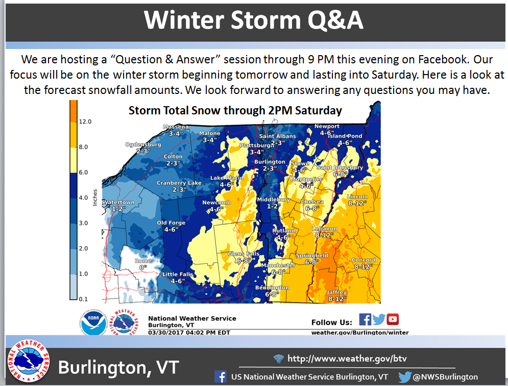
Vermont: 8-12″ of Snow Today-Saturday
* Accumulations...Snow accumulation of 8 to 12 inches.
- NOAA Burlington, VT
New Hampshire: 6-10″ of Snow Today-Saturday
* Accumulations...Snow accumulation of 6 to 10 inches.
- NOAA Grey, ME
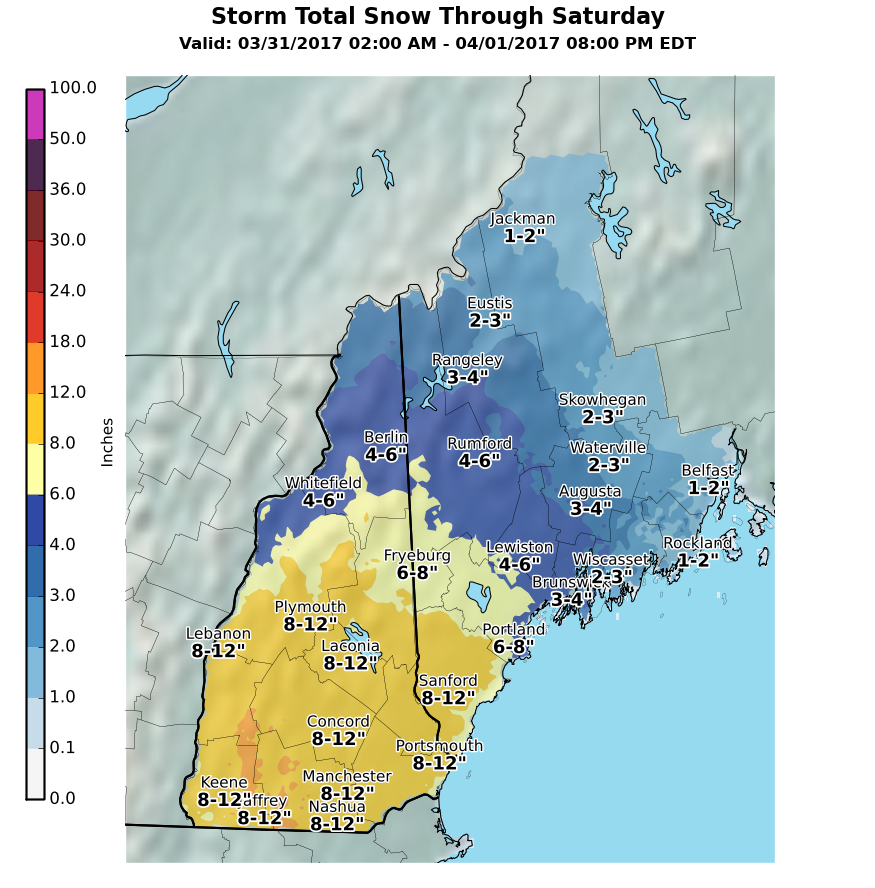
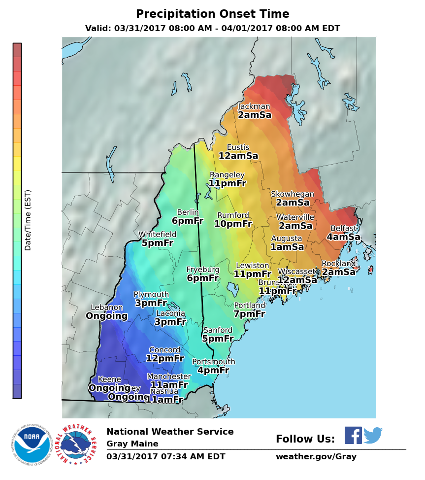
Maine: 6-10″ of Snow Tonight-Saturday Night
* Accumulations...Snow accumulation of 6 to 10 inches.
- NOAA Grey, ME


Vermont Winter Storm Warning:
Winter Storm Warning
URGENT - WINTER WEATHER MESSAGE
National Weather Service Albany NY
422 AM EDT Fri Mar 31 2017

Western Windham-Eastern Windham-
Including the cities of Stratton, Londonderry, Brattleboro,
Guilford Center, West Brattleboro, and Bellows Falls

...WINTER STORM WARNING REMAINS IN EFFECT UNTIL 5 PM EDT
SATURDAY...

* LOCATIONS...Windham County of Southern Vermont.

* HAZARD TYPES...Snow and sleet.

* Accumulations...6 to 12 inches of snow and sleet.

* TIMING...Snow will continue to develop through this morning.
  The snow will then mix with sleet at times beginning this
  afternoon, with steady precipitation continuing into Saturday
  afternoon.

* IMPACTS...Heavy, wet snow and sleet will have the potential to
  result in power outages. Snow and ice covered roadways will
  potentially make travel dangerous.

* Visibilities...Occasionally less than a mile in heavier
  snowfall.

* Temperatures...In the lower 30s.

* Snowfall Rates...Up to an inch per hour at times.