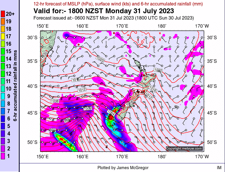
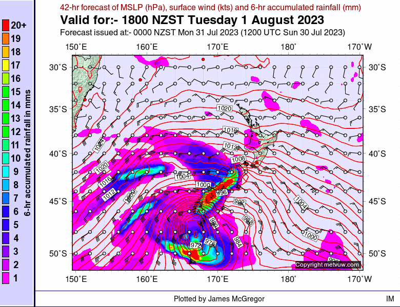
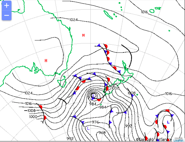
A big storm is arriving in the Otago Region on the evening of July 31, 2023, and hanging around until Wednesday August 2, 2023. The forecasts are showing heavy precipitation and lots of atmospheric pressure across the region with a smaller amount making its way up to the Canterbury region.
Snowforecast.com is predicting a large amount of snow accumulation for the four resorts in the area, Treble Cone, Cardrona, Remarkables and Coronet Peak. Some are potentially due to receive over half a metre (19 inches) according to the weather station. Below we summarized the statistics for you.
Snow Forecast snow accumulation Statistics 07/31 – 08/02:
Treble Cone: 85 cm (33 inches)
Cardrona: 50 cm (19 inches)
Remarkables: 61 cm (24 inches)
Coronet Peak: 61 cm (24 inches)
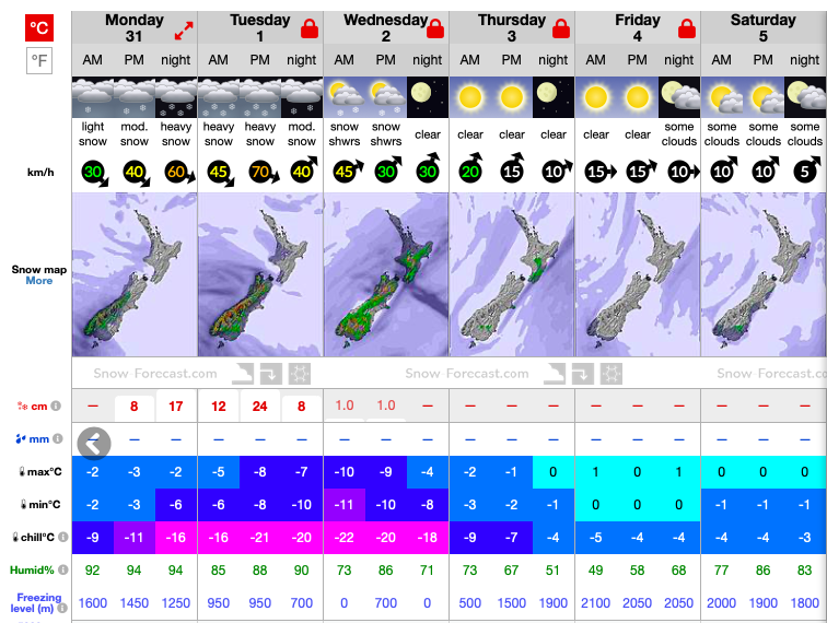
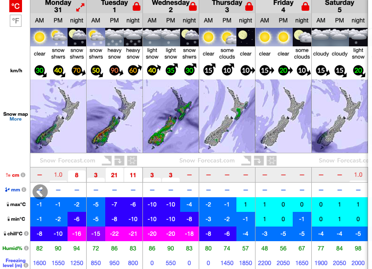
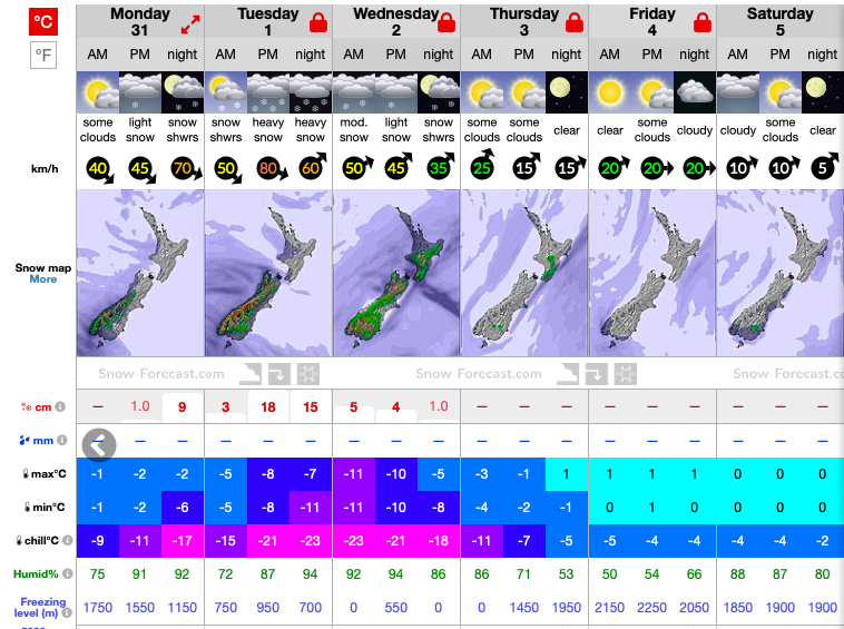
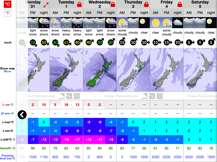
As well as precipitation, forecasters are expecting gale force winds to be hitting the Otago region. SnowForecast.com is predicting Cardrona, Remarkables and Coronet Peak to be hit by North-Westerly and Westerly winds between 65 kph (40 mph) to 120 kph (74 mph) over the night of Tuesday August 1, 2023. This will add to the areas already unstable snowpack, with heavy wind loading on North-East to South-West aspects on top of a shallow snowpack, which has rain crusts hidden with facets amongst the layers.
These high winds have become a normal expectation for New Zealand this winter. The New Zealand Avalanche Advisory have consistently forecast avalanche issues containing wind slab and persistent slab, due to a shallow pack and heavy winds. Leeward slopes, such as the North-East and South-West aspects, have been seeing a lot of avalanche activity, while other aspects have been wind stripped, creating less back-country travel. If you’re planning to head out, make sure to check the forecast on their website, it is operated by the New Zealand Mountain Guides Association.
Due to the quality of the incoming storm, Metservice.com are forecasting for the Crown Range road to possibly be closed. This road connects snow enthusiasts from Queenstown to Wanaka, giving them access to both Cardrona and Treble Cone. With this storm brewing, any travellers planning to come over the Crown Range are advised to check Metservice for road closures or recommendations of travel routes and conditions.
Once again we have our fingers crossed in New Zealand for a big dump to prolong our season. Hopefully the precipitation stays consistent and keeps away warm weather.


