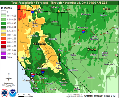

The rain finally tuned to snow on Friday morning at Alpine Meadows. The past week has been pretty painful to watch such huge amounts of unfrozen water fall from the sky and melt what little snow we had from late November. But finally after inches and inches of rain had created a bullet proof ice layer 10 inches thick, it began to snow. Friday Squaw was reporting 6″ on the upper mountain and alpine was reporting 7″.


Bombs were echoing off mountain bowls teasing the few skiers waiting in line for the upper mountain to open. Due to bad vis, the neither resorts got their upper mountains open until about 10:30-11am. After that, however it was great. Alpine had fresh, soft turns wherever you looked until you hit a wind scoured unsuspecting ice bump. There were definitely a few sketchy wind scoured ice rinks scattered around ridges and such, but the majority of turns were soft and silent.

On Friday I spent most of my morning skiing Wolverine bowl and making it over skiers left of waterfall into Three Sisters. The visibility was horrendous, but it was great skiing considering the previous week had been ice and rain slush.

Saturday was even better. It proceeded to snow another inch and a half friday afternoon which blew around and covered what had been scraped off during the day with just enough snow to make it soft again. The areas like High yellow that were not open on Friday, opened on Saturday. There were protected areas where wind deposited snow collected enough to get mini face shots and full on pow runs. It was great fun.

With not much snow in the forecast for another week, lets hope these few inches stay cold and wintery until the next storm. The silver lining from these last two warm storms is that the 10 inch layer of ice now covering many of the rocks provides a strong base that will thaw very, very slowly come spring. Lets hope for the best from the next storm.


Thanks for Good & detailed report Bevan.