California storms will start to look a little different in a warmer climate. For those living in West Coast states probably already know the term atmospheric river (AR events), but for a lot, this term might be new. Here is NOAA’s definition of an atmospheric river:
Atmospheric rivers are relatively long, narrow regions in the atmosphere – like rivers in the sky – that transport most of the water vapor outside of the tropics. These columns of vapor move with the weather, carrying an amount of water vapr roughly equivalent to the average flow of water at the mouth of the Mississippi River. When the atmospheric rivers make landfall, they often release this water vapor in the form of rain or snow.
– NOAA
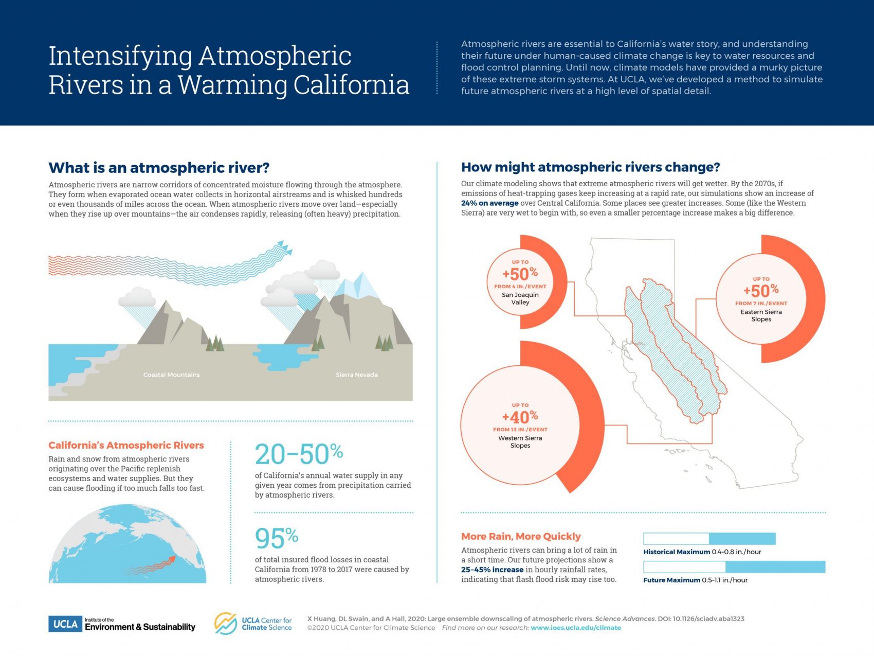
A recent study published from Science Advances shows that in the future, California will face more extreme atmospheric rivers than before. The golden state is no stranger to atmospheric rivers (AR as they make up as much as 50% of the wintertime snow and rainfall. While these storms can release ungodly amounts of snow and rain, they also account for heavy flooding risks. For perspective, the largest AR events can drop enough precipitation to match hurricane landfall events.
The study predicts that California will see 20-30% larger atmospheric rivers in a future with a warmer climate. This is measured through something called IVT. “IVT is an aggregate measure of AR strength that takes into account both the level of atmospheric water vapor and the strength of transport-level winds” – Daniel Swain. Scientists predict that almost everywhere in California will see an increase in rainfall during extreme AR events. Increases range from 15-30% increase in the western slope of the Sierra Nevada Mountains, 25-40% in the Central Valley and some small coastal valleys, and up to a 50% increase in specific areas of the eastern slope of the Sierra Nevada. These are all relative increases based on historic precipitation from past AR events for these regions. It is important to note that the highest absolute increase will be seen on the Western Slope of the Sierra Nevada where historically the largest amounts of precipitation fall in these storms.
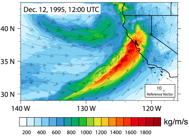
Future storms from models created look similar to Pineapple Express storms. These specific atmospheric river events have deep tropical moisture taps originating near Hawaii. This is shown in the figure below.

Another prediction from the study relates to changing hourly precipitation rates. Their models show that almost everywhere in the state will see a 30-50% increase in the most intense hourly precipitation rates. This means that no matter where you are in the state you will likely see a large increase in the heaviest rainfall compared to past events. Additionally, the study predicts that intense hourly rates will be prolonged in future storms. The explanation for this increase is a little bit above my pay-grade so if you want to read more about it click here.
Growing up in the San Fransisco Area, I became accustomed to atmospheric rivers hitting my town at least once or twice a year. Seeing how long and how much rain these storms can drop can be scary in large events. I have first hand seen the mudslides and flooding that these storms can cause. The thought of them becoming stronger is truly scary to me. I can only imagine the increased economic impact they will have on the state due to floods, mudslides, highway closures. On a possibly more positive note, it will be interesting to see how a warmer climate mixed with stronger AR events will affect Sierra Nevada snowfall.
