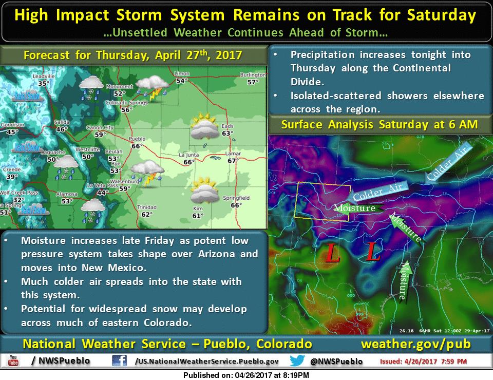
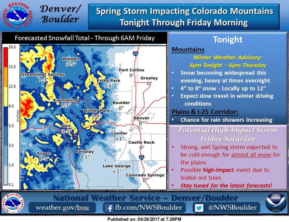
The snow continues in Colorado as a spring storm is impacting the area throughout the day today. Then a high intensity storm is expected to impact the area early this weekend. It could bring substantial snow accumulations across a wide range of elevations.
Contents
8-14+” of snow is expected to fall through Thursday.
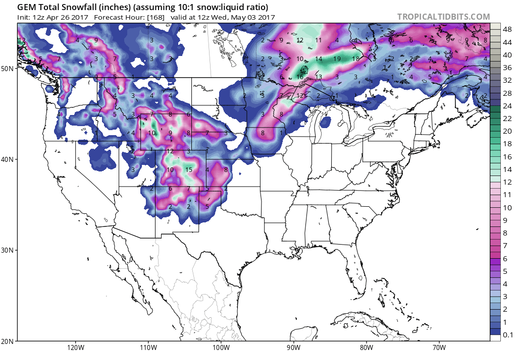
Snow levels will drop to mountain bases by early Thursday Morning and they are expected to stay at that level.
Additional Storm Information:
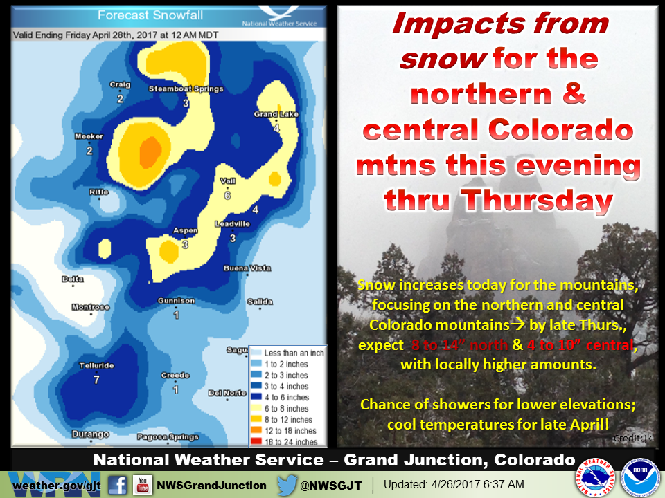
Colorado: 8-14+” of Snow Through Thursday
* SNOW ACCUMULATION...8 to 14 inches with locally heavier
  amounts.
- NOAA Grand Junction, CO


Colorado Winter Storm Warning:
URGENT - WINTER WEATHER MESSAGE
National Weather Service Grand Junction CO
105 PM MDT Wed Apr 26 2017

Elkhead and Park Mountains-Flat Tops-
105 PM MDT Wed Apr 26 2017

...WINTER STORM WARNING REMAINS IN EFFECT FROM 6 PM THIS EVENING
TO MIDNIGHT MDT THURSDAY NIGHT...

* LOCATIONS INCLUDE...Columbine, Hahns Peak, Toponas, Buford,
  and Trappers Lake.

* TIMING...Snow showers increase in coverage and intensity
  tonight and will continue through Thursday night. The heaviest
  snow is expected late tonight.

* SNOW ACCUMULATION...8 to 14 inches with locally heavier
  amounts.

* SNOW LEVEL...Near 8500 feet this evening, dropping to mountain
  bases by Thursday morning.

* WINDS...West 10 to 20 mph with gusts up to 30 mph.

* VISIBILITY...Less than 2 miles in moderate snow and below 1
  mile in heavier showers.

* IMPACTS...Higher elevation roads and highways will become icy
  and snow packed with areas of slushy conditions below the
  passes. Main impacts primarily above 9000 feet.