Wolf Creek =
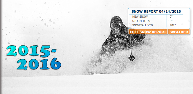
- Most snowfall in Colorado at 402″
- Deepest snowpack in Colorado at 119″
- 1-3 feet of snow forecast next 3 days
Wolf Creek just broke 400″ of snowfall this winter! They’re sitting happy with the most snowfall in Colorado at 402″.
They’re not done yet. Wolf Creek has 1-3 feet of snow forecast to fall between now and Sunday. It’s going to be a powder weekend at Wolfy.
Considering they have the most snowfall and deepest snowpack in Colorado, Wolf Creek decided to re-open this weekend for 2 days.
“Wolf Creek Powder Weekend is on its way!! This Saturday and Sunday, April 16th and 17th, Wolf Creek Ski Area will be re-opening for the weekend!! Tickets will be $43 for adults, $26 for seniors and $24 for kiddos. 100% of the mountain will be open with all lifts operating from 9:00 a.m. to 4:00 p.m. The Rental Shop, Boarder Dome and Treasure Sports will be open along with the Upper Lodge, offering a limited menu.” – Wolf Creek, CO today

WINTER STORM WARNING for WOLF CREEK, CO:
URGENT - WINTER WEATHER MESSAGE
NATIONAL WEATHER SERVICE PUEBLO CO
1127 AM MDT THU APR 14 2016

WESTERN MOSQUITO RANGE/EAST LAKE COUNTY ABOVE 11000 FT-
LEADVILLE VICINITY/LAKE COUNTY BELOW 11000 FT-
EASTERN SAWATCH MOUNTAINS ABOVE 11000 FT-
LA GARITA MOUNTAINS ABOVE 10000 FT-
EASTERN SAN JUAN MOUNTAINS ABOVE 10000 FT-
INCLUDING...CLIMAX...LEADVILLE...BONANZA...NORTH PASS...
CUMBRES PASS..WOLF CREEK PASS

...WINTER STORM WARNING IN EFFECT FROM NOON FRIDAY TO 6 AM MDT
SUNDAY...

THE NATIONAL WEATHER SERVICE IN PUEBLO HAS ISSUED A WINTER STORM
WARNING FOR HEAVY SNOW...WHICH IS IN EFFECT FROM NOON FRIDAY TO 6
AM MDT SUNDAY. THE WINTER STORM WATCH IS NO LONGER IN EFFECT.

* LOCATION...THE CONTINENTAL DIVIDE.

* CAUSE AND TIMING...A LARGE...SLOW MOVING STORM SYSTEM WILL
  TRACK ACROSS THE AREA THIS WEEKEND...BRINGING PERIODS OF HEAVY
  SNOW TO THE REGION.

* SNOW ACCUMULATION...1 TO 3 FEET.

* WIND...NORTHEAST 15 TO 25 MPH.

* IMPACT...TRAVEL MAY BECOME HAZARDOUS DUE TO A COMBINATION OF
  HEAVY SNOW...LOW VISIBILITIES AND ICY OR SNOW COVERED ROADS.
Eleven snowcat ski operation in Irwin, CO closed earlier this week measuring 409 inches for the 2015-2016 season.