[iframe id=”https://www.facebook.com/plugins/video.php?href=https%3A%2F%2Fwww.facebook.com%2FNWSSacramento%2Fvideos%2F1138507936185213%2F&show_text=0&width=400″]
NOAA video of potential Atmospheric River forecast to impact West Coast next week.
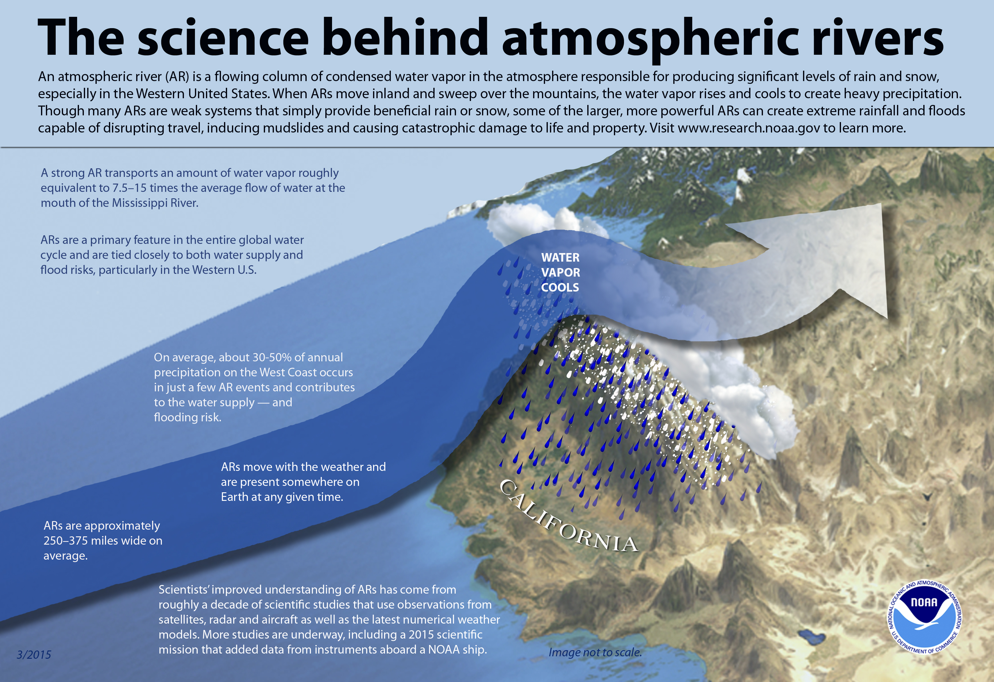
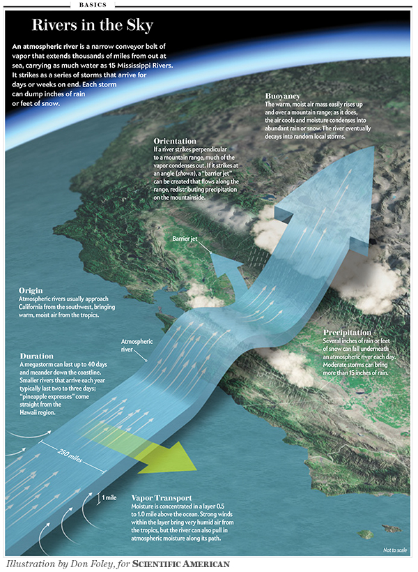
NOAA is forecasting a possible Atmospheric River for the West Coast next week.
This Atmospheric River should affect Washington, Oregon, and California with potentially large snowfall totals in the high country and big rainfall totals in the lowlands.
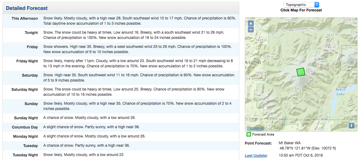
43-68″ of snowfall are forecast for the summit of 10,762′ Mt. Baker in the next 4 days. Snow is forecast every day this week for Mt. Baker. If this Atmospheric River hits Mt. Baker, just think how much snow it’ll get in the next 2 weeks… 200″? Naw… but, maybe…

The moisture for next week’s potential Atmospheric River is coming from Typhoon Chaba in the western Pacific Ocean.
Atmospheric Rivers mean huge amounts of precipitation in a short amount of time.
“Rain on the way to Northern California? It’s starting to look that way!
There is still some uncertainty in the storm track, but our computer models are trending toward a wet scenario for the region late next week! If this pans out, this would be the first Atmospheric River to impact Northern California for this young season.” – NOAA Sacramento, CA today

“Models continue to show the potential for a potent early season atmospheric river event unfolding across the Pacific Northwest late next week. The moisture associated with this atmospheric river event is from Typhoon Chaba in the Western Pacific. This moisture is expected to be entrained into the mid-latitude westerlies which will enhance the North Pacific Jet. There are still a lot of uncertainties with the details as the storm track could shift north or south. Nonetheless, next week could turn out to be extremely wet with the potential for some early season flooding.” – NOAA Portland, OR today


One thought on “NOAA: Atmospheric River Possible for West Coast Next Week”