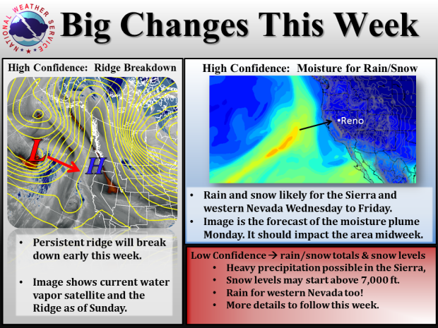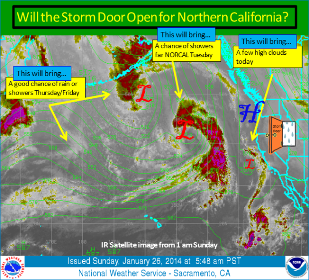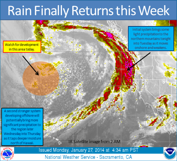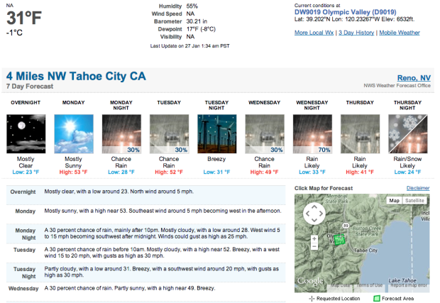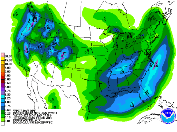
A storm might be coming into the Tahoe region this week. Right now, models are saying this storm will hit Wednesday, Thursday, and Friday. Forecast models are agreeing on somewhere around 2-3 feet of snow at the highest elevations. The only problem with this storm is going to be snow levels. NOAA is talking about snow levels around 7,000 feet or higher.
“Although a weak system will pass north of interstate 80 early this week, a second stronger system may bring higher chances for rain, snow, and gusty winds. Observational data across the eastern Pacific shows a significant moisture plume that will move into the west coast midweek, providing moisture for any systems that move into the region. Although there is high confidence for rain or snow between Wednesday and Friday, there is still some uncertainty in precipitation totals and snow levels.” – NOAA Reno, NV
DRY SURFACE AIR WILL LIMIT LIGHT PRECIPITATION
BELOW 7000 FEET, WITH UP TO A TENTH OF AN INCH POSSIBLE IN THE
MOUNTAINS. SNOW LEVELS SHOULD STAY NEAR AND ABOVE 8000 FEET, BUT
THERE COULD BE A BRIEF PERIOD OF SNOW DOWN TO 6000-7000 FEET DUE
TO EVAPORATIONAL COOLING. - NOAA Reno, NV
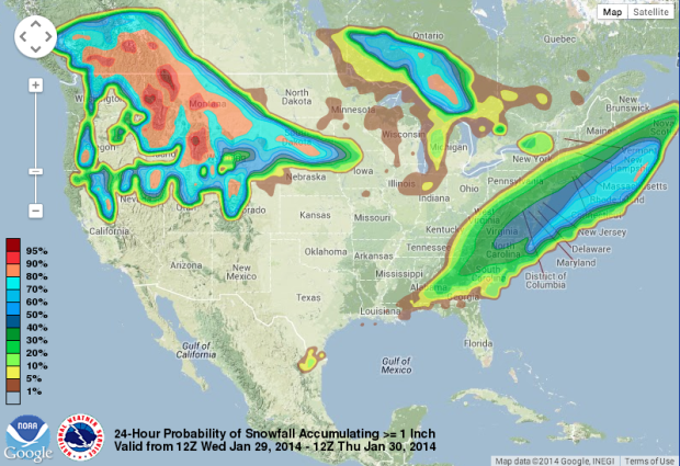
There is also a chance that the storm will fall apart. It appears that a warm tropical storm and a cold Gulf of Alaska storm could come together and create a significant precipitation event. We hope they come together.
IF THESE WEATHER
SYSTEMS ARE ABLE TO COME TOGETHER, MOST OF EASTERN CA- WESTERN NV
WOULD RECEIVE THEIR LARGEST RAIN OR SNOW TOTALS OF THE SEASON. IF
THESE SYSTEMS DO NOT MERGE, THE EVENT WOULD BE LESS IMPRESSIVE
WITH MOSTLY RAIN EVEN IN HIGHER ELEVATIONS OF THE SIERRA, AND MUCH
LOWER RAINFALL AMOUNTS EAST OF THE CREST INTO WESTERN NV. - NOAA Reno, NV
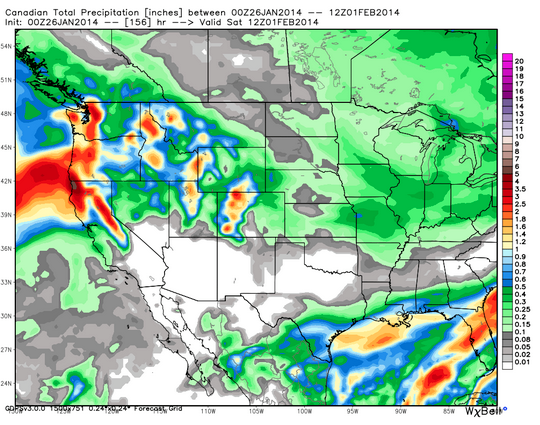
If the two storms come together, we could be looking of snow ratios around 7 to 1 and leave us with around 2 or 3 feet of snow.
“Here are the model outputs this morning, which mostly all agree on 1-2 inches of liquid over the basin and 2-3 inches along the crest. For the mountains we can equate that to feet of snow as a rough estimate until we get closer and have a better idea what the snow ratios will be.” – BA/opensnow.com
Lets all keep our fingers crossed for this storm to produce big for Tahoe.
This storm would be a huge step in the right direction as we haven’t had any real precipitation this winter in Tahoe. Man-made snow only thus far…
