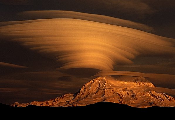
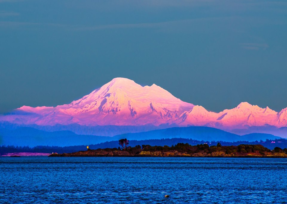
Up to 162″ of snow (13.5-feet) is currently forecast to fall on 14,411-foot Mt. Rainer in Washington state in the next 3 days. That huge snowfall total is due to an atmospheric river that will be “slamming” into Washington this weekend.
THE PRECIPITATION BULLSEYE OVER
MOUNT RAINIER IS MORE THAN 20 INCHES IN 48 HOURS IN THE WETTEST
MESOSCALE MODELS. - NOAA Seattle, WA today
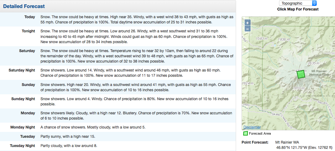
Even 10,000-foot Mt. Baker is forecast to get 70″ of snow in the next 3 days… This is gonna be a crazy weekend in Washington state.
Snow levels will start high but will drop to as low as 4,000-feet by Sunday.
SNOW LEVELS WILL DROP TO AROUND 4000 FEET ON SUNDAY WITH A FEW INCHES
OF SNOW POSSIBLE IN THE MOUNTAINS. - NOAA Seattle, WA
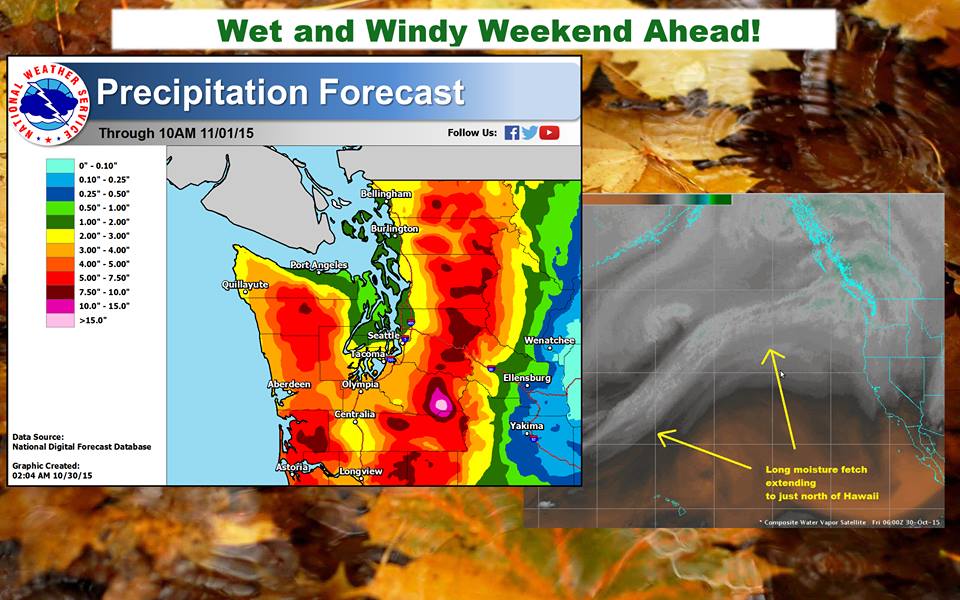
Some models are even showing up to 20-inches of liquid precipitation (which would translate to about 20-feet of snow) in only 48 hours on Sunday…
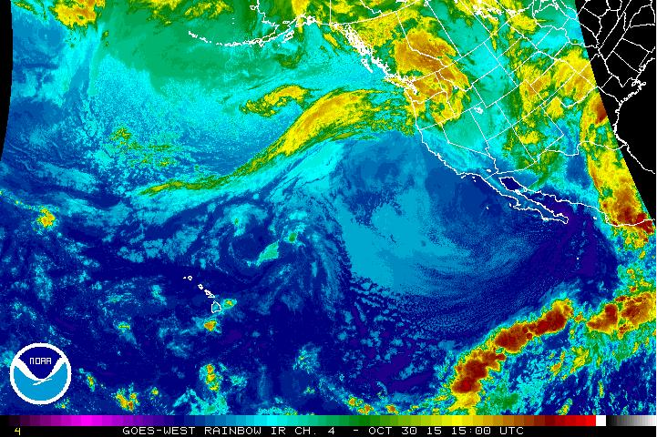
“A pair of frontal systems with a significant tap of Pacific moisture will move through western Washington this weekend. They will bring heavy rain at times with the mountains receiving 4 to 8 inches of precipitation with locally higher amounts possible near Mount Rainier. Snow levels will remain high through Saturday before falling on Sunday as a cool upper level trough digs into the region. In addition to the precipitation, windy conditions at times are expected for much of the region.” – NOAA Seattle, WA
FLOOD WATCH:
If you live in Washington, please be careful this weekend. NOAA has issued a flood watch as up to 8″ of rain are forecast for the next 3 days. Stay away from rivers and streams.
FLOOD WATCH
NATIONAL WEATHER SERVICE SEATTLE WA
404 AM PDT FRI OCT 30 2015

...FLOOD WATCH REMAINS IN EFFECT FROM THIS EVENING THROUGH SUNDAY
AFTERNOON...

THE FLOOD WATCH CONTINUES FOR

* PORTIONS OF NORTHWEST WASHINGTON AND WEST CENTRAL WASHINGTON...
  INCLUDING THE FOLLOWING COUNTIES...IN NORTHWEST WASHINGTON...
  CLALLAM...GRAYS HARBOR...JEFFERSON...KITSAP...MASON...SKAGIT AND
  WHATCOM. IN WEST CENTRAL WASHINGTON...KING...LEWIS...PIERCE...
  SNOHOMISH AND THURSTON.

global warming is bullshit ……… weather modification is real
it sounds like global warming is bullshit ………… but weather modification is real
I refer you to a Barron’s “Commodities Corner” article (11/02/2015) indicating we should anticipate decreased sun spot activity that will last for the next 5 years. This is based on data going back to 1866! Fewer sun spots are associated with colder weather. “It’s a coincidence that has existed since Galileo’s time.” This probably applies more to the northern hemisphere. The effect should be felt more in the latter part of this decade.
Remember we are skiing in Colorado at Loveland and A basin as of Thursday and we have snow on the 14 ft. peaks and lower yay
Glad to hear that. W.
Loveand and A Basin. I used to boogie there in the ’70s when lived in Boulder. May you make many happy turns.
Great Photos!
think you made a typo on one spot. obviously 20 inches precipitation does not equal 20 feet of snow. lol it happens though (typos)
Ah, I should have clarified. 20 inches of liquid precipitation can equal 20 feet of snow. Thanks, I’ll fix that.
Actually, 20 inches of liquid precip DOES equal 20 feet of snow. A factor of 10-15 is usually a good conversion….10 for wet snow, 15 for dry snow. A factor of 12 converts inches to feet.
Bring on the snow… I love Washington…. the best place to live in the world….
You obviously haven’t lived in Australia..lol..And yes, I’ve been your way 14 times..
Haha, why would you take the trouble to come THIS way (to Washington) 14 times if it weren’t any better than where you live, in Australia? 😉
The Winter Climbing season has arrived
Sounds like the Winter Rescue season is coming soon.
Bring it on
yes–we need it for next year’s river flow, the electricity and the skiiers, etc.